


Refine your search for walks in Onhaye
Onhaye walks


 The ruins of Montaigle and the Sosoye nature reserve from Falaën
 Visorando Member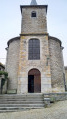
 8.24 mi
 +732 ft
 -735 ft
 4h 25
4h 25
 Moderate
 Departure from Onhaye (Province de Namur)
A varied route that passes through the village of Falaën with its stone houses, the bucolic Flavion valley, the imposing ruins of the medieval castle of Montaigle and the Montagne de Sosoye Nature Reserve with its beautiful limestone meadows.
From Falaën to the ruins of Montaigle Castle
 5.71 mi
+515 ft
-525 ft
3h 05
5.71 mi
+515 ft
-525 ft
3h 05
 Easy
Departure from Onhaye (Province de Namur)
Easy
Departure from Onhaye (Province de Namur)
In the heart of the Namur Condroz region lies the village of Falaën, one of the most beautiful villages in Wallonia. Starting from here, you will pass the ruins of Montaigle Castle.
A countryside walk between Serville and Chestruvin
 11.07 mi
+712 ft
-702 ft
5h 40
Moderate
Departure from Onhaye (Province de Namur)
11.07 mi
+712 ft
-702 ft
5h 40
Moderate
Departure from Onhaye (Province de Namur)
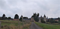
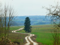
Starting from the charming hamlet of Serville, with its stream and pretty chapel, the walk heads into the forest towards Weillen. The small road linking the villages that follows is very quiet and offers beautiful views of the surrounding countryside. In Weillen, the route climbs slightly, offering lovely views of the village, its church and its castle.This is followed by a stretch through the countryside, sometimes along the edge of the forest (off the marked path) and sometimes across fields, to the hamlet of Chestruvin, which you must go round to return to Onhaye. The route, between the old quarries and the N97, also includes a short section that is not shown on the map but is clearly visible on the ground. The return journey to the starting point at Gérin takes place entirely through the countryside.
Bell tower walk from Serville
 11.79 mi
+1,073 ft
-1,073 ft
6h 20
Moderate
Departure from Onhaye (Province de Namur)
11.79 mi
+1,073 ft
-1,073 ft
6h 20
Moderate
Departure from Onhaye (Province de Namur)
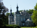
Not familiar with Onhaye? Here's a little preview!Don't worry, there aren't only bell towers in the region, but you will come across a few along the way.And not just those of churches and chapels... there are also one or two castles with turrets similar to the usual bell towers of our villages.
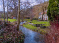
Sosoye Mountain Nature Reserve
 1.29 mi
+217 ft
-223 ft
0h 45
Easy
Departure from Anhée (Province de Namur)
1.29 mi
+217 ft
-223 ft
0h 45
Easy
Departure from Anhée (Province de Namur)
Short walk through the Sosoye mountain nature reserve and its viewpoint over the village and the Molignée valley.
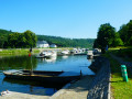
The Waulsort water crossing
 10.80 mi
+1,509 ft
-1,516 ft
6h 15
Moderate
Departure from Hastière (Province de Namur)
10.80 mi
+1,509 ft
-1,516 ft
6h 15
Moderate
Departure from Hastière (Province de Namur)
At the beginning of the 19th century, there were around ten water crossings on the Meuse between Givet and Namur. After the railway line between Givet and Dinant was opened in 1863, the water crossing – which was then in operation in both summer and winter – enabled the inhabitants of Falmagne and Falmignoul to cross the Meuse to catch the train at Waulsort.The Waulsort water crossing is the only one still in operation, but only during the (good) tourist season.
Les Cascatelles starting from Hastière
7.19 mi
+584 ft
-571 ft
3h 50
Moderate
Departure from Hastière (Province de Namur)
This walk is one of the most charming in the area if you enjoy forest trails and rolling landscapes. The name ‘Cascatelles’ is well deserved: the route follows a stream that forms a series of small waterfalls, creating a cool and soothing atmosphere. It is a walk that alternates between shaded sections, gentle climbs and views over the Meuse valley. The Yellow Rectangle is easy to follow
The Hermeton Valley from Hastière
6.02 mi
+636 ft
-643 ft
3h 20
Easy
Departure from Hastière (Province de Namur)
This walk is one of the most beautiful and ‘natural’ in Hastière. It follows the Hermeton Valley, a steep-sided and well-preserved stream, surrounded by deep forests, moss-covered rocks and wetlands. It is a varied, peaceful and at times challenging walk, with several ascents and descents.
The Pont d'Arcole Caves
 Tourist office3.03 mi
+440 ft
-440 ft
1h 45
Moderate
Departure from Hastière (Province de Namur)
Tourist office3.03 mi
+440 ft
-440 ft
1h 45
Moderate
Departure from Hastière (Province de Namur)
This hike takes you from the Meuse valley to the heights of the left bank and the village of Inzemont, initially following the course of the Feron, a small tributary of the Meuse. Along the way, you can visit the Pont d'Arcole caves, one of the many karst caves in the Upper Meuse region. The route also offers beautiful views of the valley.
On the heights of Bouvignes and Dinant
 3.53 mi
+459 ft
-476 ft
2h 00
Easy
Departure from Onhaye (Province de Namur)
3.53 mi
+459 ft
-476 ft
2h 00
Easy
Departure from Onhaye (Province de Namur)
A circular loop to discover Bouvignes and Dinant from above. The highly recommended combination with the route called "From Dinant to the Moniat rocks" allows you to fully discover this area of the Dinant region. With the exception of a few very short sections, this walk follows the GR®129 and then GR®125-126 long-distance footpaths.
Walk in Salet
 11.44 mi
+1,447 ft
-1,421 ft
6h 30
Moderate
Departure from Anhée (Province de Namur)
11.44 mi
+1,447 ft
-1,421 ft
6h 30
Moderate
Departure from Anhée (Province de Namur)
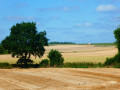
This circular route takes you on a journey of discovery across the rural plateaus on either side of the Molignée, alternating between country lanes and footpaths – sometimes through the countryside, sometimes through the woods – between the villages of Salet, Haut-le-Wastia and Warnant.
Loop at Salet – Montaigle and the Molignée hills
12.31 mi
+1,368 ft
-1,345 ft
6h 50
Moderate
Departure from Anhée (Province de Namur)
A superb loop starting from Salet, in the province of Namur, which takes you through woods, meadows, wild valleys and limestone ridges. This hike immerses you in history (medieval ruins, war memorials) while offering beautiful panoramic views of the Molignée valley and the surrounding plateaus. A well-marked, varied route with several gradual climbs.
From Dinant to the Moniat rocks
 5.46 mi
+456 ft
-469 ft
2h 55
Easy
Departure from Dinant (Province de Namur)
5.46 mi
+456 ft
-469 ft
2h 55
Easy
Departure from Dinant (Province de Namur)
A loop starting from Dinant towards the Moniat rocks, offering a magnificent view of the Meuse valley
Around Leffe Abbey
 9.41 mi
+1,076 ft
-1,060 ft
5h 15
Moderate
Departure from Dinant (Province de Namur)
9.41 mi
+1,076 ft
-1,060 ft
5h 15
Moderate
Departure from Dinant (Province de Namur)
Who doesn't know the Belgian beer called 'Leffe'?
This walk will introduce you not to this excellent range of Belgian beers, but to the wooded and rural surroundings of the abbey on the banks of the Meuse, where it was originally brewed.
Walk in the area around Maredsous Abbey
 4.46 mi
+538 ft
-558 ft
2h 30
Easy
Departure from Anhée (Province de Namur)
4.46 mi
+538 ft
-558 ft
2h 30
Easy
Departure from Anhée (Province de Namur)
A lovely walk around Maredsous Abbey, alternating between woodland and countryside.
Between the Meuse and Lesse rivers in Anseremme
 11.52 mi
+640 ft
-623 ft
5h 50
Moderate
Departure from Dinant (Province de Namur)
11.52 mi
+640 ft
-623 ft
5h 50
Moderate
Departure from Dinant (Province de Namur)
This long circular route takes you on a journey of discovery along the Meuse and Lesse rivers in one of the most beautiful parts of their course, with impressive rocks and splendid castles. Mainly wooded but also a little rural on the heights of Falmignoul, it does not present any major difficulties and is ideal for families.
Dinant, martyred town, August 1914
 8.64 mi
+814 ft
-794 ft
4h 40
Moderate
Departure from Dinant (Province de Namur)
8.64 mi
+814 ft
-794 ft
4h 40
Moderate
Departure from Dinant (Province de Namur)
Dinant, daughter of the Meuse, with its citadel, collegiate church, Rocher Bayard, river boats, and home of Adolphe Sax and Father Pire (Nobel Peace Prize winner). Dinant and its bloodstained banks in August 1914. Caught in a pincer movement between the Imperial Army and the French Army, it paid a heavy price for this situation. 674 civilians were massacred by the German Imperial Army. The route is a memorial route of this historical episode, which I invite you to discover.
A walk in Anseremme
 9.83 mi
+1,201 ft
-1,178 ft
5h 35
Moderate
Departure from Dinant (Province de Namur)
9.83 mi
+1,201 ft
-1,178 ft
5h 35
Moderate
Departure from Dinant (Province de Namur)
Anseremme is all about the Meuse and the Lesse... whether you choose one or the other, or both, the trip is usually very pleasant. It’s best done at midday on a lovely sunny day when the Lesse isn’t overrun by thousands of kayakers... The route offers some stunning panoramic views from the heights over Pont-à-Lesse and Chaleux, from the banks of the Lesse over Walzin Castle, or across the countryside around Dréhance and Hordenne. The Chawia ravine or gorge is very pretty!
Circular route around Warnant
 9.14 mi
+1,112 ft
-1,089 ft
5h 10
Moderate
Departure from Anhée (Province de Namur)
9.14 mi
+1,112 ft
-1,089 ft
5h 10
Moderate
Departure from Anhée (Province de Namur)
This circular route follows the old railway line that once linked Dinant to Tamines via Fosses-la-Ville, or in other words, the Meuse to the Sambre via the Molignée Valley and its abbeys.
The Meuse plateau via Anhée, Warnant and Haut-le-Wastia
8.97 mi
+830 ft
-810 ft
4h 50
Moderate
Departure from Anhée (Province de Namur)
A very varied route passing through woods, fields and typical villages on the Meuse plateau above Anhée. Beautiful views of the undulating plateau, villages and rocks along the banks of the Meuse. The route takes in several beautiful little paths.
Along the Hermeton
 5.80 mi
+577 ft
-551 ft
3h 10
Moderate
Departure from Hastière (Province de Namur)
5.80 mi
+577 ft
-551 ft
3h 10
Moderate
Departure from Hastière (Province de Namur)
Despite the first few kilometres being very easy, make no mistake, this walk still requires some stamina with a section featuring handrails along the Hermeton and the climb up the aptly named Tienne d'Enfer (Hell's Hill).
Discovering Waulsort
 3.60 mi
+381 ft
-384 ft
2h 00
Moderate
Departure from Hastière (Province de Namur)
3.60 mi
+381 ft
-384 ft
2h 00
Moderate
Departure from Hastière (Province de Namur)
This route takes you up to the heights of Waulsort and offers a breathtaking view of the brickworks.
The Hermeton Valley with a return via the Bois des Deux Fonds de Lays
 11.53 mi
+945 ft
-935 ft
6h 05
Moderate
Departure from Hastière (Province de Namur)
11.53 mi
+945 ft
-935 ft
6h 05
Moderate
Departure from Hastière (Province de Namur)
Set off to explore the natural, wild and rugged surroundings of the Hermeton by following it upstream to the Moulin de Soulme. The return journey takes you along small country roads, forest paths and trails where you can admire the landscape of the Meuse valley and its farmland.
Tour along the rocks of the Meuse
7.58 mi
+797 ft
-778 ft
4h 10
Moderate
Departure from Dinant (Province de Namur)
A very beautiful tour along narrow paths, with beautiful views, steep slopes, high cliffs and lots of beautiful nature. Sturdy shoes are required, as well as a camera, as there are many photo opportunities. Have fun :)
Walk between the Meuse and Meuse rivers from Baimont
 9.55 mi
+1,385 ft
-1,391 ft
5h 35
9.55 mi
+1,385 ft
-1,391 ft
5h 35
 Difficult
Departure from Hastière (Province de Namur)
Difficult
Departure from Hastière (Province de Namur)
This beautiful, fairly challenging hike explores the Meuse on either side of the centre of Hastière, crossing the meander between Heer-Agimont and Waulsort twice. Whilst the higher sections are in the countryside, the rest of the route follows paths and, above all, forest trails where progress is not always easy. Only the banks of the Meuse and the area around the Quatre Chemins crossroads are flat. The two architectural gems are undoubtedly Waulsort Castle (a former abbey – with a splendid view from the top of the rock with the flag) and the former Ermitage des Cascatelles. The village of Waulsort has a few fine buildings on the left bank, dating (probably) from the late19th or early20th century .
From Denée to Denée via Maredret and country lanes
2.35 mi
+318 ft
-315 ft
1h 20
Easy
Departure from Anhée (Province de Namur)
A short circular walk through fields and woods between Denée and Maredret, taking part of the Ravel route. This circular can be taken in either direction, there is a slight incline. It is not accessible with a pushchair.
Circular route starting from Falmagne
 8.59 mi
+787 ft
-787 ft
4h 40
Moderate
Departure from Dinant (Province de Namur)
8.59 mi
+787 ft
-787 ft
4h 40
Moderate
Departure from Dinant (Province de Namur)
This circular walk allows you to combine two of the Dinant region’s finest attractions: the Rocher de Freyr and the Chemin des Cascatelles.
A corner of Provence Mosane at the bend in Yvoir
 6.46 mi
+932 ft
-925 ft
3h 45
Moderate
Departure from Yvoir (Province de Namur)
6.46 mi
+932 ft
-925 ft
3h 45
Moderate
Departure from Yvoir (Province de Namur)
A walk around Yvoir that will take you through the Champalle nature reserve and the village of Evrehailles.
The walk can be physically demanding on three sections with significant slopes requiring some physical effort.
The Cascatelles from Falmignoul
 4.41 mi
+669 ft
-643 ft
2h 35
Moderate
Departure from Dinant (Province de Namur)
4.41 mi
+669 ft
-643 ft
2h 35
Moderate
Departure from Dinant (Province de Namur)
From Falmignoul, descend via the Chemin du Crestia, followed by a short walk along the Meuse before returning to the village via the enchanting Cascatelles trail.
From the Meuse Ridges to the Waulsort Waterfalls
6.63 mi
+840 ft
-814 ft
3h 45
Moderate
Departure from Dinant (Province de Namur)
This circular walk reveals several different facets of the Upper Meuse as you walk along.
After a climb through the woods, the ridges reveal three successive viewpoints, including the Drapeau viewpoint, offering a panoramic view of the Meuse, Waulsort, its castle and the limestone cliffs that shape the valley.
The route then reaches the riverbanks before heading up the Cascatelles valley, where the stream runs alongside the path amongst the small waterfalls. The return journey across the agricultural plateaus offers a final change of scenery before reaching Falmignoul.
Falmignoul, the Rocher de Freyr and the waterfall
 9.20 mi
+876 ft
-873 ft
5h 00
Moderate
Departure from Dinant (Province de Namur)
9.20 mi
+876 ft
-873 ft
5h 00
Moderate
Departure from Dinant (Province de Namur)
A lovely, fairly challenging walk for the first 7 kilometres, as some sections are quite narrow with slippery descents in wet weather. There are some very beautiful views, including the Rocher de Feyr. The return route takes you through the countryside along the water’s edge, up to the waterfalls, and finishes with a country lane that leads back to the starting point.
From Falmignoul to the banks of the Meuse, medium version
 6.38 mi
+794 ft
-794 ft
3h 40
Moderate
Departure from Dinant (Province de Namur)
6.38 mi
+794 ft
-794 ft
3h 40
Moderate
Departure from Dinant (Province de Namur)
From the ruins of Château Thierry to the Cascatelles, passing by the Drapeau viewpoint and the banks of the Meuse.
From Falmignoul to the banks of the Meuse, challenging version
 5.72 mi
+1,083 ft
-1,079 ft
3h 35
Moderate
Departure from Dinant (Province de Namur)
5.72 mi
+1,083 ft
-1,079 ft
3h 35
Moderate
Departure from Dinant (Province de Namur)
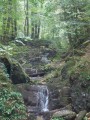
A challenging walk from the descent at Les Cascatelles to the steep climb up to the ruins of Château Thierry, passing first by the ascent up the Ruisseau de la Roule.Medium route: HERE
Walzin, Chaleux and the ancient Roman camp
 8.82 mi
+1,004 ft
-994 ft
4h 55
Moderate
Departure from Dinant (Province de Namur)
8.82 mi
+1,004 ft
-994 ft
4h 55
Moderate
Departure from Dinant (Province de Namur)
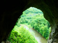
Starting from the small car park at the end of Pont-à-Lesse, this walk takes you on a journey of discovery, covering less than 15 km, to some of the most interesting sites in the Lesse Valley just before it joins the Meuse at Anseremme: Walzin Castle perched on its rock overlooking the river, the Aiguilles de Chaleux, part of the Furfooz Nature Reserve and the ruins of the Roman Camp (please note: there’s an admission charge!), the pretty village of Furfooz, and the Ferme de Sûre, which overlooks the agricultural plateau.And for those who are unaware, the Lesse has another sinkhole apart from the Gouffre de Belvaux and its resurgence at Han-sur-Lesse. There is a partial sinkhole at Furfooz, slightly downstream from Gendron Gare, with a resurgence after the Aiguilles de Chaleux. The ‘Trou qui Fume’ is situated directly above the underground course and sometimes emits steam in winter when there is a marked difference between the temperature inside (the cave) and outside (frost).
Between Yvoir and Warnant via the Ravel
 7.61 mi
+184 ft
-177 ft
3h 40
Moderate
Departure from Yvoir (Province de Namur)
7.61 mi
+184 ft
-177 ft
3h 40
Moderate
Departure from Yvoir (Province de Namur)
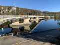
A walk suitable for everyone. Thanks to this walk, which starts and finishes in Yvoir’s main square, discover the Ravel route towards Warnant. The route generally follows a tarmac-surfaced Ravel path but is very pleasant as it passes through the forest. This walk is therefore ideal during the warmer months and is certainly magnificent in autumn. Apart from the section through the forest, the entire route is accessible to pushchairs and people with reduced mobility.
From Bioul to Saint-Gérard: a few castles and an old abbey
 9.36 mi
+509 ft
-499 ft
4h 45
Moderate
Departure from Anhée (Province de Namur)
9.36 mi
+509 ft
-499 ft
4h 45
Moderate
Departure from Anhée (Province de Namur)
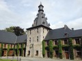
Discovering several castles and an ancient abbey, this circular walk between Bioul and Saint-Gérard runs alongside the Neffe woods and crosses beautiful countryside. The Château de Bioul, a wine-growing estate, is well worth a visit.
From Falmagne to Furfooz
 9.93 mi
+1,175 ft
-1,188 ft
5h 35
Moderate
Departure from Dinant (Province de Namur)
9.93 mi
+1,175 ft
-1,188 ft
5h 35
Moderate
Departure from Dinant (Province de Namur)
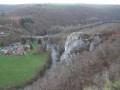
On the border between the Condroz and the Famenne, Falmagne is located on a plateau overlooking the Lesse. Discover the Aiguilles de Chaleux and Walzin Castle via the Furfooz Park.
The Transmolignée
 14.46 mi
+1,407 ft
-1,385 ft
7h 50
Difficult
Departure from Anhée (Province de Namur)
14.46 mi
+1,407 ft
-1,385 ft
7h 50
Difficult
Departure from Anhée (Province de Namur)
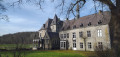
The Transmolignée is a linear hike that connects the Annevoie Gardens to the Benedictine Abbey of Maredsous via forest paths and country roads. To avoid returning along the same route, I suggest returning via the Sosoye State Nature Reserve. The only difficulty is the number of kilometres involved.
Soulme and the Hermeton valley
 10.23 mi
+758 ft
-761 ft
5h 20
Moderate
Departure from Doische (Province de Namur)
10.23 mi
+758 ft
-761 ft
5h 20
Moderate
Departure from Doische (Province de Namur)
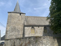
A circular walk exploring the water resources of the Hermeton between Vodelée and Soulme, as well as three listed sites: the Notre-Dame de Bonne Fontaine Chapel, the Moulin de Soulme and the Sainte-Colombe Church in Soulme.Updated May 2026 following various comments:(7) the footbridge near Moulin Bayot is now closed to the public. You must continue straight on to the road and turn right twice to rejoin the original route at Moulin Bayot. Bonus: you pass by the Hermeton waterfall, which is magnificent in frosty weather.(16) Pass the turnstile and follow the river closely... the footpath is still very much public despite the ‘private property’ sign.(19) Take the road to the right and return to the starting point. The path that used to run between the gardens has been removed.
The two mills and the marble sawmill at the start of Gochenée
 5.04 mi
+499 ft
-509 ft
2h 45
Easy
Departure from Doische (Province de Namur)
5.04 mi
+499 ft
-509 ft
2h 45
Easy
Departure from Doische (Province de Namur)
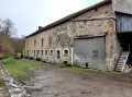
Discover the Moulin de Prêle, the marble sawmill, the mill and the village of Soulme, listed among the most beautiful villages in Wallonia.
Circular around the Bocq
 9.51 mi
+1,342 ft
-1,355 ft
5h 30
Moderate
Departure from Yvoir (Province de Namur)
9.51 mi
+1,342 ft
-1,355 ft
5h 30
Moderate
Departure from Yvoir (Province de Namur)
Numerous quarries have been or are still being exploited in the Bocq valley between Spontin (upstream) and Yvoir (downstream), and a railway line was built there connecting Yvoir to Ciney - via a few bridges and tunnels - to facilitate the transport of production. The line, which has been officially decommissioned, is operated between Évrehailles-Bauche and Ciney by the non-profit organisation Chemin de Fer du Bocq, which offers various activities, including, of course, trips in historic railcars and/or passenger carriages pulled by a steam locomotive. In short, the section between Bauche and Spontin has been reoriented towards tourism, and there are numerous trails and paths for exploring this beautiful region on foot. This walk is an invitation to explore, starting from Purnode.
Hike without description to be followed with the Visorando app.
The Hermeton and Bonne Fontaine
8.70 mi
+686 ft
-686 ft
4h 35
Moderate
Departure from Doische (Province de Namur)
Relatively unknown to hikers, the Hermeton is a rather wild river in the province of Namur, which flows into the Meuse on the left bank at Hermeton-sur-Meuse. This very accessible hike sets out to explore it around Soulme, passing by the Bonne-Fontaine site, its source, its tufa and its chapel located on the hillside between the Hermeton and Vodelée.
Circular route around Soulme via Vodelée-Gochenée
8.50 mi
+725 ft
-722 ft
4h 30
Moderate
Departure from Doische (Province de Namur)
A lovely walk, following theGRP®® “Sentier des Abbayes Trappiste” (SAT), also known asGRP®®125or the “Grande Traversée du Pays de la Forêt de Chimay”.The idea behind this walk is to cover a section of approximately 6 km along this trail by walking a circular route.The vast majority of the paths are unpaved, apart from the sections passing through villages and the final climb up to Soulme. The Hermeton, a tributary of the Meuse, is followed for much of the walk.
A detour via Bocq from Bauche
 10.85 mi
+1,362 ft
-1,375 ft
6h 10
Moderate
Departure from Assesse (Province de Namur)
10.85 mi
+1,362 ft
-1,375 ft
6h 10
Moderate
Departure from Assesse (Province de Namur)
The walk takes you on a journey of discovery through the most wooded part of the Bocq valley, between the hamlets of Bauche and Chansin.The Bocq is the birthplace of numerous quarries and of the railway line that once linked Yvoir to Ciney, thereby facilitating the transport of quarry products. There are numerous drinking water abstraction points, now managed by VIVAQUA, as well as the brewery of the same name situated in the heart of Purnode.
Between Bauche and Durnal, along the Bocq
4.19 mi
+587 ft
-558 ft
2h 25
Moderate
Departure from Assesse (Province de Namur)
The walk between Bauche, Durnal and the Bocq Valley is a pleasant circular route in Wallonia, ideal for a nature walk lasting a few hours.
It combines: forest paths, rural landscapes and a walk through the Bocq Valley, renowned for its charm.
It is a varied and accessible walk, perfect for regular walkers.
Bauche to Durnal and back down to the Bocq valley
4.19 mi
+587 ft
-558 ft
2h 25
Moderate
Departure from Assesse (Province de Namur)
A beautiful, not too long route starting from the old Bauche railway station. Parking is available for several cars. The route can be done in either direction. It's up to you to choose whether you prefer to return via the Bocq valley, which is very pretty. Be careful in wet weather, as some paths are slippery. Allow 3 hours and 15 minutes for a leisurely walk.
Fields and woods around Saint-Gérard
 7.41 mi
+476 ft
-486 ft
3h 50
Moderate
Departure from Mettet (Province de Namur)
7.41 mi
+476 ft
-486 ft
3h 50
Moderate
Departure from Mettet (Province de Namur)
An easy walk in the vicinity of Saint-Gérard, crossing vast fields and a few woods via dirt tracks and small, quiet tarmac roads. Beautiful distant views across the fields, a lovely view of Brogne Abbey, and a passage through the Bois de Neffe woods.
More walks in Onhaye
Select a point of interest below: