From Denée to Denée via Maredret and country lanes

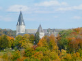
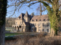
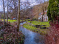
A short circular walk through fields and woods between Denée and Maredret, taking part of the Ravel route. This circular can be taken in either direction, there is a slight incline. It is not accessible with a pushchair.

Details

81912842
Creation:
Last update:
Last review:
  • Walking
    Activity: Walking
  • ↔
    Distance: 2.35 mi
  • ◔
    Average duration: 1h 20 
  • ▲
    Difficulty: Easy

  • ⚐
    Back to start: Yes
  • ↗
    Ascent: + 318 ft
  • ↘
    Descent: - 315 ft

  • ▲
    Highest point: 876 ft
  • ▼
    Lowest point: 577 ft

Waypoints

  1. S/E : mi 0 - alt. 830 ft - Rue de Maredret
  2. 1 : mi 0.22 - alt. 846 ft - Y-junction
  3. 2 : mi 0.79 - alt. 699 ft - Rue des Montis
  4. 3 : mi 1.04 - alt. 617 ft - RAVeL
  5. 4 : mi 1.46 - alt. 610 ft - Crossroads
  6. 5 : mi 1.92 - alt. 771 ft - Exit from the forest
  7. S/E : mi 2.35 - alt. 827 ft - Rue de Maredret

Reviews and comments

3.5 / 5
Based on 1 review

Ease of following the route
3 / 5
Route interest
4 / 5
User 12025347

Overall rating : 3.5 / 5

Date of your route : Oct 20, 2025
Ease of following the route : ★★★☆☆ Average
Route interest : ★★★★☆ Good
Very busy route : Yes

thank you

Machine-translated

Other walks in the area

For more walks, use our search engine .

The GPS track and description are the property of this route's author. Please do not copy them without permission.