


 Country:

 City:
City:


A word of advice: avoid the period from May to September!
A walk in Anseremme


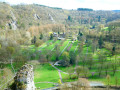
Anseremme is all about the Meuse and the Lesse... whether you choose one or the other, or both, the trip is usually very pleasant. It’s best done at midday on a lovely sunny day when the Lesse isn’t overrun by thousands of kayakers... The route offers some stunning panoramic views from the heights over Pont-à-Lesse and Chaleux, from the banks of the Lesse over Walzin Castle, or across the countryside around Dréhance and Hordenne. The Chawia ravine or gorge is very pretty!
Details
Creation:
Last update:
Last review:
-
 Activity: Walking
 -
 Distance: 9.83 mi
 -
 Average duration: 5h 35
 -
 Difficulty: Moderate
 -
-
 Back to start: Yes
 -
 Ascent: + 1,201 ft
 -
 Descent: - 1,178 ft
 -
-
 Highest point: 860 ft
 -
 Lowest point: 308 ft
Photos
Waypoints
- S/E : mi 0 - alt. 312 ft - Place Baudouin Ier - Meuse (fleuve)
- 1 : mi 0.14 - alt. 312 ft - Kayak finish - lesse (rivière) - Belgique
- 2 : mi 1.94 - alt. 548 ft - Viewpoint over Pont-à-Lesse
- 3 : mi 3.49 - alt. 331 ft - Ford (impassable) - lesse (rivière) - Belgique
- 4 : mi 3.58 - alt. 328 ft - Footbridge - lesse (rivière) - Belgique
- 5 : mi 3.74 - alt. 331 ft - View of the old Walzin Mill and the waterfall - lesse (rivière) - Belgique
- 6 : mi 3.86 - alt. 367 ft - Viewpoint over Walzin Castle
- 7 : mi 4.33 - alt. 364 ft - Dinant-Bertrix-Athus Railway Bridge
- 8 : mi 5.22 - alt. 640 ft - Viewpoint over Chaleux
- 9 : mi 5.85 - alt. 692 ft - Furfooz
- 10 : mi 7.02 - alt. 850 ft - Dréhance
- 11 : mi 7.56 - alt. 692 ft - Public footpath
- 12 : mi 7.82 - alt. 633 ft - Chawia Ravine
- 13 : mi 8.18 - alt. 568 ft - Public footpath
- 14 : mi 8.94 - alt. 741 ft - Hordenne Castle
- S/E : mi 9.83 - alt. 312 ft - Place Baudouin Ier
Notes
Reviews and comments
4.5 / 5
Based on 1 review
Ease of following the route
4 / 5
4 / 5
Route interest
5 / 5
5 / 5

Henry H
Overall rating : 4.5 / 5
Date of your route : May 01, 2026
Ease of following the route : ★★★★☆ Good
Route interest : ★★★★★ Very good
Very busy route : No
A very varied walk through valleys and plateaus with beautiful panoramic views. A few long climbs provided a good test for the legs. The map served as the main guide for the route, with plenty of help from the signposting. I didn’t bother with the more detailed instructions. In the end, I was very glad I’d taken this walk – quite demanding given its length – and enjoyed it under a perfectly blue sky.
A good mix of sections along the Lesse where we really got the feel of a wooded valley landscape, contrasting with the hills and plateaus offering splendid panoramic views. Highly recommended.
Machine-translated
Other walks in the area
Dinant, martyred town, August 1914
 Visorando Member
 8.64 mi
+814 ft
-794 ft
4h 40
Moderate
8.64 mi
+814 ft
-794 ft
4h 40
Moderate
 Departure from Dinant (Province de Namur)
Dinant, daughter of the Meuse, with its citadel, collegiate church, Rocher Bayard, river boats, and home of Adolphe Sax and Father Pire (Nobel Peace Prize winner). Dinant and its bloodstained banks in August 1914. Caught in a pincer movement between the Imperial Army and the French Army, it paid a heavy price for this situation. 674 civilians were massacred by the German Imperial Army. The route is a memorial route of this historical episode, which I invite you to discover.
Between the Meuse and Lesse rivers in Anseremme
 11.52 mi
+640 ft
-623 ft
5h 50
Moderate
Departure from Dinant (Province de Namur)
11.52 mi
+640 ft
-623 ft
5h 50
Moderate
Departure from Dinant (Province de Namur)
This long circular route takes you on a journey of discovery along the Meuse and Lesse rivers in one of the most beautiful parts of their course, with impressive rocks and splendid castles. Mainly wooded but also a little rural on the heights of Falmignoul, it does not present any major difficulties and is ideal for families.
Walzin, Chaleux and the ancient Roman camp
 8.82 mi
+1,004 ft
-994 ft
4h 55
Moderate
Departure from Dinant (Province de Namur)
8.82 mi
+1,004 ft
-994 ft
4h 55
Moderate
Departure from Dinant (Province de Namur)
Starting from the small car park at the end of Pont-à-Lesse, this walk takes you on a journey of discovery, covering less than 15 km, to some of the most interesting sites in the Lesse Valley just before it joins the Meuse at Anseremme: Walzin Castle perched on its rock overlooking the river, the Aiguilles de Chaleux, part of the Furfooz Nature Reserve and the ruins of the Roman Camp (please note: there’s an admission charge!), the pretty village of Furfooz, and the Ferme de Sûre, which overlooks the agricultural plateau.And for those who are unaware, the Lesse has another sinkhole apart from the Gouffre de Belvaux and its resurgence at Han-sur-Lesse. There is a partial sinkhole at Furfooz, slightly downstream from Gendron Gare, with a resurgence after the Aiguilles de Chaleux. The ‘Trou qui Fume’ is situated directly above the underground course and sometimes emits steam in winter when there is a marked difference between the temperature inside (the cave) and outside (frost).
From Dinant to the Moniat rocks
 5.46 mi
+456 ft
-469 ft
2h 55
5.46 mi
+456 ft
-469 ft
2h 55
 Easy
Departure from Dinant (Province de Namur)
Easy
Departure from Dinant (Province de Namur)
A loop starting from Dinant towards the Moniat rocks, offering a magnificent view of the Meuse valley
Around Leffe Abbey
 9.41 mi
+1,076 ft
-1,060 ft
5h 15
Moderate
Departure from Dinant (Province de Namur)
9.41 mi
+1,076 ft
-1,060 ft
5h 15
Moderate
Departure from Dinant (Province de Namur)
Who doesn't know the Belgian beer called 'Leffe'?
This walk will introduce you not to this excellent range of Belgian beers, but to the wooded and rural surroundings of the abbey on the banks of the Meuse, where it was originally brewed.
On the heights of Bouvignes and Dinant
 3.53 mi
+459 ft
-476 ft
2h 00
Easy
Departure from Onhaye (Province de Namur)
3.53 mi
+459 ft
-476 ft
2h 00
Easy
Departure from Onhaye (Province de Namur)
A circular loop to discover Bouvignes and Dinant from above. The highly recommended combination with the route called "From Dinant to the Moniat rocks" allows you to fully discover this area of the Dinant region. With the exception of a few very short sections, this walk follows the GR®129 and then GR®125-126 long-distance footpaths.
For more walks, use our search engine .
The GPS track and description are the property of this route's author. Please do not copy them without permission.

