


Refine your search for walks in Monts du Cantal
Monts du Cantal walks


 Plomb du Cantal from the Col de Prat-de-Bouc
 Visorando Member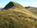
 4.88 mi
 +1,535 ft
 -1,535 ft
 3h 35
3h 35
 Average
 Departure from Albepierre-Bredons (Cantal)
The highest peak in Europe's largest volcanic complex, the Plomb du Cantal (1,855 m) offers unobstructed views of the Monts-Dore (Puy-de-Sancy) to the north and the Cézallier and Aubrac plateaus to the south.
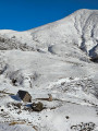
The sources of the Jordanne
 2.80 mi
+538 ft
-518 ft
1h 45
Average
Departure from Mandailles-Saint-Julien (Cantal)
2.80 mi
+538 ft
-518 ft
1h 45
Average
Departure from Mandailles-Saint-Julien (Cantal)
A beautiful, not too difficult walk with magnificent scenery. Ideal for discovering the landscapes of the Cantal.
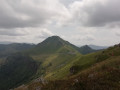
From Le Falgoux to the Col de Legal
 11.14 mi
+3,278 ft
-2,251 ft
8h 00
11.14 mi
+3,278 ft
-2,251 ft
8h 00
 Difficult
Departure from Le Falgoux (Cantal)
Difficult
Departure from Le Falgoux (Cantal)
The first stage of my three-day tour of Puy Mary, with an overnight stay either camping or at the Col de Legal lodge.
Le Puy Mary from the Col de Serre
6.02 mi
+1,654 ft
-1,654 ft
4h 15
Average
Departure from Lavigerie (Cantal)
Climb to the summit of the famous Puy Mary from the south-east, via a very pleasant trail, leaving your car quite far away to avoid the crowds of visitors who gather at the Pas de Peyrol. Some hikers may find this hike a little difficult, see reviews.
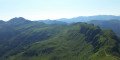
Le Puy de Peyre Arse
 5.42 mi
+1,903 ft
-1,886 ft
4h 10
Difficult
Departure from Le Falgoux (Cantal)
5.42 mi
+1,903 ft
-1,886 ft
4h 10
Difficult
Departure from Le Falgoux (Cantal)
A long walk along the ridges allows you to enjoy the view of the Puy du Cantal, the Puy de Sancy and the Plomb du Cantal. Pass through the Brèche de Roland and return to the Cirque d'Eylac with the marmots.
Puy Mary from the Pas de Peyrol
 1.56 mi
+741 ft
-745 ft
1h 20
Average
Departure from Le Falgoux (Cantal)
1.56 mi
+741 ft
-745 ft
1h 20
Average
Departure from Le Falgoux (Cantal)
The circuit offers magnificent panoramic views of twelve valleys from the summit.
Puy Mary, a veritable pyramid when seen from the sky, rises to 1,783 metres. In the heart of the Cantalien Massif, it is surrounded by exceptional landscapes formed by volcanic activity and glacial erosion, representing the largest volcano in Europe (2,700 km²).
The waterfalls from Albepierre-Bredons
 5.68 mi
+981 ft
-988 ft
3h 30
Average
Departure from Albepierre-Bredons (Cantal)
5.68 mi
+981 ft
-988 ft
3h 30
Average
Departure from Albepierre-Bredons (Cantal)
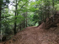
This route invites you to discover the pretty village of Albepierre-Bredons and explore the Pays de Murat national forest, which is home to many remarkable trees. In the cool woods, the Prés Long, Vergnes and Prapsou waterfalls are the main attractions of this shaded route.
Route not accessible from December to April due to snow.
The Cabrespine crossing
 9.91 mi
+2,871 ft
-2,858 ft
7h 05
Difficult
Departure from Mandailles-Saint-Julien (Cantal)
9.91 mi
+2,871 ft
-2,858 ft
7h 05
Difficult
Departure from Mandailles-Saint-Julien (Cantal)
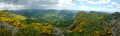
A day's walk in magnificent surroundings, using theGR® trails in the area. We are within sight of Puy Chavaroche and Puy Mary.
Le Plomb du Cantal from Super Lioran
 6.26 mi
+2,251 ft
-2,238 ft
4h 50
Difficult
Departure from Laveissière (Cantal)
6.26 mi
+2,251 ft
-2,238 ft
4h 50
Difficult
Departure from Laveissière (Cantal)
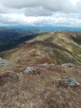
Visit this peak overlooking Super Lioran, avoiding climbing (or descending) the ski slopes. This route via theGR®4is remarkable.
Attention hikers: the IGN map shows theGR®4on the Alpins ski slope, but theGR® is now further east on a very pleasant path. To avoid this, follow the route described below.
The Émilie trail from the Col de Néronne
 4.22 mi
+545 ft
-558 ft
2h 25
4.22 mi
+545 ft
-558 ft
2h 25
 Easy
Departure from Saint-Paul-de-Salers (Cantal)
Easy
Departure from Saint-Paul-de-Salers (Cantal)
A superb hike along a ridge with views of the Cantal mountains.
Puy Griou from Les Chazes
4.31 mi
+1,818 ft
-1,818 ft
3h 35
Average
Departure from Saint-Jacques-des-Blats (Cantal)
The summit of Puy Griou has a characteristic cone shape and can be seen from afar. Located in the heart of the Cantalian volcano, it offers a superb panorama. The proposed route, which is fairly short, has the advantage of avoiding the Super Lioran ski resort facilities.
Puy Violent and Croix des Vachers
 4.13 mi
+1,109 ft
-1,106 ft
2h 50
Easy
Departure from Saint-Paul-de-Salers (Cantal)
4.13 mi
+1,109 ft
-1,106 ft
2h 50
Easy
Departure from Saint-Paul-de-Salers (Cantal)
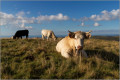
This easy walk will take you to the summit of Puy Violent, where you can admire a superb 360° view of the Aurillac plain and Puy Mary.
Above the Croix des Vachers, an orientation table will tell you the name of each peak.
Rocher du Bec de l'Aigle, Téton de Vénus and Puy Bataillouse loop
 5.46 mi
+2,208 ft
-2,195 ft
4h 25
Average
Departure from Laveissière (Cantal)
5.46 mi
+2,208 ft
-2,195 ft
4h 25
Average
Departure from Laveissière (Cantal)
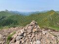
An extraordinary ridge route allowing you to visit three peaks and enjoy a splendid panoramic view of the entire Cantalian puys for much of the route.
La Roche Percée
 3.79 mi
+968 ft
-971 ft
2h 35
Average
Departure from Laveissière (Cantal)
3.79 mi
+968 ft
-971 ft
2h 35
Average
Departure from Laveissière (Cantal)
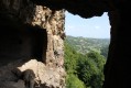
A short hike but with a steep climb through the woods, the Roche Percée site is well worth a visit.
Niervèze and Chaos de Casteltinet
 4.20 mi
+974 ft
-945 ft
2h 45
Average
Departure from Thiézac (Cantal)
4.20 mi
+974 ft
-945 ft
2h 45
Average
Departure from Thiézac (Cantal)
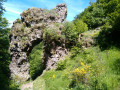
A walk in the mountains among cows and typical Cantal landscapes. Niervèze, a lively mountain village, and the geological curiosity of Chaos de Casteltinet and its impressive Lion's Gate are on the programme. Yellow markings.
The Bois Mary and the Puy de la Tourte
 7.61 mi
+1,660 ft
-1,660 ft
4h 55
Difficult
Departure from Le Claux (Cantal)
7.61 mi
+1,660 ft
-1,660 ft
4h 55
Difficult
Departure from Le Claux (Cantal)
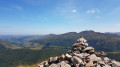
Cross the beautiful high-altitude beech forest in the Bois Mary, then follow the path along the ridge of the Monts du Cantal. This hike alternates between shade in the first half and sunshine and magnificent views in the second half.
The Saut de la Saule
 3.84 mi
+138 ft
-138 ft
1h 55
Easy
Departure from Vebret (Cantal)
3.84 mi
+138 ft
-138 ft
1h 55
Easy
Departure from Vebret (Cantal)
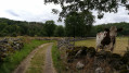
A short, easy, shaded circular walk from Cheyssac (in the commune of Vebret in Cantal) to the Saut de la Saule, a steep-sided gorge on the Rhue.
The Rhue is a tributary of the Dordogne that separates Cantal and Corrèze (and therefore Auvergne from Limousin) near Bort-Les-Orgues.
Saut de la Truite and the waterfalls of the Livernade stream
 3.61 mi
+1,211 ft
-1,220 ft
2h 45
Average
Departure from Brezons (Cantal)
3.61 mi
+1,211 ft
-1,220 ft
2h 45
Average
Departure from Brezons (Cantal)
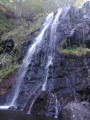
Waterfalls, woodland, stream, at the bottom of the magnificent Brezons Valley.Forests and pastures, magnificent Cantalian landscapes; old stone burons, summer pastures, views of the Plomb du Cantal peaks.Three routes: easy (40 mins), moderate (1 hr 30 mins), full (3 hr 30 mins).Well-designed facilities to make the most of the site’s beauty without spoiling it.
Puy Griou loop from the Col de Font de Cère
 4.19 mi
+1,362 ft
-1,358 ft
3h 05
Average
Departure from Saint-Jacques-des-Blats (Cantal)
4.19 mi
+1,362 ft
-1,358 ft
3h 05
Average
Departure from Saint-Jacques-des-Blats (Cantal)
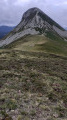
A short route to a legendary summit, offering beautiful panoramic views of the Puy mountains in the Cantal region.
Le Puy Gros and the Sources du Goul
 7.29 mi
+968 ft
-968 ft
4h 10
Average
Departure from Saint-Clément (Cantal) (Cantal)
7.29 mi
+968 ft
-968 ft
4h 10
Average
Departure from Saint-Clément (Cantal) (Cantal)
A beautiful walk along the Cantalian ridges. Open landscapes and magnificent views. To be done in good weather.
"Mountains" route in Pailherols
 6.26 mi
+846 ft
-863 ft
3h 35
Average
Departure from Pailherols (Cantal)
6.26 mi
+846 ft
-863 ft
3h 35
Average
Departure from Pailherols (Cantal)
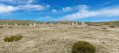
The Montagnes are isolated burons (shepherd's huts) on the Carladès summer pastures. This easy walk offers views of the typical landscapes of this Auvergne high plateau.
Loop around Plomb du Cantal
 8.85 mi
+3,061 ft
-3,061 ft
6h 45
Difficult
Departure from Albepierre-Bredons (Cantal)
8.85 mi
+3,061 ft
-3,061 ft
6h 45
Difficult
Departure from Albepierre-Bredons (Cantal)
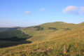
Its height of 1855 metres make Plomb du Cantal the second highest peak in the Massif Central after the Puy de Sancy.
Starting from the Col de Prat de Bouc, this hike initially leads to the summit ascent and descent on the northern slope, followed by a climb up the slopes of the Puy du Rocher before returning to Prat de Bouc.
Le Puy Griou via Bec d'Aigle and Téton de Vénus
 8.56 mi
+2,707 ft
-2,677 ft
6h 15
Difficult
Departure from Laveissière (Cantal)
8.56 mi
+2,707 ft
-2,677 ft
6h 15
Difficult
Departure from Laveissière (Cantal)
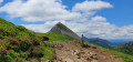
Fond d'Alagnon will be the starting point for your hike. Follow the ridge towards Puy Griou, passing by Bec de l'Aigle and Téton de Vénus. Along the way, you will enjoy numerous views of Plomb Cantal, Puy Mary, Peyre Arse and many other peaks.
Col de Font de Cère - La Brèche de Rolland - Puy Mary - Puy de Peyre Arse
 10.14 mi
+3,068 ft
-3,071 ft
7h 20
Difficult
Departure from Saint-Jacques-des-Blats (Cantal)
10.14 mi
+3,068 ft
-3,071 ft
7h 20
Difficult
Departure from Saint-Jacques-des-Blats (Cantal)
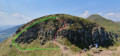
This beautiful route, starting from the Col de Font de Cère, crosses the pastures of the Cantal, passing successively through the Col de Rombière and the Puy de Peyre Arse, ending at the Puy Mary, the second highest peak in the Cantal, via the iconic Brèche de Rolland, a slightly technical passage.
Those who are prone to vertigo should take care on this section.
Throughout this hike, the 360° panoramic views allow you to admire the beautiful mountainous countryside of the Monts du Cantal.
The Girgols Plateau
3.09 mi
+371 ft
-351 ft
1h 45
Easy
Departure from Girgols (Cantal)
A magnificent tour on the plateau where the village of Girgols is located. A short stretch of tarmac road at the beginning, then paths and fields.
From the hamlet of La Bastide, you are in a wild, solitary and magnificent world.
The Salins Waterfall
 1.76 mi
+308 ft
-305 ft
1h 05
Easy
Departure from Salins (Cantal)
1.76 mi
+308 ft
-305 ft
1h 05
Easy
Departure from Salins (Cantal)
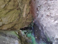
A very pleasant short walk to discover the Salins waterfall, the Monzola stream and the village of Salins, mostly in the shade of the undergrowth. There are many points of interest along the route to keep children interested (waterfall, rope bridge, river, etc.).
The path is fully marked in blue. A huge thank you to the Communauté de Communes du Pays de Mauriac for developing and maintaining this walk.
Faillitoux Waterfall
 2.68 mi
+597 ft
-574 ft
1h 45
Easy
Departure from Thiézac (Cantal)
2.68 mi
+597 ft
-574 ft
1h 45
Easy
Departure from Thiézac (Cantal)
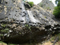
This route takes you to one of the prettiest waterfalls in the Cantal. The Faillitoux waterfall, with a drop of around 40 metres, flows over a lava flow with basalt columns at the foot of the waterfall. The pretty hamlet of Lasmolineries, with its renovated bread oven, is also worth a visit.
The Catou trail
 3.88 mi
+344 ft
-348 ft
2h 05
Easy
Departure from Le Vigean (Cantal)
3.88 mi
+344 ft
-348 ft
2h 05
Easy
Departure from Le Vigean (Cantal)
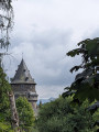
A beautiful hike, lovingly mapped out in the heart of the Cantal between the castles of Chambres and Mazerolles.
Jordanne Valley from the Col du Pertus
8.29 mi
+1,594 ft
-1,594 ft
5h 10
Average
Departure from Mandailles-Saint-Julien (Cantal)
From the Col du Pertus, discover the village of Mandailles and the hamlets of Larmandie and Liadouze on the banks of the Jordanne. On both the outward and return journeys, gaps in the forest offer beautiful views of the valley, the Chavaroche and Puy Mary massifs, as well as the Gliziou and Puy Griou.
Update 2025: see practical information
Sources de la Jordanne, Col de Cabre, Brèche de Rolland
 8.21 mi
+1,909 ft
-1,909 ft
5h 25
Average
Departure from Mandailles-Saint-Julien (Cantal)
8.21 mi
+1,909 ft
-1,909 ft
5h 25
Average
Departure from Mandailles-Saint-Julien (Cantal)
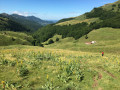
Round trip above Mandailles, in the vast cirque of Fours de Peyre-Arse and the sources of the Jordanne. Not to be missed: both green and mountainous; magnificent landscapes, moderate difficulty.
Climb under the trees, then through the meadows, then walk along an easy ridge path. 360° views in the foreground of the entire Auvergne volcano chain. No difficulty on the route. Marked but regular ascents/descents and a short climb to pass the Brèche de Rolland.
Puy de l'Usclade from Col du Pertus
 4.23 mi
+886 ft
-886 ft
2h 45
Average
Departure from Mandailles-Saint-Julien (Cantal)
4.23 mi
+886 ft
-886 ft
2h 45
Average
Departure from Mandailles-Saint-Julien (Cantal)
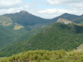
Puy de l'Usclade is little known, but offers a beautiful view of Puy Griou and the other surrounding peaks. The first part of the walk, up to Col de Gliziou, is easy and shaded, and fairly busy, while the second part is less frequented and ends with a steeper section.
The historical heritage of Neussargues en Pinatelle
9.06 mi
+1,056 ft
-1,033 ft
5h 05
Average
Departure from Chalinargues (Cantal)
Discover the history of this part of the Cézalier through the archaeological and historical remains that dot this route. Prehistoric rock shelters, tumuli, Merovingian sarcophagi, medieval forest trails, 12th-century churches, a monumental 15th-century cross, a communal oven, a wash house and beautiful old houses.
Puy Griou from Col du Pertus
 6.56 mi
+1,686 ft
-1,686 ft
4h 30
Average
Departure from Mandailles-Saint-Julien (Cantal)
6.56 mi
+1,686 ft
-1,686 ft
4h 30
Average
Departure from Mandailles-Saint-Julien (Cantal)
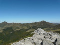
An easy, shaded approach to this iconic peak in the Monts du Cantal, with its perfect cone shape and superb views. However, the final climb is quite technical and challenging.
La Montagnoune from Salers
2.46 mi
+331 ft
-335 ft
1h 25
Easy
Departure from Salers (Cantal)
This accessible and enjoyable hike is ideal for the whole family, including children. It takes you through splendid landscapes to the summer pastures and offers breathtaking views of the burons, evidence of a mountain tradition that is still very much alive. A great opportunity to enjoy nature while discovering the authenticity of this region.
A beautiful circular route that combines nature, heritage and breathtaking views.
Carladez - The Laussac Peninsula.
 9.42 mi
+1,358 ft
-1,368 ft
5h 30
Average
Departure from Thérondels (Aveyron)
9.42 mi
+1,358 ft
-1,368 ft
5h 30
Average
Departure from Thérondels (Aveyron)
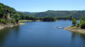
This hike, leading from the Thérondels plateau to the wooded slopes of the Truyère, offers a bird's eye view of the narrow "fjord" formed by the Sarrans Lake reservoir. The Laussac peninsula and its splendid chapel are one of the most iconic sites in Carladez, north of Aveyron.
The Impradine Valley
3.50 mi
+453 ft
-469 ft
2h 00
Easy
Departure from Lavigerie (Cantal)
Walk along the Impradine, from pastures to villages rich in beautiful old houses. Like us, you may encounter a herd of horses, deer and a fox.
Élancèze from the Col du Pertus
 2.09 mi
+860 ft
-860 ft
1h 45
Easy
Departure from Mandailles-Saint-Julien (Cantal)
2.09 mi
+860 ft
-860 ft
1h 45
Easy
Departure from Mandailles-Saint-Julien (Cantal)
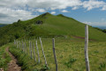
This is a fairly easy short hike to a beautiful promontory offering a panoramic view of the main Monts du Cantal and the Jordanne and Cère valleys.
The Rock of Laqueuille
5.24 mi
+876 ft
-889 ft
3h 10
Easy
Departure from Dienne (Cantal)
The summit of Rocher de Laqueuille is covered with magnificent moorland, ideal for a picnic. To get there, you will pass close to the pretty Château de la Cheyrelle. On your return, don't miss a visit to the beautiful village of Dienne, which has a remarkable 12th-century church with a bell tower and some very beautiful old houses.
The Roman de Jordanne
9.53 mi
+2,185 ft
-2,192 ft
6h 15
Average
Departure from Velzic (Cantal)
An interesting low-altitude hike above and in the Jordanne valley. Enjoy beautiful green landscapes typical of the Cantal region. Pass through pretty little hamlets with old buildings. Peaceful and natural.
The Téton de Vénus above Le Lioran
 4.92 mi
+1,791 ft
-1,798 ft
3h 50
Average
Departure from Laveissière (Cantal)
4.92 mi
+1,791 ft
-1,798 ft
3h 50
Average
Departure from Laveissière (Cantal)
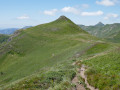
The tour of the Font d'Alagnon cirque, passing by two peaks, is the programme for this walk above the small resort of Le Lioran, which offers beautiful panoramic views of the Cantal volcanic massif.
Le Chaumeil from Saint-Cirgues-de-Jordanne
 5.10 mi
+1,352 ft
-1,348 ft
3h 30
Average
Departure from Saint-Cirgues-de-Jordanne (Cantal)
5.10 mi
+1,352 ft
-1,348 ft
3h 30
Average
Departure from Saint-Cirgues-de-Jordanne (Cantal)
A lovely walk through isolated valleys, typical of the Cantalian mid-mountains. Beautiful trees, beautiful landscapes, peace and greenery. A marked walk with no particular difficulty, if you enjoy paths and hills.
Les Roches Folles
 3.39 mi
+909 ft
-912 ft
2h 20
Easy
Departure from Mandailles-Saint-Julien (Cantal)
3.39 mi
+909 ft
-912 ft
2h 20
Easy
Departure from Mandailles-Saint-Julien (Cantal)
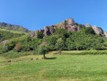
A short hike for residents of Mandailles who want to go for a walk without taking the car.
The Church of Bredons
4.75 mi
+938 ft
-935 ft
3h 00
Easy
Departure from Murat (Cantal) (Cantal)
Walk in the hills above Murat. Beautiful views over the Alagnon and Benet valleys. Beautiful old houses in the village of Bredons and the remarkable site of Bredons Church, an 11th-century Cluniac site.
A picnic on the Prés Marty
10.82 mi
+1,860 ft
-1,860 ft
6h 35
Average
Departure from Albepierre-Bredons (Cantal)
Les Prés Marty are summer pastures on the slopes of Plomb du Cantal, where beautiful Salers cows graze on lush grass. On the way there, discover three beautiful waterfalls, and on the way back, a renovated buron (shepherd's hut), an oratory and a fourth waterfall. In season, dessert will be provided by the many wild raspberry bushes that line the path.
The Mercou Woods
 6.79 mi
+558 ft
-574 ft
3h 35
Average
Departure from Paulhac (Cantal)
6.79 mi
+558 ft
-574 ft
3h 35
Average
Departure from Paulhac (Cantal)
Circuit no. 1 in the guidebook of walking, horse riding and mountain biking routes in the commune of Paulhac.
Lac de Sauvages
3.47 mi
+308 ft
-312 ft
1h 50
Easy
Departure from Dienne (Cantal)
A family walk offering beautiful views of the Limon Plateau on the other side of the Santoire Valley.
Chapelle Saint-Antoine via Rocher de Bonnevie, starting from Murat
 5.16 mi
+1,148 ft
-1,138 ft
3h 20
Easy
Departure from Murat (Cantal) (Cantal)
5.16 mi
+1,148 ft
-1,138 ft
3h 20
Easy
Departure from Murat (Cantal) (Cantal)
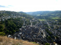
The route passes through the old town of Murat and then two religious buildings on their respective promontories. These offer views of the town of Murat and the Cantal mountains.
Three waterfalls at Albepierre-Bredons
 3.88 mi
+505 ft
-515 ft
2h 15
Easy
Departure from Albepierre-Bredons (Cantal)
3.88 mi
+505 ft
-515 ft
2h 15
Easy
Departure from Albepierre-Bredons (Cantal)
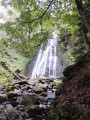
A route starting from a charming village that takes you to three waterfalls.
The Cascade des Vergnes, the uppermost of the three, is only visible from a viewing point. From here, take the opportunity to visit the Roman milestone a few metres further up.
The Cascade des Prés Longs, visible from a viewpoint and then from its base, is far more impressive than its neighbours.
The Cascade de Prapsou, superb, with a drop of several metres near the village.
Ideal spots offering a haven of greenery and coolness.
Plateau de la Planèze from Col de Prat de Bouc
 7.80 mi
+853 ft
-863 ft
4h 20
Average
Departure from Albepierre-Bredons (Cantal)
7.80 mi
+853 ft
-863 ft
4h 20
Average
Departure from Albepierre-Bredons (Cantal)
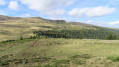
The Plateau de la Planèze starting from Prat de Bouc.
N.B. Following the route with the Visorando app can be very useful in the forest due to the numerous trail intersections encountered.
The Benet Valley
10.13 mi
+1,854 ft
-1,860 ft
6h 15
Average
Departure from Albepierre-Bredons (Cantal)
The Cirque de Chamalière was formed by a glacier that reshaped the landscape after the formation of the Cantal stratovolcano. It is a very pleasant place for summer grazing and, incidentally, for picnics. The small streams that run down its slopes feed into a brook, the Benet. This hike follows the valley of this short brook, a tributary of the Alagnon.