


Refine your search for walks in Messac (Ille-et-Vilaine)
Messac (Ille-et-Vilaine) walks


 In the countryside on the border between the municipalities of Messac, Pléchâtel and Bain
 Visorando Member
 9.81 mi
 +502 ft
 -499 ft
 4h 55
4h 55
 Moderate
 Departure from Messac (Ille-et-Vilaine) (Ille-et-Vilaine)
A route through the countryside and through the woods. The route passes at the foot of the wind farm, then follows small paths to the Chêne and the Landes de Brelon, before passing through Bagaron and ending gently on the Voie Verte.
La Trotinais in Saint-Senoux
 7.70 mi
+702 ft
-692 ft
4h 10
Moderate
Departure from Saint-Senoux (Ille-et-Vilaine)
7.70 mi
+702 ft
-692 ft
4h 10
Moderate
Departure from Saint-Senoux (Ille-et-Vilaine)
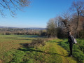
This area, aptly named Pays des Vallons de Vilaine (Land of the Vilaine Valleys), offers a rugged topography that is almost unique in the department and will delight hiking enthusiasts. The La Trotinais route has a total elevation gain of almost 200 metres. The village of Saint-Senoux and its 19th-century parish church of Saint-Abdon, as well as the hamlets of La Trotinais and La Fiolais, are well worth a visit.
From Saint-Senoux to Pléchatel along the Vilaine
7.90 mi
+558 ft
-541 ft
4h 05
Moderate
Departure from Saint-Senoux (Ille-et-Vilaine)
From the charming village of Saint-Senoux, head towards the banks of the Vilaine, first following the Voie Verte and then the other bank overlooking it to discover the green countryside.Some sections are a little challenging, mainly in the southern circular loop (between (4) and (7)). But the panoramic views that greet walkers make it all worthwhile.
Bain-de-Bretagne via the back roads
 6.41 mi
+338 ft
-315 ft
3h 15
Moderate
Departure from Bain-de-Bretagne (Ille-et-Vilaine)
6.41 mi
+338 ft
-315 ft
3h 15
Moderate
Departure from Bain-de-Bretagne (Ille-et-Vilaine)
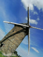
I suggest you discover this charming little town and its lake in an original way, by taking the small side roads.
Small change due to a ban on crossing the small wood next to the Moulin de Bertaud.
Land and river around Port-de-Roche
 13.14 mi
+476 ft
-472 ft
6h 25
Moderate
Departure from Langon (Ille-et-Vilaine) (Ille-et-Vilaine)
13.14 mi
+476 ft
-472 ft
6h 25
Moderate
Departure from Langon (Ille-et-Vilaine) (Ille-et-Vilaine)
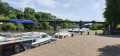
The route allows you to discover the countryside between Langon, Beslé and Brain-sur-Vilaine, passing through pretty little typical villages, crossing woods and forests and ending on the towpath along the Vilaine, for more than 9 km. Most of the trail is on beautiful stone paths. The Vilaine is very popular in these areas. You will see pleasure boats and fishermen in their boats. Don't miss the egrets and grey herons on the banks of the Vilaine.
Le Tertre Gris on the slopes of the "Volcano"
 2.14 mi
+404 ft
-404 ft
1h 20
Moderate
Departure from Poligné (Ille-et-Vilaine)
2.14 mi
+404 ft
-404 ft
1h 20
Moderate
Departure from Poligné (Ille-et-Vilaine)
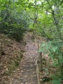
Straddling the municipalities of Pancé, Poligné and Pléchâtel, the Tertre Gris site is steeped in history: geological, historical, industrial and environmental.
Seven discovery stations are located along the path near the banks of the Semnon. You will be able to read the landscape from the viewpoint, understand the "Volcano" and the geology of the Tertre, and savour its legends (at the summit and at the foot of the volcano).Please note that this route is not signposted.
Route des Châteaux in Bourg-des-Comptes
 10.21 mi
+673 ft
-669 ft
5h 15
Moderate
Departure from Bourg-des-Comptes (Ille-et-Vilaine)
10.21 mi
+673 ft
-669 ft
5h 15
Moderate
Departure from Bourg-des-Comptes (Ille-et-Vilaine)
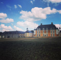
Route between Bourg-des-Comptes and Pléchâtel. Along the way, you will see four châteaux of different styles, periods and states of preservation: "Gai Lieu", "La Molière", "Le Boschet" and "Mont Rive". Thefifth, "Le Hamonay", is almost invisible.
The Saint-Pierre Cross at the Saint-Just megalithic alignments
 1.18 mi
+75 ft
-75 ft
0h 35
1.18 mi
+75 ft
-75 ft
0h 35
 Easy
Departure from Saint-Just (Ille-et-Vilaine) (Ille-et-Vilaine)
Easy
Departure from Saint-Just (Ille-et-Vilaine) (Ille-et-Vilaine)
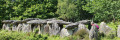
It’s a short walk suitable for children and ideal for families, whatever the season.This short circular loop runs along the western side of the Allée des Demoiselles de Cojoux, offering a view of the Étang du Val.Adults can extend the walk by heading east to see the famous Demoiselles de Cojoux and the Alignements du Moulin.
Finally, it’s well worth rounding off the walk by exploring the magnificent Allée Couverte de Tréal, which is just a 3-minute drive away.
Étang du Val and megaliths in Saint-Just
 3.43 mi
+167 ft
-194 ft
1h 45
Easy
Departure from Saint-Just (Ille-et-Vilaine) (Ille-et-Vilaine)
3.43 mi
+167 ft
-194 ft
1h 45
Easy
Departure from Saint-Just (Ille-et-Vilaine) (Ille-et-Vilaine)
Walk along the Étang du Val, then along the river, under the cover of the forest, then climb up to the plateau in the moorland to explore the varied megaliths of this exceptional site. There are many paths on the site, offering numerous possible variations.
The Semnon circuit
6.94 mi
+318 ft
-322 ft
3h 30
Moderate
Departure from La Bosse-de-Bretagne (Ille-et-Vilaine)
This route, which is partly unmarked, will allow you to explore the hills and the Semnon valley around La Bosse-de-Bretagne, Ercé-en-Lamée and Tresbœuf. It partly follows the Pierres Grises and Asphodèles routes (Bretagne Porte de Loire Community) in Ercé-en-Lamée. 5.5 km of tarmac (local roads), gravel and dirt tracks.
Tour of the Étang du Val
4.49 mi
+233 ft
-240 ft
2h 15
Easy
Departure from Saint-Just (Ille-et-Vilaine) (Ille-et-Vilaine)
Walk around the Étang du Val, crossing the Lande de Cojoux and then skirting the Château du Val.
Around Sel-de-Bretagne
 3.67 mi
+141 ft
-135 ft
1h 50
Easy
Departure from Le Sel-de-Bretagne (Ille-et-Vilaine)
3.67 mi
+141 ft
-135 ft
1h 50
Easy
Departure from Le Sel-de-Bretagne (Ille-et-Vilaine)
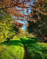
A tour around the village of Sel-de-Bretagne, allowing you to enjoy the rural paths preserved thanks to the efforts of Eugène Aulnette, a historic figure in the village. You will also pass by the Sainte-Anne Chapel, restored and decorated by this sculptor together with the villagers, and the menhirs found in the village.
Via Le Plessis and Pouchard
8.09 mi
+541 ft
-541 ft
4h 10
Moderate
Departure from La Bosse-de-Bretagne (Ille-et-Vilaine)
This unmarked route will allow you to explore the hills and valleys to the east of La Bosse-de-Bretagne, and enjoy views over part of the Semnon valley and the motocross track.It follows a number of paths through the villages of La Bosse-de-Bretagne and Tresbœuf.4.8 km of tarmac (local roads), gravel tracks and dirt tracks.
Via Sourg and Le Plessis from La Bosse-de-Bretagne
6.50 mi
+364 ft
-354 ft
3h 20
Moderate
Departure from La Bosse-de-Bretagne (Ille-et-Vilaine)
This unmarked route will allow you to explore the hills and valleys to the east of La Bosse-de-Bretagne, and to discover the motocross track.It follows a number of paths through the parishes of La Bosse-de-Bretagne and Tresbœuf.4.5 km of tarmac (local roads), gravel tracks and dirt tracks.
In the Vilaine region between Laillé and Bourg-des-Comptes
 9.79 mi
+531 ft
-522 ft
5h 00
Moderate
Departure from Laillé (Ille-et-Vilaine)
9.79 mi
+531 ft
-522 ft
5h 00
Moderate
Departure from Laillé (Ille-et-Vilaine)
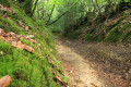
This is a beautiful circular that partly follows theGR®39along charming paths. The return journey is along the towpath, going up the Vilaine.
This path takes you through beautiful landscapes, typical villages, charming residences and locks, and ends up running alongside this river, which is so poorly named.
The Landes d’Ercé
7.35 mi
+30 ft
-30 ft
3h 25
Moderate
Departure from Ercé-en-Lamée (Ille-et-Vilaine)
This route largely follows the Circuits des Pierres Grises and the Circuits des Asphodèles (Bretagne Porte de Loire Communauté). Partly signposted, it will allow you to explore the Landes d’Ercé, de la Fleuriais and du Fayel. For your information: 1.25 km of tarmac-surfaced local roads; the rest consists of farm tracks and footpaths.
Canut Valley discovery route
 2.23 mi
+226 ft
-240 ft
1h 15
Easy
Departure from Lassy (Ille-et-Vilaine) (Ille-et-Vilaine)
2.23 mi
+226 ft
-240 ft
1h 15
Easy
Departure from Lassy (Ille-et-Vilaine) (Ille-et-Vilaine)
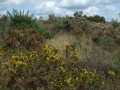
Short family walk along the discovery trail in the protected natural site of the Canut Valley.The route is mostly shaded and features educational panels on the local flora and fauna.On the trail, you will pass by the old Ritoir mill, which has been converted into the Maison des Énergies.
Countryside and Canut valley via the Streams and Landes routes
 7.54 mi
+574 ft
-574 ft
4h 00
Moderate
Departure from Lassy (Ille-et-Vilaine) (Ille-et-Vilaine)
7.54 mi
+574 ft
-574 ft
4h 00
Moderate
Departure from Lassy (Ille-et-Vilaine) (Ille-et-Vilaine)
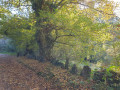
A route allowing you to see the countryside and woods around Lassy, then reach the Canut valley and the moorland.
Best done clockwise to finish with the moorland and the view of the Canut valley.
Please note: the Canut crossing between (9) and (10) can be difficult after heavy rain.
There are a few road crossings, but visibility is fairly good to very good, making it easy to cross, but caution is advised.
Boël Trail (Sentier du Boël)
 5.00 mi
+305 ft
-302 ft
2h 35
Moderate
Departure from Guichen (Ille-et-Vilaine)
5.00 mi
+305 ft
-302 ft
2h 35
Moderate
Departure from Guichen (Ille-et-Vilaine)
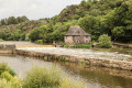
A very pleasant hike. First section at the top of cliffs, with lovely views over the Vilaine river and the site "Moulin du Boël". Cross a shady woodland, then return along the towpath.
To avoid as much as possible passing along the military site's fence ("Le Celar"), this new description uses a slightly more technical part of the GR®.
The ponds and moors of Campel
 8.59 mi
+325 ft
-341 ft
4h 15
Moderate
Departure from Campel (Ille-et-Vilaine)
8.59 mi
+325 ft
-341 ft
4h 15
Moderate
Departure from Campel (Ille-et-Vilaine)
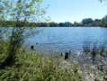
To the north of Campel lie the Étang de Livry, the Bois de la Sorais and the Bigotais moors. Whatever the season, explore these forest paths as they criss-cross one another and admire the landscapes that unfold as you emerge from the woods.
Bois de Cent Jours and moorland to the north-west of Bovel
9.43 mi
+354 ft
-361 ft
4h 40
Moderate
Departure from Bovel (Ille-et-Vilaine)
Walk in the Bois de Cent Jours (the time it took to clear 30 hectares) and on the moorland north of Bovel.
With a little care and silence, you may spot roe deer (I’ve done this walk twice on my own and once in a group of twelve); on each occasion I managed to spot some (admittedly at varying distances!).
 The Gannedel and Massérac Marshes
21.40 mi
+443 ft
-443 ft
2.5 hrs
Easy
Departure from Sainte-Marie (Ille-et-Vilaine) (Ille-et-Vilaine)
Upstream from Redon, the Vilaine valley stretches out between the hillsides that flank it to the north and south. Vast expanses of wild or cultivated marshland follow one another, through the midst of which the river flows.
Cycling along the small roads that wind around these marshes is a refreshing way to explore the area and its villages, away from the main roads.
Around Pont Péan, a former mining town
 4.68 mi
+26 ft
-26 ft
2h 10
Easy
Departure from Pont-Péan (Ille-et-Vilaine)
4.68 mi
+26 ft
-26 ft
2h 10
Easy
Departure from Pont-Péan (Ille-et-Vilaine)
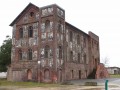
Pont Péan still bears traces of its former mining activity.A silver lead (or galena) mine was operated there from 1730 to 1797 and from 1844 to 1904.This route allows you to see some remains of this activity and to tour the village near the Tellé stream on the edge of the urban and rural areas.
Route around Corps-Nuds
 3.22 mi
+102 ft
-98 ft
1h 35
Easy
Departure from Corps-Nuds (Ille-et-Vilaine)
3.22 mi
+102 ft
-98 ft
1h 35
Easy
Departure from Corps-Nuds (Ille-et-Vilaine)
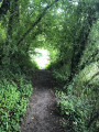
A short 5 km walk in Corps-Nuds, offering a chance to recharge your batteries amidst natural surroundings (a pond, a short forest trail with footbridges, etc.) whilst discovering the local heritage. An ideal route for families with children.