The ponds and moors of Campel

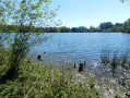
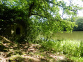
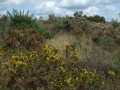
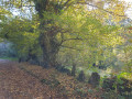
To the north of Campel lie the Étang de Livry, the Bois de la Sorais and the Bigotais moors. Whatever the season, explore these forest paths as they criss-cross one another and admire the landscapes that unfold as you emerge from the woods.

Details

3184653
Creation:
Last update:
Last review:
  • Walking
    Activity: Walking
  • ↔
    Distance: 8.59 mi
  • ◔
    Average duration: 4h 15 
  • ▲
    Difficulty: Moderate

  • ⚐
    Back to start: Yes
  • ↗
    Ascent: + 325 ft
  • ↘
    Descent: - 341 ft

  • ▲
    Highest point: 390 ft
  • ▼
    Lowest point: 253 ft
  • ⚐ Country: France
  • ⚐ City: Campel (35330)
  • ⚑
    Start/End: N 47.936744° / W 2.008277°
  • ❏
    IGN map(s): Ref. 1119SB
  • Hour-by-hour weather

Photos

Description of the walk

Car park at the Place de l’Église.

(S/E) Head towards the main street and turn right, passing in front of the town hall.

(1) Turn left onto Rue de l’Étang. Carry on straight ahead, ignoring the left-hand bend in the path
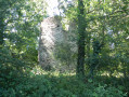
Note the ruins of the Moulin du Rocher on your left.

(2) Take the path furthest to the right and continue in the same direction. At the end of the path, turn left, then right after 150 m. Walk past the base of the wind turbine and reach the Croix des Trois Chesnots crossroads.

(3) Take the path furthest to the right, passing the cross on your right-hand side as you head towards the Étang de Livry. Just before the pond, turn right towards the south, then, at the end of the path, turn left.

(4) At the Fork in the road, continue along the path to the right and head for the hamlet of La Vigne.
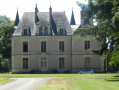
Off the route: turn right and, after 200 m, you’ll see the façade of the Château du Val at the end of the driveway
Continue along the road to the left.

(5) At the triangular central reservation, turn left. Cross the D 65 and continue straight ahead. Take thefirst path on the left after the factory car park.

(6) When the track joins the D 65, turn right onto the footpath. Continue north-east to the Étang de la Haye Pierre (private property).

(7) Turn right and, at the fork in the path, turn left. At the crossroads, carry on straight ahead. As all the paths then run at right angles to one another, turn right, then left, then right again so that the small ponds fed by the Ruisseau de la Boyère are on your left. Just after this, 200 metres to the left, you’ll see four large livestock buildings belonging to the Ferme de la Motte.

(8) Take the hairpin bend to the right and continue in this direction, heading due south for 1.7 km, first crossing the Ruisseau d’À-Bas and then reaching a road. Follow this road to the right.

(9) Go round the Bigotais by turning right, then taking thefirst path on the left. Once back on the road, follow it to the right. Continue westwards, cross the D 65 departmental road and reach the junction with the triangular central reservation.

(5) Turn left and enter Campe via Rue de Maxent.

(1) Head straight ahead. Pass the town hall again and return to the car park at the Place de l’Église (S/E).

Waypoints

  1. S/E : mi 0 - alt. 269 ft - Church car park.
  2. 1 : mi 0.24 - alt. 279 ft - Turn left towards the pond
  3. 2 : mi 0.92 - alt. 331 ft - Les Sorais – turn right
  4. 3 : mi 1.97 - alt. 387 ft - Croix des Trois Chesnots – turn right
  5. 4 : mi 2.83 - alt. 371 ft - Path on the right
  6. 5 : mi 3.28 - alt. 312 ft - Triangular traffic island – turn left
  7. 6 : mi 3.87 - alt. 367 ft - Before the road – turn right
  8. 7 : mi 4.32 - alt. 312 ft - Path on the right
  9. 8 : mi 5.56 - alt. 338 ft - Right-hand hairpin bend
  10. 9 : mi 6.73 - alt. 367 ft - La Bigotais – on the right
  11. S/E : mi 8.59 - alt. 269 ft - Church car park.

Notes

This route is a combination of two routes: the ‘Étangs’ circular route and the ‘Landes’ circular route.
Both are marked in yellow on a very temporary basis: for the ‘Étangs’ route = a large yellow bar; for the ‘Landes’ route, only the changes of direction are marked.
If in doubt, the directions in this description should be sufficient.

Worth a visit

The Étang du Val: Near this pond, only the remains of the old Moulin du Bas and the bread oven, which belonged to the Château du Val, can be seen. A few steps further on, at the top of the hill, stand the ruins of the old Moulin du Rocher, which also belonged to the seigneury of Le Val.

The Bois de la Sorais is home to two fortified camps dating from the Early Middle Ages; one known as ‘des Forêts’, the other as ‘du Tertre’ or ‘de la Bigotais’.
The fortified camp consists of a relatively low, oval or rectangular platform surrounded by an earthen rampart preceded by a ditch.

After the ‘4 ’, turn right at La Vigne; on the left stands the Château du Val (private property, not open to visitors).
http://patrimoine.region-bretagne.fr/ger...

Reviews and comments

3.8 / 5
Based on 4 reviews

Reliability of the description
3.8 / 5
Ease of following the route
3.8 / 5
Route interest
4 / 5
Picson06230
Picson06230
• Edited:

Overall rating : 4.3 / 5

Date of your route : Aug 17, 2025
Reliability of the description : ★★★★☆ Good
Ease of following the route : ★★★★☆ Good
Route interest : ★★★★★ Very good
Very busy route : No

A beautiful, uncrowded hike that deserves to be better known.
At point 7, brambles have overgrown the path to the right, but just continue along the path for 100 metres and take the lane on the right.
I will do this walk again in another season.
Best regards

Machine-translated

jackpot35200R
jackpot35200R

Hello,
It’s true that the route isn’t well signposted. With a GPS app, it’s easier to find your way around by following
the route step by step.
Kind regards.

Machine-translated

yves5000
yves5000
• Edited:

A poorly signposted and very quiet path.
There’s even a tree blocking the path at one point near the lake.
Kind regards

Machine-translated

Z108
Z108

Overall rating : 4 / 5

Date of your route : Jan 14, 2024
Reliability of the description : ★★★★☆ Good
Ease of following the route : ★★★★☆ Good
Route interest : ★★★★☆ Good
Very busy route : No

This walk can be done in winter provided you’re wearing suitable footwear. The start of the route, which takes in local heritage sites, is the most interesting part, so it might be worth doing the circular route in the opposite direction.

Machine-translated

jackpot35200R
jackpot35200R

Overall rating : 4 / 5

Date of your route : Jul 04, 2020
Reliability of the description : ★★★★☆ Good
Ease of following the route : ★★★★☆ Good
Route interest : ★★★★☆ Good
Very busy route : No

A walk amongst castles, ponds and wind turbines. The route could be better signposted, as not many people seem to do it.

Machine-translated

riko56
riko56
• Edited:

Overall rating : 3 / 5

Date of your route : Jul 06, 2020
Reliability of the description : ★★★☆☆ Average
Ease of following the route : ★★★☆☆ Average
Route interest : ★★★☆☆ Average
Very busy route : No

A rather tedious walk because it’s poorly signposted, especially the first circular route. Some paths are difficult as they’re rarely used (tall grass): nature has reclaimed its territory!! Lovely scenery, but a bit monotonous towards the end of the route along the wide paths through the woodland. Pay close attention to the markings, which aren’t always clearly visible and are easy to miss if you’re not paying attention...

At level 3: After the cross near a bench, you’ll take a path leading into the forest at the junction; don’t miss the markings on the right on a post – unfortunately hidden by foliage – to take the path. Don’t make the same mistake we did: we carried on straight ahead along the path, which was blocked by fallen trees lying across it and had spongy ground, and which leads to the pond. After a very perilous crossing, we wandered about for a while before finding the path again a little further on, having crossed through the overgrown forest…
At level 8:
at the uphill bend, with the farm buildings on the left, there were no markings for the hairpin bend; eventually, after much hesitation and going back and forth trying to find the markings, we took the small grassy path which led us onto the right track.

It’s a shame – this route deserves better maintenance and signposting – but it’s always handy and pleasant to do a circular route.

Machine-translated

Other walks in the area

For more walks, use our search engine .

The GPS track and description are the property of this route's author. Please do not copy them without permission.