In town and in the countryside in Saint-Erblon

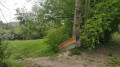
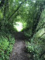
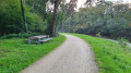
A lovely walk for the whole family along the River Ise and through the countryside around Saint-Erblon. The route is signposted in yellow for much of the way.

Details

15505597
Creation:
Last update:
Last review:
  • Walking
    Activity: Walking
  • ↔
    Distance: 7.52 mi
  • ◔
    Average duration: 3h 35 
  • ▲
    Difficulty: Moderate

  • ⚐
    Back to start: Yes
  • ↗
    Ascent: + 102 ft
  • ↘
    Descent: - 102 ft

  • ▲
    Highest point: 154 ft
  • ▼
    Lowest point: 75 ft

Description of the walk

Park near the church at Saint-Erblon.

(S/E) Take the road leading to Noyal-Chatillon (Rue du Verger) and, at the first roundabout, turn right. Leave the street on your right, negotiate the bend, then turn right onto Rue des Leuzières to enter the park. Cross the River Ise via the footbridge, then turn right and follow the path upstream.

(1) Cross the D36 (Rue de l’Ise) at the Saint-Erblon exit and follow the path opposite.

(2) Before reaching the hamlet of l’Ourmais, turn left and pass through Douazel. Take the D36 for about 50 metres to the right, then take the first road on the left at the bus stop. Carry on straight ahead to Ercé.

(3) As you leave the hamlet, take the wide path opposite, which runs alongside a field on the right and a lovely tree-lined hedge on the left. Keep to the right at the fork and continue to the hamlet known as ‘la Barricade’.

(4) Turn right towards La Chouanière, then take a small path on the left just before the farm entrance.

(5) At the hamlet known as ‘Le Petit Coin’, turn left towards the Ercé moor and, at Haurée, at the foot of the water reservoir, turn right. Follow the road for about 200 metres.

(6) At the first houses on the right, take the path on the left. At the entrance to the Ourmais woods, take the path on the right that runs alongside the woods and stay on the edge until you reach the road again.

(7) Follow the road to the right and head for the hamlet known as l’Ourmais.

(8) Take the path on the left to reach the Moulin du Blochet, then turn right to walk alongside the River Ise.

(9) Cross the River Ise, then take a series of bends to the left and right, keeping the Douvettes buildings on your right. Join the D82.

(10) Cross the D82 with extreme caution as the road is very busy and the crossing is on a straight stretch. Follow the path towards the pond and, once past it, turn right at the junction. In the right-hand bend, turn left onto a side path and follow it to the right.

(11) Turn left, pass the pond and then continue left onto the road. At the last house on the right, turn right onto a path that joins Avenue de l’Alliance. Cross at the pedestrian crossing, head straight ahead and reach the next pedestrian crossing.

(12) Cross the road and follow the path opposite. Cut across Rue Simone Morand and continue straight ahead; rejoin the street and follow it to the right. Continue along Rue Paul Féval until you reach the church square and the starting point (S/E).

Waypoints

  1. S/E : mi 0 - alt. 108 ft - Église Saint-Hermeland (Saint-Erblon)
  2. 1 : mi 0.71 - alt. 85 ft - D36 road
  3. 2 : mi 1.3 - alt. 131 ft - L’Ourmais
  4. 3 : mi 2.28 - alt. 95 ft - Ercé
  5. 4 : mi 3.18 - alt. 128 ft - La Barricade
  6. 5 : mi 3.48 - alt. 135 ft - Le Petit Coin
  7. 6 : mi 3.92 - alt. 141 ft - Ruzé
  8. 7 : mi 4.55 - alt. 151 ft - Exit from the woods
  9. 8 : mi 4.77 - alt. 105 ft - L’Ourmais
  10. 9 : mi 5.2 - alt. 85 ft - Bridge over the River Ise
  11. 10 : mi 5.69 - alt. 102 ft - D82 road
  12. 11 : mi 6.33 - alt. 125 ft - Junction
  13. 12 : mi 6.95 - alt. 118 ft - Rue des Prés Mêlés
  14. S/E : mi 7.52 - alt. 108 ft - Église Saint-Hermeland (Saint-Erblon)

Worth a visit

The Blochet mill lies between (8) and (9).

Reviews and comments

4.3 / 5
Based on 2 reviews

Reliability of the description
4.5 / 5
Ease of following the route
4.5 / 5
Route interest
4 / 5
Marie Carray
Marie Carray

Overall rating : 4.7 / 5

Date of your route : Sep 14, 2026
Reliability of the description : ★★★★★ Very good
Ease of following the route : ★★★★★ Very good
Route interest : ★★★★☆ Good
Very busy route : No

A flat and easy route, completed in 02:40, taking in more countryside than town, following a few tarmac sections with little or no traffic and numerous paths through woodland or along fields. As with most routes on Visorando or any other app, it’s best to use the GPX track.

Machine-translated

User 17501852

Overall rating : 4 / 5

Date of your route : Mar 26, 2026
Reliability of the description : ★★★★☆ Good
Ease of following the route : ★★★★☆ Good
Route interest : ★★★★☆ Good
Very busy route : No

The route was interesting and offered a variety of scenery. We set off from the Isé Bridge as there is a carpool car park there.
There is then a choice to be made 200–300 metres after setting off, as we have to choose between Hamerland West and Hamerland East, which has nothing to do with the name of the route as stated. We chose the ‘west’ route and covered 13.6 km, avoiding a 2 km circular route and the final 1.5 km of the route.
But overall, it remains an interesting route.
Thank you.

Machine-translated

Other walks in the area

For more walks, use our search engine .

The GPS track and description are the property of this route's author. Please do not copy them without permission.