


Refine your search for walks in Marizy
Marizy walks


 Around Marizy through the hills
 Visorando Member
 7.55 mi
 +538 ft
 -538 ft
 3h 55
3h 55
 Moderate
 Departure from Marizy (Saône-et-Loire)
This easy circular route, which largely avoids muddy paths, follows quiet country lanes offering lovely views of the countryside. It passes near the Pierre d’Orgeval, a local landmark, then heads towards Fontaine Chaude, a spring that maintains a constant temperature all year round.
La Croix Racot
 4.23 mi
+351 ft
-358 ft
2h 15
4.23 mi
+351 ft
-358 ft
2h 15
 Easy
Departure from Saint-Vallier (Saône-et-Loire) (Saône-et-Loire)
Easy
Departure from Saint-Vallier (Saône-et-Loire) (Saône-et-Loire)
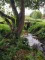
A walk through meadows and woods, with some beautiful views.
Saint-André-le-Désert circular
 5.88 mi
+581 ft
-581 ft
3h 15
Easy
Departure from Saint-André-le-Désert (Saône-et-Loire)
5.88 mi
+581 ft
-581 ft
3h 15
Easy
Departure from Saint-André-le-Désert (Saône-et-Loire)
The village of Saint-André-le-Désert is located between Clunisois and Charolais. I suggest this short walk in the heart of the Charolais cattle breeding region. The paths run through a landscape of rolling hills and hedgerows. You will pass through small hamlets with stone houses and places steeped in history. Suitable for families.
A circular route to the north of Joncy
6.39 mi
+591 ft
-591 ft
3h 25
Easy
Departure from Joncy (Saône-et-Loire)
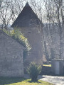
This route starting from Joncy will take you past plenty of stonework. From the quarries and stone houses in Rains to the Domaine du Petit Balay with its large square tower and a pile of stone gathered from fields.
From Carapone to Rains on stone-lined paths
 6.22 mi
+610 ft
-627 ft
3h 25
Moderate
Departure from Saint-Clément-sur-Guye (Saône-et-Loire)
6.22 mi
+610 ft
-627 ft
3h 25
Moderate
Departure from Saint-Clément-sur-Guye (Saône-et-Loire)
This 10km loop hike starts from Saint-Clément-sur-Guye, with the Carapone at its highest point (440m), and takes in the villages of Saint-Clément-sur-Guye (Romanesque church listed as a historic monument in 1927, a tower to the east of the church), Rains, commune of Joncy (pretty stone houses), Le Petit Ballay, its square tower, its 'Murgers' (piles of stones removed from the vines), before Corcelles (hamlet of Saint-Clément).
A trip to the valley from the Butte de Suin
 Tourist office
 9.13 mi
+1,020 ft
-1,001 ft
5h 05
Moderate
Departure from Suin (Saône-et-Loire)
9.13 mi
+1,020 ft
-1,001 ft
5h 05
Moderate
Departure from Suin (Saône-et-Loire)
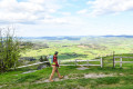
An unmissable viewpoint offering a magnificent panorama of the Charolais and Beaujolais hills. This route invites you to discover an unspoilt landscape, alternating between meadows and forests.
La Mer de Pierre
 7.37 mi
+814 ft
-814 ft
4h 05
Moderate
Departure from Genouilly (Saône-et-Loire) (Saône-et-Loire)
7.37 mi
+814 ft
-814 ft
4h 05
Moderate
Departure from Genouilly (Saône-et-Loire) (Saône-et-Loire)
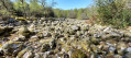
A special treat for walkers is discovering, deep in the woods, this ‘Mer de Pierre’, recognised by experts as a geological curiosity.As the walk gains altitude in its first section, it offers sweeping views over the Guye Valley to the east and the Baudots area to the north. Largely shaded, the route then offers a few glimpses of the Monts du Charollais.See practical information.
The Santagny cross from Genouilly
 Association / Club / Walk leader
 5.07 mi
+571 ft
-554 ft
2h 50
Easy
Departure from Genouilly (Saône-et-Loire) (Saône-et-Loire)
5.07 mi
+571 ft
-554 ft
2h 50
Easy
Departure from Genouilly (Saône-et-Loire) (Saône-et-Loire)
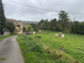
A walk in the countryside of Genouilly, a small rural village in the Guye valley, between the limestone hillsides where vines grow and the granite forest chaos.
Rivers, hedges and copses punctuate this hike, which follows paths and small roads.
La Sorme from the dike
 4.34 mi
+115 ft
-115 ft
2h 05
Easy
Departure from Blanzy (Saône-et-Loire)
4.34 mi
+115 ft
-115 ft
2h 05
Easy
Departure from Blanzy (Saône-et-Loire)
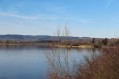
An easy, pleasant walk near the Etang de la Sorme. Beautiful scenery and little change in altitude.A few stretches on tarmac, but not very busy.
From Maizeray to Saint-Martin-du-Tartre
 5.22 mi
+515 ft
-515 ft
2h 50
Easy
Departure from Saint-Martin-du-Tartre (Saône-et-Loire)
5.22 mi
+515 ft
-515 ft
2h 50
Easy
Departure from Saint-Martin-du-Tartre (Saône-et-Loire)
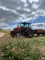
A short walk through meadows and vineyards, taking in the village of Saint-Martin-du-Tartre and its beautiful views.
Butte de Suin, starting from Buffières
11.21 mi
+1,457 ft
-1,457 ft
6h 25
Moderate
Departure from Buffières (Saône-et-Loire)
Setting off from Buffières, we head for Suin and its famous “butte” via theGR®76Cand then theGR®7. The Butte de Suin rises to around 600 m. From the orientation table, there is a 360° view. You can see the Charolais region to the west, Mont Saint-Vincent and Montceau-les-Mines to the north-west, the Chalon region to the north-east, the Cluny region to the east, and Mont Saint-Cyr and the foothills of the Beaujolais to the south. The return journey is via Sivignon.
The hillside walk from Beaubery
 8.97 mi
+1,017 ft
-1,010 ft
5h 00
Moderate
Departure from Beaubery (Saône-et-Loire)
8.97 mi
+1,017 ft
-1,010 ft
5h 00
Moderate
Departure from Beaubery (Saône-et-Loire)
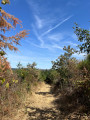
Starting from the village of Beaubery, this walk offers a wonderful immersion in the heart of the Charolais bocage. The route winds its way through hills and along small country lanes, revealing sweeping views.
From Verosvres to Chevagny-sur-Guye via the GR®7
 15.14 mi
+1,322 ft
-1,841 ft
10h 10
15.14 mi
+1,322 ft
-1,841 ft
10h 10
 Difficult
Departure from Verosvres (Saône-et-Loire)
Difficult
Departure from Verosvres (Saône-et-Loire)
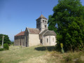
On the GR®7 trail between the Col des Vaux, in the commune of Verosvres, and Chevagny-sur-Guye, passing by the Butte de Suin
This is a very quiet section of the GR®7. There are no signposts at some junctions and no footprints in the tall grass to mark the route, so you must take an IGN map with you, although a GPS device is preferable.
This section of the GR® needs to be more popular, as it is not difficult and offers beautiful scenery. The view from the Butte de Suin is magnificent.
From Verosvres to Mont Rigaud via the GR®7
 17.52 mi
+3,451 ft
-1,529 ft
11h 05
17.52 mi
+3,451 ft
-1,529 ft
11h 05
 Very difficult
Departure from Verosvres (Saône-et-Loire)
Very difficult
Departure from Verosvres (Saône-et-Loire)
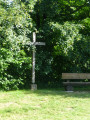
On the GR®7 trail, between the Col des Vaux in the commune of Verosvres and Mont Rigaud, passing through the village of Saint-Bonnet-des-Bruyères.
There are many shaded sections in the forest and beautiful landscapes.
The trail is sometimes unmarked, so bring an IGN map, but it is preferable to have a GPS device.
A circular to the west of Saint-Laurent-d'Andenay
 7.51 mi
+308 ft
-328 ft
3h 45
Moderate
Departure from Saint-Laurent-d'Andenay (Saône-et-Loire)
7.51 mi
+308 ft
-328 ft
3h 45
Moderate
Departure from Saint-Laurent-d'Andenay (Saône-et-Loire)
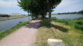
Saint-Laurent d'Andenay, a small village near Montchanin, is crossed by the Paris-Marseille TGV line. During this walk, you can take a picnic break on the banks of the pond, where tables are available.
From Étang de Montchanin to Étang Berthaud
 6.13 mi
+174 ft
-167 ft
3h 00
Easy
Departure from Écuisses (Saône-et-Loire)
6.13 mi
+174 ft
-167 ft
3h 00
Easy
Departure from Écuisses (Saône-et-Loire)
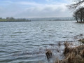
From the Étang de Montchanin, which is reserved for fishing, to the Étang Berthaud, which is open for swimming and fishing, walk along the Canal du Centre (this canal connects the Loire to the Saône between Digoin and Châlon sur Saône) between the Pont Jeanne Rose and the first lock on the Atlantic side, passing by the dam, a path with information about the local flora and fauna, the dyke and Berthaud beach, Montchanin le Haut (commune of Saint-Eusèbe), and Le Bon Enfant (hamlet of Saint-Laurent-d'Andenay).
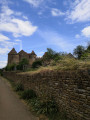
Château de Pontus or Pontus Castle
 7.62 mi
+915 ft
-886 ft
4h 20
Moderate
Departure from Fley (Saône-et-Loire)
7.62 mi
+915 ft
-886 ft
4h 20
Moderate
Departure from Fley (Saône-et-Loire)
A hill walk with no major challenges, in an unspoilt setting with villages overlooked by Mont Bouzu. Changing views all along the way, including a wide shot of Mont Saint-Vincent and a visit to the Château de Pontus-de-Thyard.
From Saint-Laurent d'Andenay to Écuisses
 7.10 mi
+361 ft
-381 ft
3h 35
Easy
Departure from Saint-Laurent-d'Andenay (Saône-et-Loire)
7.10 mi
+361 ft
-381 ft
3h 35
Easy
Departure from Saint-Laurent-d'Andenay (Saône-et-Loire)
During this hike, you will leave from the entrance to Saint-Laurent d'Andenay and head to the village of Écuisses along the RCEA (Route Centre Europe Atlantique), then cross Écuisses les Sept-Écluses via the greenway along the Canal du Centre. In Écuisses, you have the option of visiting the Canal Museum and Villa Perrusson. Then, still following the greenway, you will reach the Jeanne Rose bridge and your starting point via the D18.
The Moulin de la Roche in Marcilly-lès-Buxy
 6.92 mi
+741 ft
-751 ft
3h 50
Moderate
Departure from Marcilly-lès-Buxy (Saône-et-Loire)
6.92 mi
+741 ft
-751 ft
3h 50
Moderate
Departure from Marcilly-lès-Buxy (Saône-et-Loire)
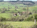
A peaceful walk through the remote forests and wooded countryside of Saône-et-Loire, where the villages along the way have managed to preserve their rural character.
Écuisses - Buxy
 13.07 mi
+1,217 ft
-1,309 ft
7h 05
Difficult
Departure from Écuisses (Saône-et-Loire)
13.07 mi
+1,217 ft
-1,309 ft
7h 05
Difficult
Departure from Écuisses (Saône-et-Loire)
This is the third section of the southern Burgundy crossing, which is part of the VIA Burgundia. From the confluence of the Yonne and Seine rivers in Montereau-Fault-Yonne, it crosses the whole of Burgundy to reach Macon. It is also the Eternal Burgundy trail, where history blends with heritage to reveal the region's beautiful natural surroundings.
Between La Guye and Rimont
 4.53 mi
+719 ft
-702 ft
2h 45
Moderate
Departure from Cersot (Saône-et-Loire)
4.53 mi
+719 ft
-702 ft
2h 45
Moderate
Departure from Cersot (Saône-et-Loire)
A circular route offering stunning views in a rural setting amidst vineyards and hedgerows.
Between fields and streams around Sassangy
 8.92 mi
+1,165 ft
-1,152 ft
5h 05
Moderate
Departure from Sassangy (Saône-et-Loire)
8.92 mi
+1,165 ft
-1,152 ft
5h 05
Moderate
Departure from Sassangy (Saône-et-Loire)
A pleasant walk with a very varied landscape (meadows, streams, limestone plateaus, vineyards). You’ll follow the Guye river towards Cersot, with a short climb towards Montagny-lès-Buxy and a return via Mont Brogny after passing through the village of Bissey-sous-Cruchaud. Best done between September and May to avoid the intense heat, as there is very little shade. It’s possible to do it with a head torch in summer, which is very pleasant.
Grand Tour of Saint-Julien-de-Civry
 17.30 mi
+1,873 ft
-1,873 ft
9h 35
Very difficult
Departure from Saint-Julien-de-Civry (Saône-et-Loire)
17.30 mi
+1,873 ft
-1,873 ft
9h 35
Very difficult
Departure from Saint-Julien-de-Civry (Saône-et-Loire)
In the heart of the Brionnais region, this walk invites you to immerse yourself in a well-preserved bocage landscape, typical of southern Burgundy. An ideal walk for nature lovers. Panoramic views, a castle, wash houses, traditional houses, woods, ponds, a spring… everything you need to enjoy the Brionnais.