Country:

 City:
City:


(S/E) Leave the cemetery car park, passing in front of the church, and turn immediately right – almost going against the flow of traffic – along the edge of a property.
Follow this path between the hedges until you come to a small lane running perpendicular to it a little further on. Turn left and you’ll soon reach the Volvin farm
(1) Walk past the farm buildings and take the dirt track opposite, leaving the road that branches off to the right. Keep to the right at the next two junctions and stay on the track, which turns southwards, reaching a four-way crossroads after just under a kilometre.
(2) Carry on straight ahead, still heading south, until you come to a gate. Turn right and follow a track through the fields, which joins a road after a series of 90° bends.
Turn left, ignore the path coming from the right, and you’ll reach the first houses of Savianges at the next junction.
(3) Leave the lane leading to Les Pignerets on your left and carry on straight ahead until you reach, not far from there, a junction marked by a stone cross.
Keep to the right and cross the village, maintaining the same direction at the following junctions until you reach the edge of the village just past the last houses.
(4) Turn right towards the west up a hill towards Mondornon (yellow sign) and carry on straight ahead at the first junction to reach, a little further up, another junction at the edge of the forest.
(5) Carry on straight ahead, still heading west, and enter the Bois du Rougeon.
The path continues to climb and soon turns south-west until, about 900 metres further on, it reaches a junction just after a cleared area on the right.
(6) Turn right towards the north; the gradient will reverse after about 500 metres. Carry on straight ahead, ignoring the side paths, and reach the edge of the woodland after a 1-kilometre descent.
You’ll soon cross your first road and, not far from there, reach the Prettement crossroads.
(7) Take the road opposite, signposted as a dead end, and reach the hamlet after a right-hand bend. Continue until you reach the last houses at the end of the road.
(8) Carry on along the extension of the road on a dirt track and, after 200 metres, turn right at the Fork in the road.
The path will soon turn right and head north-east, reaching the village of Martrat at the end of Impasse des Punaises after 1 km.
(9) Follow the road opposite until, a little further on, you cross the Impasse du Château at the school.
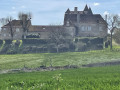
Turn right and continue along the path, which immediately turns left. A little further on, ignore a path branching off to the right and stay on the path, which will turn first right and then left to go round the castle grounds.
Keep to the right at the Fork in the road and, just after the bend, turn left to return to the cemetery car park (S/E).




 Visorando Member

 Easy
Easy