A short walk around Marizy, taking in the Pierre d’Orgeval and the Étang Neuf

A short walk around Marizy will take you into the countryside to discover the Pierre d’Orgeval hidden in the forest, the ancient Roman road and the Étang Neuf, tucked away in the middle of the Bois de Montchappa.

Details

n°20573997
Creation:
Last update:
Last review:
  • Walking
    Activity: Walking
  • ↔
    Distance: 8.32 mi
  • ◔
    Average duration: 4h 15 
  • ▲
    Difficulty: Moderate

  • ⚐
    Back to start: Yes
  • ↗
    Ascent: + 446 ft
  • ↘
    Descent: - 453 ft

  • ▲
    Highest point: 1,263 ft
  • ▼
    Lowest point: 1,056 ft
  • ⚐ Country: France
  • ⚐ City: Marizy (71220)
  • ⚑
    Start/End: N 46.566393° / E 4.408543°
  • ❏
    IGN map(s): Ref. 2927SB
  • Hour-by-hour weather

Description of the walk

Start from the Place de l’Église in Marisy.

(S/E) From this square, head towards Saint-Bonnet-de-Joux.

(1) Turn left to climb up to the hamlet of Le Brouillat and walk alongside the forest as far as the telecoms mast. Then continue to the right along the tarmac road.

(2) Take a break and veer off the main route by following a small path that climbs to the right (marked in red) and leads to the Pierre d’Orgeval.

(3) When you reach the T-junction, turn right onto the main road (D303) until you reach the entrance to the forest.

(4) Turn right to enter the forest. Follow the old Roman road for several hundred metres.

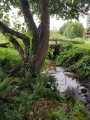
(5) At the junction, stop off to admire the Étang Neuf. This little lake is well worth a look. Then, return to the junction to continue along the path until you reach the road.

(6) At the vegetable garden, turn right and walk alongside the forest until you reach a road.

(7) Cross the road, then carry on straight ahead, walking alongside the fir trees.

(8) At the road, turn left until you reach the cross flanked by four lime trees.

(9) Turn right onto the Chemin du Moulin de Mérey. Cross the bridge over the Arconce, then head uphill to the Les Clochards farm.

(10) At the road, turn right and join the Route de Charolles (D33).

(11) Turn right and head downhill to the T-junction on the left.

(12) Turn left towards Les Apports. Walk through the hamlet until the road becomes a track.

(13) Keep to the right to head back down to the village of Marizy via the Chemin des Écus.

(14) On the bridge over the stream, turn left; the church is in sight (S/E).

Waypoints

  1. S/E : mi 0 - alt. 1,089 ft - Place de l’Église
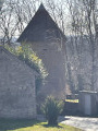
  2. 1 : mi 0.37 - alt. 1,132 ft - Ancient medieval motte.
  3. 2 : mi 1.19 - alt. 1,253 ft - Path of the - La Pierre d'Orgeval
  4. 3 : mi 1.56 - alt. 1,138 ft - Route de la Guiche
  5. 4 : mi 2.01 - alt. 1,227 ft - Entrance to the Roman road
  6. 5 : mi 3.02 - alt. 1,227 ft - L’Étang Neuf
  7. 6 : mi 3.72 - alt. 1,198 ft - Route de Grivery
  8. 7 : mi 4.03 - alt. 1,181 ft - Route de Saint-Bonnet
  9. 8 : mi 4.15 - alt. 1,145 ft - Route de la Défense
  10. 9 : mi 4.43 - alt. 1,161 ft - The Cross of the Linden Trees
  11. 10 : mi 5.11 - alt. 1,102 ft - Ferme des Clochards
  12. 11 : mi 5.87 - alt. 1,142 ft - Route de Charolles
  13. 12 : mi 6.02 - alt. 1,112 ft - Triangle des Apports (D33)
  14. 13 : mi 6.98 - alt. 1,175 ft - Junction with Chemin des Écus
  15. 14 : mi 7.94 - alt. 1,083 ft - Bridge over the Saint-Pierre stream
  16. S/E : mi 8.32 - alt. 1,089 ft - Place de l’Église

Notes

Water tap available on the Place de l’Église (off in winter).

Worth a visit

The Pierre d’Orgeval will only take you a few minutes off the original route, but it’s well worth the detour just to have a go at trying to decipher the text carved into the large stone.

The Roman road is particularly interesting due to its well-preserved condition. On either side of this ancient highway, which led to Autun (Augustudunum), you’ll find its ditches and the earthworks that characterised all Gallo-Roman roads around 200 AD.

Reviews and comments

3.8 / 5
Based on 2 reviews

Reliability of the description
4.5 / 5
Ease of following the route
4 / 5
Route interest
3 / 5
buchaudon
buchaudon

Overall rating : 3.3 / 5

Date of your route : Sep 28, 2026
Reliability of the description : ★★★★★ Very good
Ease of following the route : ★★★☆☆ Average
Route interest : ★★☆☆☆ Disappointing
Very busy route : No

Far too much driving – it’s really far too monotonous.

Machine-translated

benpaolo
benpaolo

Overall rating : 4.3 / 5

Date of your route : Apr 10, 2022
Reliability of the description : ★★★★☆ Good
Ease of following the route : ★★★★★ Very good
Route interest : ★★★★☆ Good
Very busy route : No

A lovely walk, best done in dry weather as there is a muddy section.

Machine-translated

clesol
clesol

not yet done

Machine-translated

Other walks in the area

For more walks, use our search engine .

The GPS track and description are the property of this route's author. Please do not copy them without permission.