Country:
 City:


In Dieulegard, when parking, please ensure you do not inconvenience the residents of this hamlet; the starting point is on the road you took to reach this spot.
(S/E) Take the road towards Noiseret; at the crossroads, turn left towards La Galoche (Saint-Laurent d’Andenay) and follow this road to Thézu.
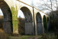
(1) At the junction, turn right towards La Gandré. Follow this road to the hamlet of La Gandré; once in the hamlet, take a path on the left and follow it as it runs alongside a meadow or an open field, depending on the season. At one point, you’ll come to a spot with three gates (from left to right: two wooden ones and one metal one); go through the middle one, behind which the path enters the woods. Follow this path as it winds its way down through the woods to the Fiolles viaduct.
(2) Behind this viaduct, which once supported the Montchanin to Saint-Gengoux railway line, a path passing under the TGV line leads to the stream Le Brénnon and the D28. Do not go under the bridge but continue straight on along the path which climbs alongside the old viaduct. Pass through the hamlets of La Chapelle, where the path becomes a small road to the right, and Montsarin. Along this path, you may come across one or two gates, which may be open or closed. After passing through them, return them to the position in which you found them.
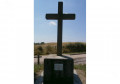
(3) After Montsarin, leave this small road and take another one on the left which turns into a track (Chemin de la Croix). Follow it to the Croix à la Boiteuse.
(4) Here, you may wish to sit down and read the story of ‘La Boiteuse’.
Continue along the track to the left of the cross and follow it; it will become a road at Le Brûlard, where you’ll reach the D977 – turn left onto it. Take care. Continue along this road, passing a few houses (Le Chêne Guidon), until you reach a small road on the left.
(5) Take this road towards Le Guidon and Les Baraques; continue along this road, cross the “Ruisseau de la Fiotte” – which feeds the Berthaud pond at Saint Eusèbe – on your right, and carry on until you reach the hamlet of La Goutte.
(6) Take the small road on the left. A little further on, another road joins from the right; carry on and your route will bend to the left, leading to a three-way junction where you’ll need to turn right and continue to a recycling collection point.
(7) Turn left onto a tarmac track; further down, you’ll reach the D164. Follow it to the left until you reach a small crossroads, then turn left towards Les Buissons. You’ll arrive at the entrance to the hamlet near Château des Buissons.
(8) At this point, ignore the path leading off to the left; continue through the hamlet and, when you reach a farm, turn onto the path on the left which runs alongside a large farm building and follow this path to the end. You will then come to a small road leading only to the hamlet known as Le Douvent; continue left along this same road and, once you have passed a building, the road becomes a path again.
(9) At this point, veer to the left, continue along this track which will bend to the right, ignore a track coming from the left and carry on along this track. After a bend to the left followed by one to the right, you’ll reach a junction of three tracks; take the left-hand one which does not cross the stream, then, near a small reservoir on your left, you’ll come to a three-way junction.
(10) Continue along the left-hand path and, from there, keep climbing all the way to Dieulegard (S/E).

 Visorando Member

 Easy
 Association / Club / Walk leader

 Difficult