Country:

 City:
City:


From the car park in Le Bourg, on Route de Mochère, head towards the church and follow the signs.
Follow the SJC4 signposts throughout the route.
(S/E) In Le Bourg, head towards Amanzé and St-Germain-en-Brionnais, turning left then right.
(1) Take the road on the left at the junction after Le Bourg.
(2) At La Noue, at the junction of the Route des Cantiaux and the Route du Moulin, turn right; cross the D279 and then take the grassy track opposite.
(3) When you reach Route des Bouffiers, turn right onto it.
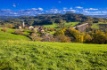
(4) At the Croix Monmessin, enjoy the exceptional panoramic view. Then keep to the right, then turn left down towards the Place du Saule. Continue to keep to the right all the way to the Pré du Four.
(5) At the Pré du Four, head towards Tollecy straight ahead.
(6) Take the Route d’Oyé D20 to the right, then turn left straight away.
(7) At the end of the road, take the Route de Poisson, then turn right.
(8) At Bois de Sarre, turn left then keep to the right until the end of the road. Turn right towards the Pont de Pierre and continue on the left.
(9) At the Pont de Pierre (on the River Arconce), turn right (not the path running alongside the river, but the one further up). At the four-way junction, head up to the right, continue straight ahead along the path and take the next right.
(10) In Chevagny, follow the signposts to the left towards Charnay.
(11) Cross the Bois de Laye and turn right as you leave the woods to reach Roussy.
(12) Return to the road and turn right towards Maringue.
(13) Then turn right again onto the Chemin du Pré de l’Étang. At the next junction, continue left towards the Château de Vaulx and keep to the right.
(14) Head straight ahead and walk past the Château de Vaulx.
(15) At the Guidon junction, cross the D985 to take the grassy Chemin de Marolle opposite.
(16) At the junction after Le Guidon, turn right towards Ville Martin.
(17) Turn right again at the junction to take the Chemin de l’Étang de la Place. Turn right at the junction.
(18) At Gros Bois, continue to the right until you reach a junction with a cross.
(19) Keep to the right, cross the railway line and turn right after the next cross. Then keep to the left to join the Chemin des Grands Pommiers.
(20) Carry on until you cross the D985 towards Civry.
(21) Carry on straight ahead to Civry.
(22) In Civry, go straight on, then take the road on the right and then the one on the left. Then keep to the right to rejoin the road you took at the start.
(2) Return to the car park by following the reverse route of the outward journey to the right (S/E).
 Tourist office
 Moderate
 Difficult
  Visorando Member
 Easy
Easy