Around Marizy through the hills

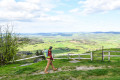
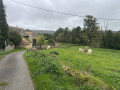
This easy circular route, which largely avoids muddy paths, follows quiet country lanes offering lovely views of the countryside. It passes near the Pierre d’Orgeval, a local landmark, then heads towards Fontaine Chaude, a spring that maintains a constant temperature all year round.

Details

n°20623863
Creation:
Last update:
Last review:
  • Walking
    Activity: Walking
  • ↔
    Distance: 7.55 mi
  • ◔
    Average duration: 3h 55 
  • ▲
    Difficulty: Moderate

  • ⚐
    Back to start: Yes
  • ↗
    Ascent: + 538 ft
  • ↘
    Descent: - 538 ft

  • ▲
    Highest point: 1,319 ft
  • ▼
    Lowest point: 1,086 ft
  • ⚐ Country: France
  • ⚐ City: Marizy (71220)
  • ⚑
    Start/End: N 46.566431° / E 4.408525°
  • ❏
    IGN map(s): Ref. 2927SB
  • Hour-by-hour weather

Description of the walk

Park on the Place de l’Église.

(S/E) Head towards Saint-Bonnet-de-Joux via the D91 and continue as far as the feudal mound.

(1) Turn left onto the Chemin du Brouillat and follow this path as far as the mobile phone mast.

(2) Continue to the right along the tarmac road until you reach the junction with the Route de La Guiche (D303).

(3) Turn right towards the forest and continue to the junction with the old Roman road.

(4) Turn left onto a path and head down to the houses. Continue along the road until you reach the junction with the Route de Chalon (D33).

(5) Cross this road with care and head uphill towards the farm, then turn left.

(6) At the three-way junction, carry on straight ahead towards a house and continue to the hamlet of Montboin.

(7) At the end of the track, turn right onto the tarmac road until you reach the next junction.

(8) Turn left onto the Route des Vernes Bredas, cross a stream and reach a crossroad.

(9) Turn right onto the Route de Sury and stay on this road at the three-way junction, keeping to the left. Head uphill towards the houses.

(10) Just after the first house on the left-hand side of the road, turn onto the path leading off to the left. At the small copse, veer right to head westwards towards the Route de Montceau (D91).

(11) Turn left towards a large bend.

(12) Turn right onto the small Chemin des Bruyères and keep to the right until you reach the junction by the electricity pylon.

(13) Turn left, then carry on straight ahead until you reach the playground. Then turn left to head back down towards the church and return to the Place de l’Église (S/E).

Waypoints

  1. S/E : mi 0 - alt. 1,089 ft - Place de l’Église
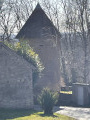
  2. 1 : mi 0.37 - alt. 1,132 ft - Former feudal motte
  3. 2 : mi 0.94 - alt. 1,211 ft - Mobile phone mast
  4. 3 : mi 1.56 - alt. 1,138 ft - Triangle on Route de la Guiche
  5. 4 : mi 2.01 - alt. 1,227 ft - Junction with the Roman road
  6. 5 : mi 2.35 - alt. 1,171 ft - D33
  7. 6 : mi 2.84 - alt. 1,201 ft - Three-way junction
  8. 7 : mi 3.3 - alt. 1,247 ft - The hamlet of Montboin
  9. 8 : mi 3.81 - alt. 1,319 ft - Les Vernes Bredas crossroads
  10. 9 : mi 4.39 - alt. 1,165 ft - Route de Sury
  11. 10 : mi 4.83 - alt. 1,260 ft - Start of the Sury/Volsin path
  12. 11 : mi 5.65 - alt. 1,243 ft - Route de Montceau
  13. 12 : mi 5.88 - alt. 1,227 ft - Les Bruyères
  14. 13 : mi 6.57 - alt. 1,135 ft - Crossroads by the pylon
  15. S/E : mi 7.55 - alt. 1,089 ft - Place de l’Église

Notes

Water point on the Place de l’Église.
Water point near the rubbish bins on the way up, close to the community hall.

Worth a visit

The Pierre d’Orgeval is on the route and requires only a short detour to the right shortly after passing the mast. A sign points the way; follow the red markings to find it.

Reviews and comments

4 / 5
Based on 2 reviews

Reliability of the description
4.5 / 5
Ease of following the route
4.5 / 5
Route interest
3 / 5
Bandline
Bandline

Overall rating : 5 / 5

Date of your route : Jan 29, 2024
Reliability of the description : ★★★★★ Very good
Ease of following the route : ★★★★★ Very good
Route interest : ★★★★★ Very good
Very busy route : No

A lovely walk with some stunning scenery. A very peaceful spot with few visitors. Quite a few stretches along the road, but hardly any cars. Make sure you wear sturdy shoes as the paths are muddy.

Machine-translated

Le Rousset-Marizy
Le Rousset-Marizy

Hello,
Noted. I’ll take care of reorganising and highlighting the elements described.
Thank you for your contribution.
Normally, the other paths are passable.
Kind regards.
Fp

Machine-translated

FILLON René
FILLON René

Overall rating : 3 / 5

Date of your route : Aug 23, 2022
Reliability of the description : ★★★★☆ Good
Ease of following the route : ★★★★☆ Good
Route interest : ★☆☆☆☆ Very disappointing
Very busy route : No

A few comments:

  • The water fountain, set at 14°C, has been left to fall into disrepair;
  • The Orgeval stone is poorly described and there is no information on site (thankfully there’s Google);
  • The section from Sury towards the south-west is not maintained.

Machine-translated

Other walks in the area

For more walks, use our search engine .

The GPS track and description are the property of this route's author. Please do not copy them without permission.