Country:
 City:



Park in the car park by the rubbish bins, between the level crossing and the canal.
(S/E) Head towards the village via Rue de la Gare. Cross the bridge over the Canal du Centre.
(1) Walk uphill towards the church. Walk past it and continue to the nearby junction.
(2) Turn right onto Rue Saint-Thibault and walk past the sports ground.
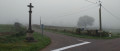
(3) At the wayside cross, turn left towards “Obseigne – les Coudnots”. Continue straight on along Rue des Coudnots until you reach a three-way junction.
(4) Turn right towards the Bois de Charnay. Pass the house on your left, then, in the bend to the right, take the dirt track on the left leading into the woods. Continue to the end until you reach the D985. Then turn right and walk carefully alongside the road until you reach the first junction.
(5) Turn right towards Lespinasse. In the right-hand bend, ignore the turn-off to the hamlet and carry on straight ahead along a dirt track. Cross a road and follow another small tarmac road opposite.
(6) Turn right onto the tarmac-surfaced Chemin de Gratery. Continue along a dirt track, which passes between two ponds and then curves to the left into the Bois de Riollot. Keep heading in the same direction along this almost straight track; leave the woods when you reach the tarmac again and carry on to the hamlet of Nérot.
(7) Take the track on the right towards “Poujux – le Cabanon”. The track is a dirt track with a stream on the left. Follow this track until you reach a small cottage on the right: le Cabanon, at the D25 road.
(8) Turn right onto the D25 and continue to the junction. Then turn right onto the D128 towards Palinges, pass Villeneuve and continue for about a hundred metres.
(9) Turn left onto the Route des Forges: there is a ‘No vehicles over 5 tonnes’ sign. Follow this track until you reach the D25.
(10) Turn right onto the D25 and head towards the canal: there’s a picnic area on the left.
(11) Cross the bridge over the canal, then the one over the Bourbince. Then cross the level crossing.
(12) Take the second right onto Route d’Usigny. At the three-way junction, veer left to follow the path which climbs slightly and leads to a four-way junction.
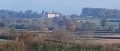
(13) Turn left towards a house (dog breeding and boarding). In the distance on the right, you can see Digoine Castle. Follow the path until you rejoin the tarmac road (D25).
(14) Turn right and follow it for about 200 m, then take a dirt track on the right (clay quarry). Carry straight on, ignoring the side paths on either side. You’ll come to a fork in the road.
(15) Carry on to the right, pass a quarry and rejoin a tarmac track.
(16) Follow it to Varennes, turn right and reach a level crossing.
(17) Cross the level crossing, then turn immediately left onto a dirt track running alongside the railway line: enjoy another view of Digoine Castle on your right.
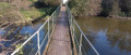
(18) Move away from the railway line by veering to the right, cross the footbridge over the Bourbine and reach the embankment of the Canal du Centre (D974).
(19) Cross the road and go over the bridge over the canal, then carry on straight ahead past the cemetery.
(20) Take the next dirt track on the left and head for the bridge over the canal.
(1) Go up the steps and turn left to cross the bridge. You will soon reach the starting car park (S/E).
 Visorando Member
 Very difficult

 Moderate

 Easy