


Refine your search for walks in La Buisse
La Buisse walks


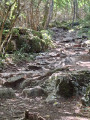
 Rochebrune
 Visorando Member
 6.07 mi
 +1,306 ft
 -1,302 ft
 3h 55
 Moderate
 Departure from Saint-Julien-de-Raz (Isère)
This low peak and its twin opposite on the Vercors side, the Dent de Moirans, watch over the exit of the Isère as it flows quietly towards the Rhône and the entrance of rain and snow clouds pushed by the north winds. A remarkable viewpoint over the valleys, it is an ideal half-day walk.
Tour of the Grand Ratz plateau
 4.78 mi
+804 ft
-804 ft
2h 55
 Easy
Departure from La Buisse (Isère)
A beautiful loop around the Grand Ratz, passing by the Roche Brune viewpoint with its breathtaking view of the Isère valley.
Rochebrune from Voreppe
 5.51 mi
+2,907 ft
-2,884 ft
5h 05
Moderate
Departure from Voreppe (Isère)
A lovely but fairly strenuous hike. Return via the same route.
Roche Brune and the Grand Ratz plateau, starting from Pommiers-la-Placette
7.97 mi
+2,864 ft
-2,838 ft
6h 10
Moderate
Departure from Pommiers-la-Placette (Isère)
This lovely route, less than 30 minutes from Grenoble, will delight lovers of forests and panoramic views.
There are no significant difficulties apart from a few steep slopes on the way up to Roche Brune.
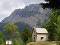
Pommier–Prairie de Charminelle
 12.90 mi
+4,751 ft
-4,744 ft
10h 05
 Difficult
Departure from Pommiers-la-Placette (Isère)
The second half of the route is very scenic thanks to the numerous waterfalls the path crosses and the view of the Lorzier rock.
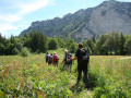
Charminelle Circuit
 Association / Club / Walk leader
 9.01 mi
+4,239 ft
-4,239 ft
7 hrs
 Very difficult
Departure from Pommiers-la-Placette (Isère)
A challenging and demanding hike set against the impressive backdrop of the sheer drops and cliffs typical of the Chartreuse foothills, ancient high-altitude meadows, and a descent into the torrential valleys of Charminelle and La Roize, passing through the peaceful haven of Chalais Monastery before returning to the starting point.
Trail No. 6 of the “Sentiers de Chartreuse Occidentale”. This is a circular route marked in both directions, but it is strongly recommended that you follow this route in a clockwise direction.
These are mountain and/or forest trails, with all the inherent risks: falling branches, trees, stones and rocks; mudslides; torrential floods; and slips. You will be walking alongside ravines and cliffs . Do not stray from the signposted path. This area should be avoided in wet or snowy conditions, particularly when descending.
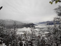
Discovering Voiron
 9.07 mi
+2,274 ft
-2,270 ft
6h 10
Moderate
Departure from Voiron (Isère)
A very beautiful route for exploring Voiron and its surroundings, with stunning views over the Grenoble valley, the Chartreuse, the Vercors and Belledone.
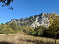
Charminelle circular loop, via the Pas de l’Aronde and Pas de Miséricorde
 5.72 mi
+2,874 ft
-2,864 ft
5h 10
Very difficult
Departure from Pommiers-la-Placette (Isère)
A low-altitude circular loop that can be completed in half a day starting from La Placette on the western slope of the Grande Sure massif; best tackled in the afternoon to make the most of the light. The ascent via the Pas de l’Aronde requires caution, particularly when crossing exposed ledges on the cliff face and, above all, when traversing earthy gullies where sliding is prohibited. The return route via the Pas de Miséricorde is also exposed and is currently closed due to rockfalls => you must take the detour via the Combe des Veaux and Jusson until it reopens officially.
Notre-Dame de Vouise
 5.24 mi
+1,434 ft
-1,434 ft
3h 40
Moderate
Departure from Voiron (Isère)
An easy hike to discover the statue towering above Voiron. A real treat, especially in snowy weather.
The statue of the Virgin Mary was erected in honour of the Iron Virgin of Le Puy-en-Velay. Legend has it that Bonnassieux committed suicide after sculpting the Virgin. However, he did not commit suicide and died with honours. He deliberately placed Jesus in her right arm so that he would not hide his mother's face as she blesses the town
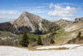
Rochers du Lorzier via the Charminelle ladders
 12.22 mi
+5,095 ft
-5,089 ft
8 hrs
Very difficult
Departure from Pommiers-la-Placette (Isère)
The hike to the Lorzier rocks via the Charminelle ladders takes us on an adventure along an original route combining slightly dizzying passages through chimneys or on century-old ladders once used by hunters. Several viewpoints offer beautiful panoramic views, particularly at the top of the Lorzier rocks and at the Col des Banettes.
Racin Circular Loop
 2.70 mi
+499 ft
-518 ft
1h 40
Easy
Departure from Voreppe (Isère)
A family-friendly walk where you’ll discover Voreppe set amidst its rolling hills, with its old hamlets, its hillsides once covered in vineyards, and the Poor Clares’ monastery.
Trail No. 1 of the “Sentiers de Chartreuse Occidentale”, a circular route, signposted in both directions.
However, this trail does present the risks typical of mountain and forest trails (falling branches and the Roize river overflowing at the ‘Pas Japonais’ crossing, etc.).
The Chemin des Mariniers in Voreppe
 5.10 mi
+253 ft
-256 ft
2h 35
Easy
Departure from Voreppe (Isère)
This walk is ideal for families. It gives you an insight into the age-old struggle of the people of Voreppe against the flooding of their two main rivers, the Roize and the Isère. These rivers have also been a source of wealth for centuries. The Roize powered numerous mills, sawmills and water-driven hammers. The Isère, the main route of communication southwards until the advent of the railway, provided work for boatmen.
Trail No. 12 "Western Chartreuse Trails". This is the only one in this series that is not circular, to avoid using the greenway frequented by many cyclists.
Tour of the Mollard d’Arbon
 3.82 mi
+1,532 ft
-1,532 ft
3h 05
Moderate
Departure from Voreppe (Isère)
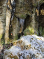
This walk takes you back to Voreppe’s medieval past. As you pass through the hamlet of Gachetière, the original village of Voreppe, you can catch a glimpse of the ruins of the Château Vieux, the former Dauphin’s castle. It is also an opportunity to explore the hillsides, where steep ravines—fragrant with the scent of wild garlic in spring—alternate with streams, old charcoal kilns and vantage points.
This is Trail No. 5 of the Western Chartreuse Trails. The trail is signposted in both directions.
Follow the directional signs at junctions, marked with a yellow square bearing the number 5, and the yellow markings.
This trail presents the risks typical of mountain and forest trails (falling branches, fallen trees, mudslides, falling rocks, ravines).
Les Passières de Charminelle
 6.22 mi
+2,434 ft
-2,438 ft
5 hrs
Very difficult
Departure from Pommiers-la-Placette (Isère)
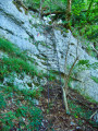
This low-altitude loop takes you up an old passage equipped with ladders by hunters, before crossing the formidable Roize and returning via Chalais and its monastery.
The Roize Circuit
 5.44 mi
+1,345 ft
-1,348 ft
3h 40
Moderate
Departure from Voreppe (Isère)
This walk, starting from Voreppe, takes you through a few old hamlets of Voreppe, through the woodland and along the Roize torrent.
The Roize torrent is one of the most powerful in the Chartreuse. In mid-May, it wasn’t showing off its full power.
The Roize has powered a number of facilities: mills, sawmills and tanneries, and has helped make Voreppe a small economic hub in the Isère valley.
The Col de Tençon
5.23 mi
+1,355 ft
-1,355 ft
3h 35
Moderate
Departure from Voreppe (Isère)
Pleasant circular route starting from Voreppe, which passes through Pommiers-la-Placette and the Col de Tençon at the foot of the Rochebrune summit.
Tour de la Tençon
 6.39 mi
+2,100 ft
-2,100 ft
4h 45
Moderate
Departure from Voreppe (Isère)
At the southern end of the Jura massif (the Ratz range), this walk is rich in history:- Former fireclay quarry.- Sites associated with the Resistance.- Ruins of an ancient settlement (including a bread oven).- A centuries-old track, of which the paving and retaining walls still remain.- Views over the Cirque de Roize.- The Isère plain and gorge, a natural corridor carved out by glaciers between the Vercors and the Chartreuse
Trail No. 2 of the “Sentiers de Chartreuse Occidentale”. This circular route is signposted in both directions, with a shared section for the outward and return journeys up to the Col de la Tençon.
This trail presents the usual risks associated with mountain and forest trails (falling branches and rocks along the cliff face), and care should be taken when crossing the departmental road.
Tour de Pommiers
 5.26 mi
+1,365 ft
-1,378 ft
3h 35
Moderate
Departure from Voreppe (Isère)
A picturesque walk leading to the charming little hamlet of Pommiers-la-Placette (which forms part of the commune of La Sure-en-Chartreuse), nestled amidst the mountains (Charminelle, La Grande Sure and the Ratz range). You’ll follow the old road linking Voreppe to Saint-Laurent-du-Pont, which was used before the RD520A was built in 1820. There’s a panoramic view of the Isère gorge and the Bas Dauphiné. This is trail no. 3 of the ‘Sentiers de Chartreuse Occidentale’, signposted in both directions.This trail presents the usual risks associated with mountain and forest trails (falling branches). And take care when crossing the two departmental roads.
 The Moirans Islands
 16.15 mi
+115 ft
-115 ft
2.5 hrs
Easy
Departure from Voreppe (Isère)
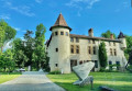
A hybrid bike ride starting from Voreppe towards the plain between Moirans and Tullins via the Chemin des Digues and the path running alongside the River Fure to the south of Saint-Jean de Chépy.
Pisserotte Waterfall
 Tourist office1.44 mi
+476 ft
-486 ft
1h 05
Easy
Departure from Saint-Joseph-de-Rivière (Isère)
Situated on the outskirts of Saint-Joseph-de-Rivière, the Pisserotte Waterfall plunges at full speed down from the Grande Sure mountain. It offers an easy, family-friendly walk to the foot of the waterfall. Nestled in the mountainside, it is a cool haven and a peaceful, relaxing spot.
This 64-metre-high waterfall is easily accessible via a 15-minute walk. It is particularly impressive in March and April, when the snowmelt results in a strong flow of water.
Tour of La Plaine de Voreppe
 6.75 mi
+361 ft
-351 ft
3h 25
Moderate
Departure from Voreppe (Isère)
This peaceful walk passes through the hamlets of the plain. It invites you to explore a veritable history book of Voreppe, from the Middle Ages to the present day: mining ruins, reminders of former agricultural and boatmen’s activities, and the remains of romantic holiday resorts. It also highlights the significant topographical contrast within the commune.
Trail No. 11 of the Western Chartreuse Trails.
This route can also be explored by mountain bike.
La Grande Sure via the Jusson Chimney and the Pas de Pierre Taillée
 7.23 mi
+4,626 ft
-4,646 ft
7h 20
Difficult
Departure from Pommiers-la-Placette (Isère)
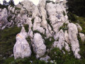
Randonnée en huit partant des Trois Fontaines, un lieu baigné de fraicheur où il fait bon s'attarder en plein été.Le sentier commence dans la forêt en s'élevant dans une rude pente par de nombreux lacets. Il franchit des gradins rocheux pour rejoindre une bergerie d'alpage, le Chalet de Jusson. En haut de la prairie se présente la Cheminée de Jusson qui s'escalade sans difficulté pour parvenir au sommet et profiter d'un magnifique panorama. Descendre la crête et une partie du vallon de l'Hérétang puis remonter la Combe des Veaux pour retrouver le Chalet de Jusson. La descente par le Pas des Rochers de Pierre Taillée s'effectuant sur une sente en déshérence puis dans la forêt pour retrouver le parking conviendra aux randonneurs en quête de lieu secret.
GPS ou application Visorando recommandé.Ce parcours s'adresse à des randonneurs bien préparés physiquement.
Between Lorzier and Jusson via the Pas de l’Aronde and the Refuge d’Hurtières
8.47 mi
+4,114 ft
-4,085 ft
7h 30
Very difficult
Departure from Pommiers-la-Placette (Isère)
A challenging and somewhat exposed circular route (Pas de l’Aronde). It is advisable to tackle it in this direction, as the descent via the Pas de l’Aronde can prove more dangerous than the ascent. You will be rewarded with magnificent views once you have passed the Goulet du Lorzier (Belledonne, Chartreuse...).
⚠️ Caution! Some sections are exposed; a rope of around ten metres may be useful.
A lovely little tour of Voiron
 9.15 mi
+794 ft
-810 ft
4h 55
Moderate
Departure from Voiron (Isère)
This semi-urban route will take you through part of Voiron town centre, but you’ll probably also discover some lesser-known and less-frequented neighbourhoods, paths and stairways. In several places, you’ll also enjoy beautiful views of the Chartreuse, the Vercors and the Grenoble valley.
Around La Vouise, via La Croix de Saint-Denis, La Gratonnière and Monure
7.00 mi
+1,480 ft
-1,460 ft
4h 30
Moderate
Departure from Voiron (Isère)
Mostly along forest tracks; the only difficult bit is the climb to the Croix de Saint-Denis, which is easier going the other way.Park at the La Garenne secondary school car park; the Voironnais bus route 34 also takes you there via the stadium.
From the Crossey Gorges to the Pierre Chave Bridge, a circular route
 9.64 mi
+1,506 ft
-1,493 ft
5h 45
Moderate
Departure from Saint-Étienne-de-Crossey (Isère)
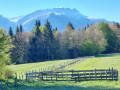
Starting from the impressive Crossey Gorges (200 m high), this double-circular route, mainly through woodland and presenting no technical difficulties or hazards, will take you to the Tourniquet or Pont de Pierre Chave – a rather rare spiral-shaped structure where the road passes successively under and over the bridge. On the return journey, the route passes by the Rocher de la Garde, a lovely viewpoint overlooking Saint-Étienne de Crossey and the Voironnais region.
Crossey Gorges - Croix du Rocher de la Garde
 2.61 mi
+741 ft
-745 ft
1h 50
Moderate
Departure from Saint-Étienne-de-Crossey (Isère)
This is an easy hike, except for a short acrobatic passage on the sharp limestone pavement near the cross. Beautiful view of Saint-Étienne-de-Crossey and its surroundings.
La Roche de la Garde
 6.34 mi
+922 ft
-925 ft
3h 45
Moderate
Departure from Saint-Étienne-de-Crossey (Isère)
A lovely little walk, mostly through woodland. The tarmac sections are along a quiet road. The view from the Rocher de la Garde is very pleasant.
The Rocher de la Garde
 3.29 mi
+1,099 ft
-1,096 ft
2h 30
Moderate
Departure from Saint-Étienne-de-Crossey (Isère)
A short walk through the woods starting from the Gorges de Saint-Étienne de Crossey, passing by the Rocher de la Garde and its lovely viewpoint over the western part of the Chartreuse and the eastern part of the Pays Voironnais.
Rocher de la Garde via Pierre Chave’s turnstile, from La Bourderie
 7.60 mi
+1,214 ft
-1,204 ft
4h 35
Moderate
Departure from Saint-Joseph-de-Rivière (Isère)
This route between the Pierre Chave Bridge and the Rocher de la Garde overlooks Saint-Aupre and offers views of the Chartreuse foothills and the Col des Mille Martyrs. Enjoy the 360° view from the Rocher de la Garde over the Saint-Laurent-du-Pont plain, the Chartreuse Massif and the hills of the Pays Voironnais.
The Aiguille de Chalais
 1.78 mi
+564 ft
-538 ft
1h 20
Easy
Departure from Voreppe (Isère)
A family-friendly circuit starting from Chalais Monastery and ending at the eponymous Aiguille.
Tour de Mont-Saint-Martin
 4.89 mi
+1,677 ft
-1,660 ft
3h 45
Moderate
Departure from Voreppe (Isère)
Tour of Mont-Saint-Martin: Trail No. 9 of the Western Chartreuse Trails.
This hike takes you to Mont-Saint-Martin, a small village nestled at the foot of the Rocher de l’Église, once a hub of intense pastoral activity. It is also full of contrasts: the shade of the tall, centuries-old forests, the thrill ofthe cable car ascent, the light on the Mont-Saint-Martin mountain pasture slopes, and the tranquillity along the meadows and streams overlooking the Isère valley landscape.Read the practical information.
Tour des Bannettes
 9.49 mi
+4,012 ft
-3,986 ft
6 hrs
Very difficult
Departure from Voreppe (Isère)
Warning: Trail for experienced walkers. It is strongly recommended that you follow this trail in a clockwise direction (Cheminée de Lorzier is not roped off).
Trail No. 7 of the “Sentiers de Chartreuse Occidentale”. This circular route is signposted in both directions.
Although our trails are regularly maintained, they are mountain and/or forest trails, with all the inherent risks:falling branches, trees, stones and rocks; mudslides; torrential floods; slips and slides… You will be walking alongside ravines and cliffs. Do not stray from the signposted trail.
Loop starting from Chalais Monastery
5.45 mi
+1,900 ft
-1,890 ft
4h 10
Moderate
Departure from Voreppe (Isère)
This is a loop south of the Chartreuse, at a modest altitude. It starts at Chalais Monastery, climbs up the cable-assisted passageway of the chimney, then heads towards the small village of Mont-Saint-Martin and returns via the Cuchet route.
Traditional yellow directional signs indicate the distance to be covered and the time needed to reach the destinations concerned.