Pommier–Prairie de Charminelle

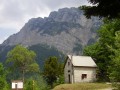
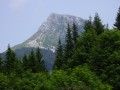
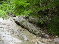
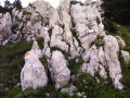
The second half of the route is very scenic thanks to the numerous waterfalls the path crosses and the view of the Lorzier rock.

Details

n°36595
Creation:
Last update:
Last review:
  • Walking
    Activity: Walking
  • ↔
    Distance: 12.90 mi
  • ◔
    Average duration: 10h 05 
  • ▲
    Difficulty: Difficult

  • ⚐
    Back to start: Yes
  • ↗
    Ascent: + 4,751 ft
  • ↘
    Descent: - 4,744 ft

  • ▲
    Highest point: 4,905 ft
  • ▼
    Lowest point: 1,663 ft

Photos

Description of the walk

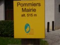
Getting to the start of the route: (S) the car park is opposite the town hall in Pommier-la-Placette.
Follow the signs for “Chalais”.

(1) To do this, take the road that goes uphill and then turn right. Carry on straight ahead until you reach the square by the old church.

(2) At the church, turn left. Follow the road until you reach a right-hand bend where a forest track begins. The start of the route consists of approximately 1.5 km of tarmac road.
Then follow the yellow markings, go through a gate leading into a field and continue along the path.

(3) The path crosses a stream. Once you reach the ‘Gerboudière’ sign, follow the signs for ‘Chalais’. When you reach the ‘Bouzonnière’ sign, take the road that climbs towards ‘Chalais’.

(4) The path then crosses a road with a sign on the right indicating the Voreppe public forest.
Once you reach the sign for “Chalais”, follow “Charminelle” along the forest track that climbs uphill. At one point, the path comes out onto a junction of forest tracks. Take the one on the right and, a little further on, rejoin the path on the right-hand side of the track.

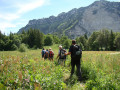
(5) Once you reach the Roize shelter, take the path just to its left. This path descends for a while, crosses a waterfall, then climbs again and crosses further waterfalls. Then follow the yellow markings to the Charminelle meadow (the grass is very tall) (6).

The return journey follows the same route in reverse back to the car park (E).

Waypoints

  1. S/E : mi 0 - alt. 1,663 ft - Car park in front of Pommier-la-Placette Town Hall
  2. 1 : mi 0.11 - alt. 1,732 ft - Turn right as you go uphill
  3. 2 : mi 0.43 - alt. 1,686 ft - At the church, turn left
  4. 3 : mi 1.69 - alt. 2,087 ft - The path crosses the - Roize (cours d'eau) - Affluent du canal de Vence
  5. 4 : mi 3.35 - alt. 2,746 ft - The path crosses a road
  6. 5 : mi 4.44 - alt. 3,740 ft - At the Roize shelter, take the path on your left
  7. 6 : mi 6.39 - alt. 4,888 ft - Charminelle Meadow
  8. S/E : mi 12.9 - alt. 1,670 ft - Car park

Notes

No special equipment is required.
There is only one shelter on this route, the Roize shelter, which is situated roughly halfway along the route. Between the start and this shelter, there are no water supply points. However, on the second half of the route, the path passes through numerous waterfalls and there is even a spring just before the finish.

Reviews and comments

3.8 / 5
Based on 2 reviews

Reliability of the description
3 / 5
Ease of following the route
4 / 5
Route interest
4.5 / 5
AlexandruNedelcu
AlexandruNedelcu

Overall rating : 4.3 / 5

Date of your route : Jun 25, 2019
Reliability of the description : ★★★★☆ Good
Ease of following the route : ★★★★☆ Good
Route interest : ★★★★★ Very good

A very beautiful route, which is relatively challenging for those who are out of practice on the final section (between points 5 and 6, from the waterfall onwards).
There’s a lovely view from the Charminelle meadow towards Grenoble.
I haven’t seen any accompanying description, but it seems to me that a route starting from Chalais and going as far as the Chalet des Bannettes or the Col d’Hurtières could be suggested, with a similar level of difficulty.
Have a good day,

Machine-translated

gazok54
gazok54 ★

Hello
We have included waypoints in the route description for this long walk to help you find your way more easily.

Machine-translated

gazok54
gazok54 ★

Hello nadiusha, and thank you for this first post.
I can’t see this high-voltage line on any map. Is it a line with large steel pylons, each topped with three cables? Sometimes these cables are even doubled or tripled, and you can hear a crackling sound when you’re nearby.
If that’s the case, we can clarify the description, but you’ll need to help us pinpoint its location more precisely.

Machine-translated

nadiusha
nadiusha

Overall rating : 3.3 / 5

Date of your route : Apr 14, 2015
Reliability of the description : ★★☆☆☆ Disappointing
Ease of following the route : ★★★★☆ Good
Route interest : ★★★★☆ Good

I was a bit disappointed with the first part of the walk, as the description never mentioned that you walk alongside a high-voltage power line for quite a while, which spoils all the pleasure of being out in nature. Otherwise, the rest of it was really lovely.

Machine-translated

Other walks in the area

For more walks, use our search engine .

The GPS track and description are the property of this route's author. Please do not copy them without permission.