Country:

 City:


The route starts in Voreppe Bourg, at the ‘Parking des gradins de Roize’ car park on Quai du Dr. Jacquin (towards Chalais); however , you must park at the ‘Parking des Randonneurs’ car park on Rue Pré Boulat, 100 metres further up (it is signposted).
Follow directional signs no. 3 and the yellow markings. This route is described in an anti-clockwise direction.
(S/E) From the ‘Parking des Randonneurs’, cross the bridge over the Roize and follow the D520A road to the right. Take care on this stretch of approximately 200 metres. Cross the second bridge over the Roize and turn onto the tarmac ‘Chemin du Gigot’.
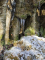
(1) Admire the small Cascade du Référon (a tufa waterfall known as a ‘ponytail’ waterfall), and continue along the track. At the Roize dam, carry straight on towards Pommiers-la-Placette.
(2) When you reach the end of the tarmac track, cross the Roize again and take the forest track leading to Pommiers-la-Placette (in the commune of La Sure-en-Chartreuse)
(3) At the place known as Ancienne Église (there is no longer a church), carry on straight ahead. At the junction (at a place known as Pierrefit), turn left towards the church and the town hall. Carry on until you reach the D520A. Cross at the pedestrian crossing and turn right to walk alongside the road for 300 metres.
(4) At the signpost for “Bois de Ratz”, turn left until you reach the tarmac road and carry on straight on towards the Col de la Tençon along an uphill forest track.
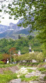
(5) The Col de la Tençon is the highest point of the route. Walk straight down for a few metres, then turn left towards Arbre Fourchu. On the descent, look out for a lovely viewpoint on the left over the neighbourhoods of Malossane and Racin, with the Aiguille de Chalais in the background.
(6) At the signpost for Arbre Fourchu, you can take a short round trip to the Belvédère du Bourget to enjoy magnificent views over the Grésivaudan valley, the hills of the Voironnais and the Vercors. Alternatively, continue down the slope. A viewpoint with a bench offers a view of the town of Voreppe in the foreground, followed by the Isère valley stretching all the way to Grenoble. Continue down the slope – which can be slippery in places on the rocky slabs – until you reach the D520A.
(7) Once you reach the D520A, keep to the right-hand side for 50 metres. Then cross this road, at the ‘Turn left’ sign, with great care, as it is a busy road. Cross when it’s safe to do so. As long as you can hear vehicles, do not cross. And watch out for bicycles and electric cars, which are silent. Climb over the safety barrier on the other side. Follow this road for about 300 metres and go down the steps to the signpost for “Malossane”.
Opposite you will find the Gouffre Gondrand. The Gouffre Gondrand was an open-cast refractory clay quarry, in operation from 1880 to 1915. Turn right and, at the fountain (signpost), turn left. Take care at the bottom of the steps when crossing the D520A. Walk straight down Rue du Boutet to the village of Voreppe.
(8) At the bottom of the street, turn left and head back up to the chemist’s. Cross at the traffic lights and take the footbridge over the Roize. Turn left and head back up to the Hikers’ Car Park (S/E).
 Association / Club / Walk leader


 Visorando Member

 Easy