Roche Brune and the Grand Ratz plateau, starting from Pommiers-la-Placette

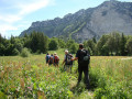
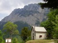
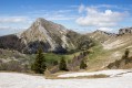
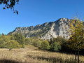
This lovely route, less than 30 minutes from Grenoble, will delight lovers of forests and panoramic views.
There are no significant difficulties apart from a few steep slopes on the way up to Roche Brune.

Details

20598528
Creation:
Last update:
Last review:
  • Walking
    Activity: Walking
  • ↔
    Distance: 7.97 mi
  • ◔
    Average duration: 6h 10 
  • ▲
    Difficulty: Moderate

  • ⚐
    Back to start: Yes
  • ↗
    Ascent: + 2,864 ft
  • ↘
    Descent: - 2,838 ft

  • ▲
    Highest point: 3,061 ft
  • ▼
    Lowest point: 1,240 ft

Description of the walk

Park at the junction of the D520a and the Route des Barniers.

(S/E) Follow the tarmac road for a few hairpin bends; first reach the hamlet of Les Barniers, then Les Côtes, staying on the right-hand road at the Y-junction. Les Côtes marks the end of the tarmac road.

(1) Continue along a wide path through the woods until you reach a multi-way junction on the edge of the woods and a meadow, where there is a signpost.

(2) Turn sharply to the right, almost 180°, towards Roche Brune. You will then alternate between ascents and gentle slopes before reaching the north-eastern ridge of Roche Brune.

(3) Then turn left; ignore the Yellow Cross. Continue along a well-marked path to reach the Roche Brune viewpoint.

(4) Retrace your steps to rejoin the main path and head due north until you reach a 90° junction.

(5) Head slightly to the left to reach a magnificent clearing (Le Grand Bachat) from where, below, paragliders take off. Extreme caution is advised here as the slope is very steep (sliding is prohibited).

(6) Then take the path along the edge of the ridge to reach the Sabot viewpoint.

(7) Follow the wide path down a slope that is sometimes steep. As you descend, you’ll join a wider track.

(8) Continue left along this track and, after a series of bends, you’ll reach the Champ Civet crossroads.

(9) Turn left onto the path and continue to the junction with the Route des Combes, where you’ll find a signpost.

(10) Turn left, walk through the hamlet of Les Combes, follow the road and the yellow markings to reach the hamlet of Le Batier.

(11) Opposite, take a new, straight, wide track that climbs gently. Further on, you’ll reach the crossroads above the quarry in the Bois de la Tençon.

(12) Here you have two options:
- continue gently straight ahead to reach the Col de Tençon, which you passed on the way out; this is the route shown on the map,
- leave the track, turn right to extend the route and enjoy new views; you’ll then reach the Maquisards viewpoint and subsequently the Bourget viewpoint; next, turn left onto the path coming from Voreppe to reach the Col de Tençon.

(2) Then retrace your steps along the route you took on the way out to return to the car park at the junction of the D520a and the Route des Barniers (S/E).

Waypoints

  1. S/E : mi 0 - alt. 1,611 ft - Car park at the junction of the D520a
  2. 1 : mi 0.46 - alt. 1,821 ft - End of the road
  3. 2 : mi 0.79 - alt. 2,064 ft - Col de la Tençon
  4. 3 : mi 1.57 - alt. 2,943 ft - Grand Ratz Plateau
  5. 4 : mi 1.82 - alt. 2,805 ft - Roche Brune viewpoint
  6. 5 : mi 2.24 - alt. 2,854 ft - 90° junction
  7. 6 : mi 2.88 - alt. 2,631 ft - Paragliding area
  8. 7 : mi 3.15 - alt. 2,218 ft - Sabot Viewpoint
  9. 8 : mi 3.43 - alt. 2,487 ft - Track
  10. 9 : mi 4.35 - alt. 1,969 ft - Champ Civet junction
  11. 10 : mi 4.76 - alt. 1,414 ft - Les Combes hamlet
  12. 11 : mi 5.34 - alt. 1,276 ft - Le Batier
  13. 12 : mi 6.05 - alt. 1,562 ft - Alternative junction
  14. S/E : mi 7.97 - alt. 1,608 ft - Car park at the junction of the D520a

Notes

It isn’t always easy to park as close as possible to the start of the trail, so I’d advise you to arrive early.
The route is extremely well signposted with well-maintained paths.
There are a few buildings where you can top up your water supplies, but as always in the Chartreuse, make sure you bring plenty with you.

Reviews and comments

3.6 / 5
Based on 4 reviews

Reliability of the description
3.3 / 5
Ease of following the route
3.3 / 5
Route interest
4.3 / 5
Martin73
Martin73

Overall rating : 3.3 / 5

Date of your route : Sep 21, 2024
Reliability of the description : ★★★☆☆ Average
Ease of following the route : ★★★☆☆ Average
Route interest : ★★★★☆ Good
Very busy route : No

For parking, head to the centre of the village of Pommiers-La-Placette, where there’s a large car park and no problems.

It’s a bit tricky to find the Roche Brune viewpoint, as there are several similar-looking spots. The description isn’t very clear on this point.

It’s easy to reach the paragliding take-off point; there’s a sign on the path. Crossing the meadow is straightforward; you arrive at the side of the slope, so you simply cross over and carry on straight ahead.

The total distance recorded using a Garmin Etrex GPS was 16 km.

Machine-translated

revolclaude
revolclaude

Overall rating : 3 / 5

Date of your route : Jun 18, 2024
Reliability of the description : ★★★☆☆ Average
Ease of following the route : ★★☆☆☆ Disappointing
Route interest : ★★★★☆ Good
Very busy route : No

The description mentions two viewing points, but there are three! Pas du Col, Croix de Rochebrune and Le Sabot.
At the junction at the Pas du Col (not mentioned), there’s a viewpoint at the old medieval quarry!! The description bears a striking resemblance to the route to the Croix de Rochebrune viewpoint!! But the distances are very different!! . Once you reach the Grands Bois, everything falls into place... On the way back from the Croix de Rochebrune, the route leaves the yellow markings... but where exactly?? There are lots of forest tracks: which one leads to the paragliding take-off point?
The rest of the route presents little difficulty.

Machine-translated

Jimka
Jimka

Overall rating : 4.3 / 5

Date of your route : Aug 29, 2023
Reliability of the description : ★★★★☆ Good
Ease of following the route : ★★★★★ Very good
Route interest : ★★★★☆ Good
Very busy route : No

The route runs largely through woodland, which is very pleasant during hot weather. There are numerous viewing points, which are always welcome.

Machine-translated

ocarina0656
ocarina0656

Overall rating : 3.7 / 5

Date of your route : Nov 27, 2022
Reliability of the description : ★★★☆☆ Average
Ease of following the route : ★★★☆☆ Average
Route interest : ★★★★★ Very good
Very busy route : No

From the start to point 3: no problems. At point 3, you reach A viewpoint but not the Roche Brune viewpoint, which is much further away. You cannot follow the ridges as the map seems to suggest.
At point 4: The 90° junction is called Les Grands Bois (there’s a signpost indicating that the Roche Brune viewpoint is 800 m away). You can easily reach it by following the yellow markings. Then retrace your steps to rejoin the main path on your left, ignoring the Yellow Cross.
At point 5: you need to realise that you have to go down the meadow running alongside the paragliding launch site. From there, you can take the ridge path to reach the ‘Sabot’ viewpoint.
The rest of the route is straightforward.
One more thing: as we set off along the track after Les Côtes, we came across a prefectural order dated 24 August 2022 (no doubt issued following the Voreppe fire, prohibiting access to the Balmes and Bois de la Tençon areas). Don’t worry, we didn’t see any other notices during the circular route. We didn’t notice any particular risk of rockfalls, and the path is well-used by locals.
Apart from our hesitation at the various junctions, the walk is very scenic (though best avoided on rainy days, as some descents can be very slippery) and takes 6 hours at a very leisurely pace.

Machine-translated

Other walks in the area

For more walks, use our search engine .

The GPS track and description are the property of this route's author. Please do not copy them without permission.