Country:

 City:



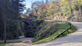

Park at the side of the Chemin de la Bourderie, taking care not to obstruct other vehicles.
(S/E) Set off along the path on the right and you’ll soon reach a three-way junction.
(1) Leave the track on your right and head for the path opposite. Keep going in the same direction, ignoring the various turnings to the left and right, until you reach a mast on your right.
(2) At this junction, turn left and, continuing to the right and then straight on, head for the Jolys junction.
(3) Head uphill to the left, then turn right; after passing between some rocky outcrops, you’ll reach an X-shaped junction.
(4) Take thesecond path on the right, leave it further on to head uphill to the left and join a track at the 585-metre mark.
(5) Head right and, keeping straight ahead, reach a small road at a bend. Follow this to the right for about a hundred metres.
(6) Take the path on the left and you’ll come out onto the Route de Saint-Roch (D49). Carry on to the left until you reach the oratory.
(7) Leave the road and take the path on the right, then take a sharp left-hand bend to return to the road and pass the Pierre Chave turnstile, heading uphill to the right. Continue for about a hundred metres past the bridge.
(8) Take the path on the right, which leads onto the Chemin des Balmettes, and turn right. Walk through the hamlet of Les Verneys, staying on the tarmac road, and continue until you reach a junction with two paths.
(9) Take the path on the right and head towards a junction at the edge of the woods.
(10) First turn left then right. Further on, at a right-hand bend near Les Vessières, take the path on the left and then carry on straight ahead to reach the junction by the Prairie des Balmettes.
(11) Carry on to the left to go round the meadow and head up into the Bois de l’Église.
(12) Head to the right and continue through the Bois de Plantimey. You’ll come to a junction with a signpost for ‘Maladière’.
(13) Carry on straight ahead.
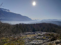
(14) Carry on straight ahead, following the sign for “Rocher de la Garde”. Pass the first path on the right and take the second one. Further on, turn right again to reach the Rocher de la Garde: panoramic view.
(15) Retrace your steps, then rejoin the route to the right to reach the Sous le Rocher junction.
(16) Head off to the left, turn right a few dozen metres further on and head down towards La Borderie to return to the car park (S/E).
 Visorando Member

 Tourist office
 Easy