The Rocher de la Garde

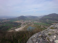
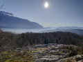
A short walk through the woods starting from the Gorges de Saint-Étienne de Crossey, passing by the Rocher de la Garde and its lovely viewpoint over the western part of the Chartreuse and the eastern part of the Pays Voironnais.

Details

4521448
Creation:
Last update:
Last review:
  • Walking
    Activity: Walking
  • ↔
    Distance: 3.29 mi
  • ◔
    Average duration: 2h 30 
  • ▲
    Difficulty: Moderate

  • ⚐
    Back to start: Yes
  • ↗
    Ascent: + 1,099 ft
  • ↘
    Descent: - 1,096 ft

  • ▲
    Highest point: 2,277 ft
  • ▼
    Lowest point: 1,542 ft

Photos

Description of the walk

Park in the car park on the right as you leave Saint-Étienne de Crossey on the D520 towards Saint-Laurent-du-Pont.

(S/E) Cross the D520 – which is a fairly busy road – with the utmost care to reach the start of the Chemin des Chèvres opposite the car park, heading towards Saint-Étienne-de-Crossey and the Gorges de Crossey. The path climbs gently through the woods. You will reach a spot called ‘Au-dessus des Gorges’.

(1) Turn left towards the Rocher de la Garde, signposted as 1 km away. Follow the path, which is marked with yellow stripes and climbs a little more steeply through the woods.
You’ll arrive at the point marked ‘Sous le Rocher’.

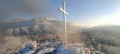
(2) Turn left to reach the Rocher de la Garde and its cross in no time.
Caution: the summit is dotted with numerous sharp limestone pavements, some of which are very deep. Take great care, especially with children and in wet or snowy weather.
From the summit, admire the view over Saint-Étienne-de-Crossey, which lies below, and, on the other side, the Grande Sure.

Head back down to the previous crossroads: Sous le Rocher.

(2) Then turn left towards Plantimey. You’ll very quickly reach the spot known as La Garde.

(4) Pass the path on your left marked by an arrow – this is the route you’ll take on the way back. Turn right onto the path that winds its way down through the woods in wide hairpin bends. You’ll reach another junction.

(5) Take the path on the left, despite the presence of a Yellow Cross. You’ll then come to another junction with a signpost showing two arrows. Head left uphill to reach another junction further up.

(6) Turn left again, following the yellow markings. When you reach the spot known as Plantimey, turn left towards La Garde. Walk through a lovely forest of majestic pine trees. A few hundred metres further on, there is another sign for Plantimey. Continue to follow the signs for La Garde, turning left. Climb a short section secured with cables, which presents no particular difficulty. The path then descends again to rejoin the junction you passed on the way there.

(4) Turn right to reach the spot known as La Gard and, a little further on, Sous le Rocher.

(2) Then follow the same path you took on the way there to head back down to the car park (S/E), taking great care once again when crossing the road.

Waypoints

  1. S/E : mi 0 - alt. 1,542 ft - Car park on the outskirts of Saint-Étienne de Crossey
  2. 1 : mi 0.39 - alt. 1,742 ft - Above the gorges
  3. 2 : mi 0.95 - alt. 2,260 ft - Sous le Rocher
  4. 3 : mi 1.02 - alt. 2,247 ft - Rocher de la Garde
  5. 4 : mi 1.16 - alt. 2,224 ft - Junction of the circular loop
  6. 5 : mi 1.42 - alt. 2,011 ft - Junction
  7. 6 : mi 1.82 - alt. 1,965 ft - Path on the left
  8. S/E : mi 3.29 - alt. 1,545 ft - Car park on the outskirts of Saint-Étienne de Crossey

Notes

There are no particular difficulties on this walk.
The car park has several picnic tables.
In winter, the walk can be done on snowshoes if there is plenty of snow.

Worth a visit

Chocolatier Bonnat’s production workshop has been based in the village of Saint-Étienne de Crossey since 2020. The shop is still located in Voiron, 7 km away.

Reviews and comments

3.5 / 5
Based on 4 reviews

Reliability of the description
3.5 / 5
Ease of following the route
4 / 5
Route interest
3 / 5
NaBa
NaBa

Overall rating : 3.7 / 5

Date of your route : Nov 07, 2022
Reliability of the description : ★★★★☆ Good
Ease of following the route : ★★★★☆ Good
Route interest : ★★★☆☆ Average
Very busy route : No

A fairly unremarkable route, apart from the finish at Les Milandes. Around 30 per cent tarmac.
A climb right from the start for 15 minutes

Machine-translated

micheldiguet
micheldiguet

Overall rating : 3 / 5

Date of your route : Aug 22, 2022
Reliability of the description : Not used / Not applicable
Ease of following the route : Not used / Not applicable
Route interest : ★★★☆☆ Average
Very busy route : No

Hello,
Unfortunately, roadworks prevented us from reaching the start of this walk.
If the Department of Public Works had closed the road 25 metres further on, we would have found the start.
So we took a different route and it was a right nightmare.

Machine-translated

vuagnoux
vuagnoux

Overall rating : 4.5 / 5

Date of your route : Mar 23, 2021
Reliability of the description : Not used / Not applicable
Ease of following the route : ★★★★★ Very good
Route interest : ★★★★☆ Good
Very busy route : No

Starting from the same point, we extended the route after “La Garde” (lovely view) along the ridges above St Aupre as far as the pumping station towards “Les Vernays”. We returned partly along the same pleasant path through the woodland, then descended towards La Maladière and walked back along the edge of the quarry, via point 494, to the car park.

Machine-translated

canard bleu
canard bleu

Overall rating : 2.7 / 5

Date of your route : Feb 08, 2021
Reliability of the description : ★★★☆☆ Average
Ease of following the route : ★★★☆☆ Average
Route interest : ★★☆☆☆ Disappointing
Very busy route : Yes

rather disappointing and not particularly clear in terms of guidance

Machine-translated

Other walks in the area

For more walks, use our search engine .

The GPS track and description are the property of this route's author. Please do not copy them without permission.