The Moirans Islands

A hybrid bike ride starting from Voreppe towards the plain between Moirans and Tullins via the Chemin des Digues and the path running alongside the River Fure to the south of Saint-Jean de Chépy.

Details

n°32996156
Creation:
Last update:
Last review:
  • Touring/Gravel
    Activity: Touring/Gravel
  • ↔
    Distance: 16.15 mi
  • ◔
    Duration according to the author: 2.5 hrs 
  • ▲
    Difficulty: Easy

  • ⚐
    Back to start: Yes
  • ↗
    Ascent: + 115 ft
  • ↘
    Descent: - 115 ft

  • ▲
    Highest point: 712 ft
  • ▼
    Lowest point: 594 ft
  • ⚐ Country: France
  • ⚐
    Areas: Alps, Dauphiné
  • ⚐ City: Voreppe (38340)
  • ⚑
    Start/End: N 45.295125° / E 5.629303°
  • ❏
    IGN map(s): Ref. 3233SB, 3235OT, 3334OT, 3334OTR

  • ◶
    Type of surface:
  •  
     
     
    ■ 33% Road ■ 34% Byway ■ 33% Path
  • Hour-by-hour weather

Photos

Description of the route

Start from the car park near the fast-food restaurant in Voreppe.

(S/E) Take the cycle path that runs along the right bank of the Roize to join the Chemin des Digues, after passing under the motorway bridge, alongside the Étang de Roize.

(1) Take this path on the left, which runs between the Canal de Vence and the Étangs de l’Île Rose and de la Volmat, leading onto the road to the sewage treatment works.

(2) Follow this road for 300 metres, then turn left onto the greenway that runs alongside the River Isère. Continue to the junction with the sign indicating the direction of Moirans.

(3) Turn right onto this road, cross the bridge over the motorway and, at the three-way junction, turn left. Then continue straight on until you reach the hamlet of Les Îles.

(4) On leaving the hamlet, turn left and ignore the roads on either side. Pass through the hamlets of Les Petites Îles, Les Grandes Îles, La Trace and Le Fays until you reach a three-way junction.

(5) Turn left onto Route des Îles, heading towards La Trace. At the next junction, turn right, then further on, turn left and enter the village.

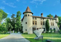
(6) Ignore Rue de l’Étang de Mai on the left and carry on straight ahead. Reach the Château de Saint-Jean de Chépy by taking the next path on the left, Chemin du Domaine.

(7) Then return to Saint-Jean de Chépy via Rue de l’Étang de Mai.

(6) Follow this road to the right, then continue along the track. Walk alongside the Fure stream until you reach a crossroad with a bridge on the right.

(8) Cross the bridge and turn left immediately. Follow the road, pass the hamlet of Le Port and, at the foot of the motorway, turn right until you reach a roundabout.

(9) Take the D45 towards Saint-Quentin, go under the motorway and, before the bridge over the Isère, turn right to join the cycle route running alongside the Isère.

(10) Continue to the left, towards Grenoble, and rejoin the route you have already taken.

(3) Follow the cycle path until you reach the sign pointing towards Voreppe, with a bridge on your left.

(11) Turn left, cross the bridge and turn left straight away. Ride alongside the Étang de Roize on your right until you reach the track you took on the way there. Continue to the right and follow the route in the opposite direction to the outward journey until you reach the car park near the fast-food restaurant (S/E).

Waypoints

  1. S/E : mi 0 - alt. 709 ft - Car park near the fast-food restaurant in Voreppe - Roize (cours d'eau) - Affluent du canal de Vence
  2. 1 : mi 0.55 - alt. 640 ft - Chemin des Digues
  3. 2 : mi 1.4 - alt. 633 ft - Road to the sewage treatment works - Isère (rivière)
  4. 3 : mi 2.45 - alt. 630 ft - Signpost for Moirans
  5. 4 : mi 3.74 - alt. 610 ft - Turn left onto the road as you leave the hamlet of Les Iles
  6. 5 : mi 5.69 - alt. 607 ft - Turn left onto the road after the hamlet of Le Fays
  7. 6 : mi 7.22 - alt. 633 ft - Rue de l’Étang de Mai
  8. 7 : mi 7.59 - alt. 623 ft - Castle
  9. 8 : mi 8.98 - alt. 597 ft - Bridge crossing the River Fure - Fure (rivière)
  10. 9 : mi 9.67 - alt. 604 ft - D45 roundabout
  11. 10 : mi 10.01 - alt. 620 ft - Greenway - Morge (rivière) - Affluent de l'isère
  12. 11 : mi 15.31 - alt. 636 ft - Signpost for Voreppe
  13. S/E : mi 16.15 - alt. 709 ft - Car park near the fast-food restaurant - Gare de Voreppe

Notes

On the return journey, before reaching (3), there is a rest area with dry toilets and benches.

Worth a visit

The Château de Saint-Jean de Chépy is a private estate for holidays and seminars, combining nature, art and heritage. The grounds are generally open to visitors free of charge.

Reviews and comments

4.3 / 5
Based on 2 reviews

Reliability of the description
4.5 / 5
Ease of following the route
4 / 5
Route interest
4.5 / 5
User 10596301

Overall rating : 4 / 5

Date of your route : Jul 28, 2025
Reliability of the description : ★★★★☆ Good
Ease of following the route : ★★★☆☆ Average
Route interest : ★★★★★ Very good
Very busy route : No

Aaaaaaaaaaa

Machine-translated

Pascalou38250
Pascalou38250

Overall rating : 4.7 / 5

Date of your route : Dec 21, 2023
Reliability of the description : ★★★★★ Very good
Ease of following the route : ★★★★★ Very good
Route interest : ★★★★☆ Good
Very busy route : No

A very pleasant and easy route

Machine-translated

Other walks in the area

For more walks, use our search engine .

The GPS track and description are the property of this route's author. Please do not copy them without permission.