


 Country:

 City:
City:


Starting point at Les Trois Fontaines, with a large car park for hikers, accessible from the Col de la Placette (D520A) via a road that winds uphill and ends with a short stretch of forest track (easily passable by car).
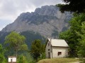
(S) From the car park, continue along the forest track, pass the hamlet of Les Reynaud and follow the path which descends slightly to the chalet at Le Soulet.
(1) Immediately afterwards, stay on the forest track on the right which descends, before climbing quite steeply towards the south.
(2) At the Cota Bois junction, carry straight on along the path which climbs steeply up the slope, due south.
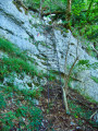
(3) Cross the first gap in the path through a rocky ridge. Follow the yellow markings carefully, as there are a few exposed sections.
(4) At the Pas de l’Aronde, take care: this is an exposed section involving a 5-metre traverse across a scree slope of mixed stones, earth and leaves.A rope is provided to secure the passage (sliding down is strongly discouraged). Continue the ascent by following the marked path, which then turns left and follows the summit ridge to the Prairie de Charminelle.
(5) A welcome splash of greenery in this meadow after a fairly steep and challenging climb in places. Continue straight on until you reach a junction with the Sentier de Charminelle, at the edge of the woodland.
(6) Carry on straight ahead, then begin the climb up to the Goulet de Lorzier.
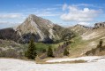
(7) Stunning views of Belledonne, the Vallon de Lorzier and the Grande Sure… Carry on along the path which leads gently up to the Col d’Hutières.
(8) Head straight north, following the Vallon de Lorzier; note the mountain hut below on the left, then reach a fork in the path.
(9) Turn left, heading west, and descend to the Refuge d’Hurtière.
(10) Water supply point; toilets in a hut a little further on. Continue along the path in front of the refuge, which descends slightly northwards, until you reach a fork in the path, below the summit ridge of the Grande Sure.
(11) Keep left, descending westwards to the Combe des Veaux junction.
(12) Head uphill to the right, reach the west face of the Grande Sure, then descend to the Chalet de Jusson.
(13) Continue along the path that starts a little further down, in the forest. Follow the yellow markings carefully on this path, which was re-marked in 2024/25; ignore any other possible tracks. Descend until you reach the Trois Fontaines car park (S/E).



 Visorando Member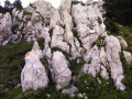
 Difficult
 Association / Club / Walk leader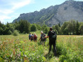
 Moderate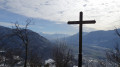
 Easy
Easy  Tourist office
