Racin Circular (Trail No. 1 of the “Sentiers de Chartreuse Occidentale”)

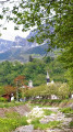
A family-friendly walk where you’ll discover Voreppe set amidst its rolling hills, with its old hamlets, its hillsides once covered in vineyards, and the Poor Clares’ monastery.

Trail No. 1 of the “Sentiers de Chartreuse Occidentale”, a circular route, signposted in both directions.

However, this trail does present the risks typical of mountain and forest trails (falling branches and the Roize river overflowing at the ‘Pas Japonais’ crossing, etc.).

Details

n°1635040
Creation:
Last update:
Last review:
  • Walking
    Activity: Walking
  • ↔
    Distance: 2.70 mi
  • ◔
    Average duration: 1h 40 
  • ▲
    Difficulty: Easy

  • ⚐
    Back to start: Yes
  • ↗
    Ascent: + 499 ft
  • ↘
    Descent: - 518 ft

  • ▲
    Highest point: 1,352 ft
  • ▼
    Lowest point: 823 ft

Photos

Description of the walk

The start is in Voreppe Bourg, at the ‘Roize terraces car park’, Quai du Dr Jacquin (towards Chalais); however, you must park at the ‘hikers’ car park’ on Rue Pré Boulat, 100 metres further up (it is signposted). Then make your way back to the Roize terraces car park, the starting point for the trails.

Follow the No. 1 directional signs and the yellow markings.

(S/E) Take the Route de Raciun for a few metres, then take the path on the right which runs alongside the cemetery wall. When you reach the road again, follow it to the right. At the next junction, head straight on along the Chemin du Clet, then take the path leading uphill on the left after about 50 metres.
At the top of this path, you’ll reach the hamlet of Le Clet, where you’ll see an old grape press on your right.

(1) At the signpost for “Le Clet”, take the path on the left towards “Chalais”.

(2) As you continue, you’ll pass the Poor Clares’ monastery, where you can take a short detour to visit the chapel, whose stained-glass windows were created by the Voreppin artist Louis Christolhomme.

Return to the path to reach the hamlet of Racin.

(3) Join the tarmac road (Route de Chalais) and follow it to the right for about 400 metres. After the hairpin bend, you’ll come to a few houses.
Take the second path marked No. 1 – this is the Chemin du Groupe Raymond – which descends to your left towards the Roize dam. The descent has been made safer by the construction of wooden steps

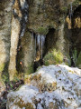
At the bottom of this descent, you’ll cross the Baconnière stream; this is a very romantic spot where you can relax on the bench installed by the Atout à z’art association, with the lapping of the water as a backdrop and the stepped tufa formations as a setting.

Carry on until you reach another tarmac road (known as the ‘Chemin du Gigot’), at the signpost for ‘Roize Dam’.

(4) Carry on straight ahead to cross the Roize torrent via the stepping stones.

Please note: if the stepping stones are covered in water, you should not cross the Roize. In this case, return to your starting car park by walking down the road on the left bank.

(5) After crossing the Roize, take the path that leads uphill towards the hamlet of Malossane.
As you leave the path, take the road leading down to your left and head for the hamlet of Malossane Bas.

You’ll pass the “Gouffre Gondrand”, from where refractory stone was once quarried.

Continue downhill to the next houses. Take the path on the left between the houses. Go down a few steps and cross the RD520A with care.
Turn into Rue du Boutet opposite and walk down to the village of Voreppe.
At the bottom of Rue du Boutet, turn left, cross the Roize on the footbridge at the traffic lights and follow Quai du Docteur Jacquin to the left to reach the walkers’ car park (S/E).

Waypoints

  1. S/E : mi 0 - alt. 883 ft - Hikers’ car park opposite the cemetery
  2. 1 : mi 0.55 - alt. 1,260 ft - Le Clet
  3. 2 : mi 0.71 - alt. 1,260 ft - Monastery of the Poor Clares
  4. 3 : mi 0.96 - alt. 1,293 ft - The hamlet of Racin
  5. 4 : mi 1.5 - alt. 1,145 ft - Roize Dam
  6. 5 : mi 2 - alt. 1,073 ft - The hamlet of Malossane and the Gouffre Gondrand
  7. S/E : mi 2.7 - alt. 883 ft - Hikers’ car park opposite the cemetery

Notes

An added bonus to this walk: this route, starting from the Roize terraces car park, can be complemented by a historical and heritage walk through the old village of Voreppe.

Worth a visit

(2) Monastery of the Poor Clares: formerly the “Institution Saint Nizier”, founded in 1874 for secondary education. It was not until 1964 that the Poor Clares moved their monastery there.
(3) The hamlet of Racin is the oldest in Voreppe. It is mentioned in a charter from the Chalais cartulary in 1101. There you will see a typical fountain carved out of the rock.
Roize Dam: it was built on the site of a former ford, following the torrential flooding of 1971. Its purpose is to retain the rocks and tree trunks carried downstream.
(5) The hamlet of La Malossane comprised numerous farms and town houses from the18th century onwards. Its name derives from the molasse stone that was quarried there until the19th century.
In this area lies the Gondrand chasm, a former fireclay quarry operated from 1880 to 1915.

Visit the Corepha association’s website to learn more about the heritage and history of the commune of Voreppe.

Reviews and comments

4.1 / 5
Based on 3 reviews

Reliability of the description
4 / 5
Ease of following the route
4 / 5
Route interest
4.3 / 5
matei
matei

Overall rating : 5 / 5

Date of your route : Mar 22, 2021
Reliability of the description : ★★★★★ Very good
Ease of following the route : Not used / Not applicable
Route interest : ★★★★★ Very good
Very busy route : No

A lovely family walk, with clear signposting and helpful directions from Visorando.

Machine-translated

mapoi
mapoi

Overall rating : 4 / 5

Date of your route : Mar 01, 2020
Reliability of the description : ★★★★☆ Good
Ease of following the route : ★★★★☆ Good
Route interest : ★★★★☆ Good

Easy walk; matches the description on Visorando

Machine-translated

PATRICK.S
PATRICK.S

Overall rating : 3.7 / 5

Date of your route : Mar 04, 2019
Reliability of the description : ★★★☆☆ Average
Ease of following the route : ★★★★☆ Good
Route interest : ★★★★☆ Good

Hello,

It is essential to state at the beginning of the description that this is the OLD cemetery of Voreppe, which is located near the church in LE BOURG. This is because when you arrive at the entrance to Voreppe, the first cemetery signposted is the new one, which is also the only one listed online, on Rue Blanchard.

Kind regards
Patrick

Machine-translated

Other walks in the area

For more walks, use our search engine .

The GPS track and description are the property of this route's author. Please do not copy them without permission.