


Refine your search for walks in Grayssas
Grayssas walks


 Circular Grayssas route towards Saint-Martin and Néguevieille.
 Visorando Member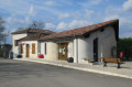
 6.86 mi
 +741 ft
 -725 ft
 3h 50
3h 50
 Moderate
 Departure from Grayssas (Lot-et-Garonne)
This circular route, which leads to the Chapel of Saint-Martin and the streams of Saint-Martin and Néguevieille, with large wooded areas, offers numerous views of the valleys to the north and south.
Panoramic view of Saint-Maurin, its abbey and the Séoune valleys
3.69 mi
+390 ft
-390 ft
2h 00
Moderate
Departure from Perville (Tarn-et-Garonne)
This route, which takes you through both hillside and flat terrain, will charm you with its panoramic views in thefirst half of the walk – including, amongst other things, the village of Saint-Maurin and its abbey – and then with its wooded setting during the refreshingsecond half.
Gasques washhouse route
3.90 mi
+512 ft
-509 ft
2h 15
 Easy
Departure from Gasques (Tarn-et-Garonne)
Easy
Departure from Gasques (Tarn-et-Garonne)
A strip of chalky rock runs down from the Quercy highlands to the outskirts of Valence d’Agen. On this short route, you’ll wander over hill and dale. You’ll pass by a few old wash houses. The first, below the village, still has its stone benches for washing clothes. The others, halfway along the route, on either side of the road, are overgrown with vegetation or water lilies. (Excerpt from “Emilie’s Trails in the 82” by Randoéditions).
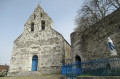
Through the hills and valleys of Clermont-Soubiran
 6.01 mi
+748 ft
-771 ft
3h 25
Moderate
Departure from Clermont-Soubiran (Lot-et-Garonne)
6.01 mi
+748 ft
-771 ft
3h 25
Moderate
Departure from Clermont-Soubiran (Lot-et-Garonne)
From the heights of Clermont-Soubiran, this route descends southwards into the Garonne valley, offering views of the nearby Golfech nuclear power station, before climbing back up towards the hills of Rigou and Aureillac via the Ruisseau de Néguevieille valley, alternating between footpaths and tarmac sections.
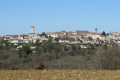
From Saint-Romain-le-Noble to Puymirol
 5.90 mi
+525 ft
-499 ft
3h 10
Moderate
Departure from Saint-Romain-le-Noble (Lot-et-Garonne)
5.90 mi
+525 ft
-499 ft
3h 10
Moderate
Departure from Saint-Romain-le-Noble (Lot-et-Garonne)
A circular walk between Saint-Romain-le-Noble and Puymirol, following ridge paths offering numerous panoramic views.
Route des Vergers du Brulhois
 Association / Club / Walk leader9.36 mi
+217 ft
-210 ft
4h 30
Moderate
Departure from Donzac (Tarn-et-Garonne) (Tarn-et-Garonne)
Association / Club / Walk leader9.36 mi
+217 ft
-210 ft
4h 30
Moderate
Departure from Donzac (Tarn-et-Garonne) (Tarn-et-Garonne)
Whether on foot, by mountain bike, on horseback, with friends, with family, or on your own, this route is accessible to everyone. The Circuit des Vergers is one of the hiking routes of the Sentiers du Brulhois. Located in the commune of Donzac, it mainly passes through orchards, of course, but also vineyards and forests.
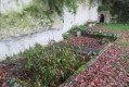
Saint-Martin-de-Beauville circular
 5.25 mi
+433 ft
-459 ft
2h 45
Easy
Departure from Saint-Martin-de-Beauville (Lot-et-Garonne)
5.25 mi
+433 ft
-459 ft
2h 45
Easy
Departure from Saint-Martin-de-Beauville (Lot-et-Garonne)
A route between Saint-Martin-de-Beauville and La Sauvetat-de-Savères.
Cachepiot Route of the Brulhois Trails
 6.39 mi
+571 ft
-584 ft
3h 25
Moderate
Departure from Saint-Loup (Tarn-et-Garonne) (Tarn-et-Garonne)
6.39 mi
+571 ft
-584 ft
3h 25
Moderate
Departure from Saint-Loup (Tarn-et-Garonne) (Tarn-et-Garonne)
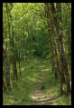
On foot or by mountain bike, with friends, family or on your own, this hike is perfect for those who enjoy hills (10% gradients) and beautiful views. The Cachepiot route is one of the hiking trails in the “Sentiers du Brulhois” network. Located in the commune of Saint-Loup, it mainly passes through forests and meadows, with a few quiet tarmac sections.
Circular route around La Sauvetat-de-Savères
 6.14 mi
+607 ft
-600 ft
3h 20
Easy
Departure from La Sauvetat-de-Savères (Lot-et-Garonne)
6.14 mi
+607 ft
-600 ft
3h 20
Easy
Departure from La Sauvetat-de-Savères (Lot-et-Garonne)
A circular route from the Petite Séoune valley up to the heights of Saint-Damien and Saint-Robert.
From Saint-Jean-de-Thurac to Saint-Romain-le-Noble
 5.51 mi
+689 ft
-689 ft
3h 10
Moderate
Departure from Saint-Jean-de-Thurac (Lot-et-Garonne)
5.51 mi
+689 ft
-689 ft
3h 10
Moderate
Departure from Saint-Jean-de-Thurac (Lot-et-Garonne)
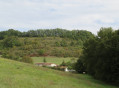
A circular route between the plain, the Saint-Jean-de-Thurac picnic area on the side of the D 813, and the Saint-Romain-le-Noble plateau, featuring three lovely climbs.
Circular walk between Engayrac and Beauville
 5.19 mi
+535 ft
-564 ft
2h 50
Easy
Departure from Engayrac (Lot-et-Garonne)
5.19 mi
+535 ft
-564 ft
2h 50
Easy
Departure from Engayrac (Lot-et-Garonne)
From the Engayrac plateau, this circular walk descends on one side into the valley of the Ruisseau de Gandaille and on the other into the valley of the Ruisseau d’Estrénats, passing through Beauville.
The Malause hillsides
4.71 mi
+466 ft
-476 ft
2h 35
Easy
Departure from Malause (Tarn-et-Garonne)
Enjoy lovely views of the hillsides around Malause and discover the Church of Sainte-Rose (12th and 13th centuries).
Auvillar - Castet Arrouy
 13.86 mi
+1,332 ft
-1,234 ft
7h 30
13.86 mi
+1,332 ft
-1,234 ft
7h 30
 Difficult
Departure from Auvillar (Tarn-et-Garonne)
Difficult
Departure from Auvillar (Tarn-et-Garonne)
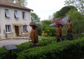
Thirty-fifth stage of the Way of St James. On this stage, you enter the Gers via Lomagne, this land of steep hills also known as ‘humpbacked Gascony’. This world-famous gastronomic region, home to foie gras and Armagnac, is also a land of captains, with its castles, fortified farms, redoubts, bastides, strongholds and more. Who hasn’t heard of d’Artagnan!
You will follow pretty paths running parallel to the road, lined with fruit trees (apples, pears, cherries, figs, hazelnuts) and cypresses.
Campagnac circular
 6.01 mi
+758 ft
-732 ft
3h 25
Moderate
Departure from Engayrac (Lot-et-Garonne)
6.01 mi
+758 ft
-732 ft
3h 25
Moderate
Departure from Engayrac (Lot-et-Garonne)
Circular route between Campagnac (in the municipality of Engayrac) and Le Bugat (in the municipality of Bourg-de-Visa).
Autour d'Auvillar par le Moulin de Gâches
 6.50 mi
+663 ft
-669 ft
3h 35
Easy
Departure from Auvillar (Tarn-et-Garonne)
6.50 mi
+663 ft
-669 ft
3h 35
Easy
Departure from Auvillar (Tarn-et-Garonne)
This hike is accessible to most people and follows aPR® marked in yellow and parts ofthe GR® 65 marked in white and red. All this around one of the most beautiful villages in France.