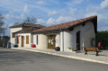
Cachepiot Route of the Brulhois Trails

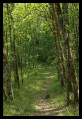
On foot or by mountain bike, with friends, family or on your own, this hike is perfect for those who enjoy hills (10% gradients) and beautiful views. The Cachepiot route is one of the hiking trails in the “Sentiers du Brulhois” network. Located in the commune of Saint-Loup, it mainly passes through forests and meadows, with a few quiet tarmac sections.

Details

96100505
Creation:
Last update:
Last review:
  • Walking
    Activity: Walking
  • ↔
    Distance: 5.86 mi
  • ◔
    Average duration: 3h 10 
  • ▲
    Difficulty: Moderate

  • ⚐
    Back to start: Yes
  • ↗
    Ascent: + 538 ft
  • ↘
    Descent: - 551 ft

  • ▲
    Highest point: 505 ft
  • ▼
    Lowest point: 184 ft

Photos

Description of the walk

Start from the car park of the main village hall in Saint-Loup.

(S/E) Take the road on the right, then take the first road on the left.

(1) At the junction on the way out of St-Loup, follow the path up to the left.

(2) Once at the top, leave the path and turn left onto the Route de la Côte du Gasaillant.

(3) Leave the road and head down the path on the right through the woods until you reach the D10.

(4) Follow it to the right until you reach the junction with the Route du Moulin de la Saigne.

(5) Turn left onto the Route du Moulin de la Saigne and continue to the D953.

(6) Cross it and continue along the path opposite until you reach the junction.

(7) Turn left onto Route de Labraque then continue straight on along Impasse de Montaygut.

(8) Turn left onto the path and continue through the woods until you reach the roundabout.

(9) Cross the D953 and, after the roundabout, turn right onto Route de Mondou.

(10) Follow it to the left and continue along Chemin de Mondou until you reach Impasse du Puntal.

(11) Turn left into the cul-de-sac, cross the D12 and continue on the D10. Keep going straight ahead until you reach the village of Saint-Loup. Then return to the car park at the Saint-Loup village hall (S/E).

Waypoints

  1. S/E : mi 0 - alt. 289 ft - Village hall
  2. 1 : mi 0.23 - alt. 341 ft - Crossroads
  3. 2 : mi 0.81 - alt. 495 ft - “Côte du Gasaillant” route
  4. 3 : mi 1.11 - alt. 456 ft - Entrance to the woods
  5. 4 : mi 1.58 - alt. 233 ft - D10
  6. 5 : mi 2.18 - alt. 259 ft - Route du Moulin de la Saigne
  7. 6 : mi 2.72 - alt. 230 ft - D953 - Arrats (rivière) - Affluent de la Garonne
  8. 7 : mi 3.07 - alt. 505 ft - Labraque Route
  9. 8 : mi 3.87 - alt. 482 ft - Entrance to the woods
  10. 9 : mi 4.56 - alt. 200 ft - Departmental
  11. 10 : mi 4.83 - alt. 190 ft - Route de Mondou
  12. 11 : mi 5.25 - alt. 187 ft - Impasse de Puntal
  13. S/E : mi 5.85 - alt. 289 ft - Village hall

Notes

The “Sentiers du Brulhois” are a collection of short hiking routes designed for walkers, mountain bikers and horse riders (some sections are accessible to horse-drawn carriages) in the southern part of the Communauté de Communes des Deux Rives. A range of routes of varying lengths are available, starting from the villages of Donzac, Dunes, Sistels and Saint-Loup. On these walks, which take a few hours, you’ll discover the rolling landscapes of the Brulhois region, the architectural heritage of the Gascon bastides and the charm of the flower-filled villages.

Worth a visit

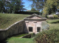
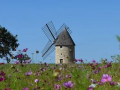
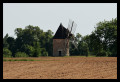
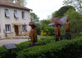
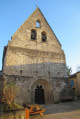
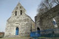
The village of St-Loup and its fountain, the views over the Arratz and Garonne valleys, the Saigne bridge and, just a stone’s throw away, the old telegraph tower.

Other walks in the area

For more walks, use our search engine .

The GPS track and description are the property of this route's author. Please do not copy them without permission.