Country:
 City:
City:



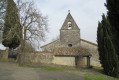
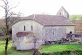
Park next to the Campagnac chapel, in the village of Engayrac.
(S/E) With your back to the church, set off along the road on the right which climbs due north towards the old windmill.
(1) At the top of the hill, near the old mill on the right, take the road on the left for 150 m, then, near an electricity pole, take a grassy path to the right. Follow this path, keeping to the left, until you reach the road.
(2) Turn left towards Couzinet and Millaussou.
(3) Carry on straight ahead, passing Perrou on your left. Just before reaching Laplagne, leave the road and follow the gravel track to the right (visible on OSM) downhill to the D16.
(4) Cross the D16 with care, then cross the bridge. Continue along the road until you reach a right-hand bend, where you take the path (not shown on maps) opposite, into the woods. Follow this path until you reach a hiking signpost.
(5) Turn right and follow the signposted Route No. 1 towards Le Bugat. Pass through the hamlet of Pagès, following the yellow signposts, then follow the road to the left towards Le Bugat.
(6) Once you reach the hamlet, turn right, then left at the cross towards Lasbourdettes until you reach the church.
(7) Take the grassy path that runs alongside the cemetery on the left and joins a road. Turn left and, immediately afterwards, turn right between two fields, following the yellow markings.
(8) At the crossroads, turn right, then right again about fifty metres further on. Once at the road, first turn right then left to reach the hamlet of Cavaillé; walk through it and continue to the D16.
(9) Cross the road carefully and take the gravelled path opposite towards La Bourdette. At the end of this path (which is blocked off), follow the grassy track on the right. Cross the access road to Gary and head straight on to return to the church at Campagnac (S/E).

 Visorando Member
 Easy
Easy