Country:
 City:
City:


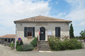
Park in the town hall square.
(S/E) Leave the car park to the right and take the path passing near the book box. Walk past the town hall, then turn right onto the road towards the RN21. After the first house on the left, number 183, take the tarmac lane towards the house at number 189 and continue up the path. As you reach the top of the hill, at the three-way junction, take the grassy path on the right, with the Green Cross on the left. On the path, 50 metres before a tarmac lane, turn left onto the stony track, marked in green.
(1) On the descent, at the three-way junction, leave the green markings on your left and continue down the path opposite, marked by a Green Cross. At the end of the grassy path, continue along the small tarmac road to the left.
(2) When you reach the crossroads, carry on straight ahead along the Allée de Caillaou. In front of the entrance to the house at Caillaou, number 133, take the path leading uphill to the right. At the top of the climb, you’ll reach the road; follow it to the right for about 300 metres.
(3) When you reach the three-way junction at house number 105, head down the grassy path straight ahead, running alongside the woodland; further on, turn left.
(4) On the descent, running alongside a meadow on the right, at a three-way junction of wide paths, take the path leading uphill to the left. When you reach a white gravel track, cross it and continue straight ahead for about fifty metres, then turn right, following the yellow markings.
(5) Go round the house in the hamlet of Le Pech and carry on straight ahead along the grassy track running alongside the house. Continue along the stony track, which then becomes tarmac.
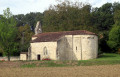
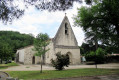
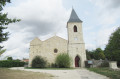
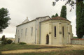
(6) As the road descends, between house numbers 210 and 184, turn left onto the descending gravel track, which continues as a footpath. At the bottom of the path, after house number 125, take the descending road to the right. On your left, you’ll see the Church of Sainte-Foy de Jérusalem.
(7) At the junction with the D310, turn left and follow the road carefully towards Bajamont. Cross the railway bridge and continue along the road until you reach the junction with the road to Castagné and Lestaque on the right, marked by a Stop sign.
(8) Turn right onto the road to Castagné and cross the bridge; follow the green signposts. Just after the bridge, take the road leading uphill to the right towards Lestaque. At the top of the hill, turn left into Allée de Lestaque. About fifty metres before the end of the road, where there is a barrier, continue uphill along the path to the left and then to the right.
(9) At the top of the path, at the three-way junction, leave the ascending path on your right (marked with an orange cross) and continue left along the stony path, marked with orange signs.
(10) At the junction of the paths, turn left, following the orange markings; there is an orange and Blue Cross on the right.
At the bottom of the descent, at the junction with a path coming from the left, continue to the right along the edge of a hedge, marked with green and orange signs. Pass a transformer and continue to a road at the foot of the lake’s embankment.
(11) When you reach the road, near the pumping station, turn left, then left again after about a hundred metres, following the green markings. Pass under the viaduct of the Agen–Périgueux railway line, cross the La Masse stream via the metal bridge, and continue to the right towards the village, following the green and yellow signposts. When you reach the road, leave the church and cemetery on your left and continue straight ahead, going round the church along the edge of the sports grounds to reach the car park (S/E).

 Visorando Member
 Moderate
 Difficult