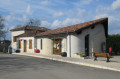
Panoramic view of Saint-Maurin, its abbey and the Séoune valleys

This route, which takes you through both hillside and flat terrain, will charm you with its panoramic views in thefirst half of the walk – including, amongst other things, the village of Saint-Maurin and its abbey – and then with its wooded setting during the refreshingsecond half.

Details

3279277
Creation:
Last update:
Last review:
  • Walking
    Activity: Walking
  • ↔
    Distance: 3.69 mi
  • ◔
    Average duration: 2h 00 
  • ▲
    Difficulty: Moderate

  • ⚐
    Back to start: Yes
  • ↗
    Ascent: + 390 ft
  • ↘
    Descent: - 390 ft

  • ▲
    Highest point: 640 ft
  • ▼
    Lowest point: 246 ft
  • ⚐ Country: France
  • ⚐ City: Perville (82400)
  • ⚑
    Start/End: N 44.179495° / E 0.879021°
  • ❏
    IGN map(s): Ref. 1940O
  • Hour-by-hour weather

Description of the walk

Start from Perville cemetery.

(S/E) Go round the cemetery on the left, taking the dead-end track. Continue along a signposted path (the markings alternate between red and green and yellow). Pass the hamlet of Tout-y-manque on your left. Follow the dirt track for about 1.5 km; it runs alongside farmland and continues downhill through a small wood, alternating between earth and limestone.

(1) At the edge of the woodland, turn right and continue downhill to the edge of the woodland (dirt track, red and green markings). Cross a small stream (dry in summer) to reach the farmland. Continue along the track that runs alongside the fields until you reach a junction.

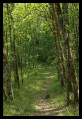
(2) Turn right, head up the slight incline towards the woodland, then turn left. Follow the path through the undergrowth for about 1 km until you reach a junction. Then veer left to leave the woodland.

(3) Leave the main path and head up towards the field on the right. You’ll reach another dirt track at the edge of the woods. Walk up through the woodland for about 700 m, below a tarmac road. An old wash house or drinking trough is located on this track.

(4) At the top of this track, turn right onto a dead-end road leading to Flottes.

(5) At the bend leading to this hamlet, turn left onto the path which climbs for about 400 m. You’ll come out onto a tarmac road; follow it as it continues towards Perville. At the entrance to the village, turn right and head towards the cemetery (at the top of the village) (S/E).

Waypoints

  1. S/E : mi 0 - alt. 636 ft - Start from the cemetery
  2. 1 : mi 1.24 - alt. 279 ft - Entrance to the woods
  3. 2 : mi 1.87 - alt. 249 ft - Crossroads. View over the valley of the - Séoune (rivière)
  4. 3 : mi 2.49 - alt. 289 ft - Start of the uphill path
  5. 4 : mi 2.9 - alt. 486 ft - Junction of footpath and road
  6. 5 : mi 3.25 - alt. 522 ft - The path starts on the left
  7. S/E : mi 3.69 - alt. 636 ft - Cemetery

Notes

At the bottom of the village, there is a car park; otherwise, there are one or two spaces available at the cemetery.

Worth a visit

At (2), at the junction on the left, stands the fortified mill of Ferrussac, which dates back to the early centuries AD. Indeed, the chapel on the estate (Notre Dame de Ferrussac) most likely stands on the foundations of a Gallo-Roman villa, as evidenced by the ‘ac’ ending of its name. The date of construction of the mill itself is unknown. It existed in the 12th century, and one can observe the evolution of its defence system, linked in particular to developments in weaponry: a 14th-century arrow slit, the conversion of arrow slits into firing positions for firearms… Its inner courtyard is still surrounded by a moat on three sides

Former washhouse or drinking trough, then rock / spring

Reviews and comments

4.3 / 5
Based on 3 reviews

Reliability of the description
4.3 / 5
Ease of following the route
4 / 5
Route interest
4.7 / 5
MaPomme
MaPomme

Overall rating : 5 / 5

Date of your route : Sep 01, 2023
Reliability of the description : ★★★★★ Very good
Ease of following the route : ★★★★★ Very good
Route interest : ★★★★★ Very good
Very busy route : No

Having been alerted by the comments, we kept a close watch at Bridge 3.
You need to go into the field (the Yellow Cross on the left indicates that you should not follow the path), and if you look at the edge of the field slightly higher up on the left-hand side, you’ll see the wooden sign for the ‘Route du Furet’ to continue the walk.
A very pleasant walk in the heart of the countryside, which gave us the chance to discover the soya and sorghum fields (crops that don’t grow in our region).

Machine-translated

Zefuredo
Zefuredo

Overall rating : 4 / 5

Date of your route : Aug 11, 2022
Reliability of the description : ★★★★☆ Good
Ease of following the route : ★★★☆☆ Average
Route interest : ★★★★★ Very good
Very busy route : No

We had a bit of trouble finding our way to point 3 (the field had been ploughed, so it was harder to spot that tiny path). But it was a very pleasant walk – thank you!

Machine-translated

MNORDIC
MNORDIC

Overall rating : 4 / 5

Date of your route : Nov 15, 2021
Reliability of the description : ★★★★☆ Good
Ease of following the route : ★★★★☆ Good
Route interest : ★★★★☆ Good
Very busy route : No

A very well-signposted route – yellow –
Easy and very pleasant, especially with the autumn colours
To extend the walk, at the junction (3) follow the Chemin de Cluny (green and pink) to explore the village of St Maurin, its market hall and the ruins of the abbey castle… well worth a detour to see it ‘in its original state’!
Complete the circular route and head back to rejoin the Chemin du Furet...

Most of the route follows footpaths, with lovely panoramic views and the sort of woodland we love: wild and unspoilt!...and not a soul in sight!
We 💛

Machine-translated

Other walks in the area

For more walks, use our search engine .

The GPS track and description are the property of this route's author. Please do not copy them without permission.