


Refine your search for walks in Flavignerot
Flavignerot walks


 The three shelters from Flavignerot
 Visorando Member
 7.42 mi
 +1,401 ft
 -1,401 ft
 4h 40
4h 40
 Moderate
 Departure from Flavignerot (Côte-d'Or)
Discover the Rentes de Chamerey, Écotois and Leuzeu farms starting from Flavignerot. A short and different variation on the Rentes route. A completely shaded route with smooth trails and relatively gentle slopes will allow for easy progress that is accessible to most people.
Through the woods and vineyards from Flavignerot to Marsannay-La-Côte
13.67 mi
+2,067 ft
-2,051 ft
8h 05
 Difficult
Departure from Flavignerot (Côte-d'Or)
Difficult
Departure from Flavignerot (Côte-d'Or)
A walk through wooded hills and vineyards, passing through four renowned wine-growing villages.
The Rentes route starting from Flavignerot
 14.14 mi
+1,824 ft
-1,847 ft
8h 05
Difficult
Departure from Flavignerot (Côte-d'Or)
14.14 mi
+1,824 ft
-1,847 ft
8h 05
Difficult
Departure from Flavignerot (Côte-d'Or)
This route starts from Flavignerot and links the various ‘rentes’ (isolated farmsteads) in the western Dijon region
It thus links Mont Afrique, the ‘Rente Neuve’, the ‘Rente de Chamerey’, the ‘Rente de la Reppe’, the village of Clémencey, the ‘Rente des Écotois’ and the ‘Rente du Leuzeu’.
It offers the chance to explore the beautiful, unspoilt landscapes of the western Dijon region, a vast limestone plateau dominated by Mont Afrique at an altitude of 600 metres, deeply carved by numerous wild valleys.
Tour du Mont Afrique via the rampart walk
 4.56 mi
+194 ft
-197 ft
2h 15
4.56 mi
+194 ft
-197 ft
2h 15
 Easy
Departure from Flavignerot (Côte-d'Or)
Easy
Departure from Flavignerot (Côte-d'Or)
The classic trail for a tour of Mont Afrique via the rampart walk. With little elevation gain, beautiful panoramic views and several military structures from the Séré-de-Rivières line, this is an ideal hike for training or getting back into the swing of things!
Trail around Mont Afrique via the Naizou spring
 4.02 mi
+377 ft
-381 ft
2h 10
Easy
Departure from Corcelles-les-Monts (Côte-d'Or)
4.02 mi
+377 ft
-381 ft
2h 10
Easy
Departure from Corcelles-les-Monts (Côte-d'Or)
Short hike to discover the Fontaine du Naizou and the village of Flavignerot.
Notre-Dame d'Étang via the Sainte-Anne Fountain
 5.30 mi
+653 ft
-650 ft
3h 00
Moderate
Departure from Velars-sur-Ouche (Côte-d'Or)
5.30 mi
+653 ft
-650 ft
3h 00
Moderate
Departure from Velars-sur-Ouche (Côte-d'Or)
A circular loop through the woods to (re)discover this famous monument in the Dijon region, which has undergone a beautifully executed restoration. And beautiful views of the Dijon region and the Ouche valley.
A very pleasant walk on a full moon night.
La Cude - Le Leuzeu - Mont Afrique
10.69 mi
+2,142 ft
-2,146 ft
6h 45
Difficult
Departure from Velars-sur-Ouche (Côte-d'Or)
This hike, which includes a steep climb (called the Montée du Ouf by hikers from Dijon), allows you to discover the historic Leuzeu farm, which is very well equipped for hikers, and Mont Afrique, one of the highest points in the Côte d'Or.
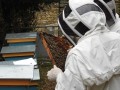
Combe à la Serpent Park - The apiary
 2.15 mi
+282 ft
-279 ft
1h 15
Easy
Departure from Corcelles-les-Monts (Côte-d'Or)
2.15 mi
+282 ft
-279 ft
1h 15
Easy
Departure from Corcelles-les-Monts (Côte-d'Or)
A very short walk in this valley, well known to the people of Dijon. The route is through open woodland on a wide path. There is a long descent, then a return trip with a short, steep climb at the apiary. Very good signposting. Several other routes are available in the area.
Above the valleys at Couchey
4.54 mi
+256 ft
-226 ft
2h 20
Easy
Departure from Couchey (Côte-d'Or)
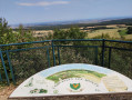
Starting from the Couchey orientation table, a route above the Vaulon, Pévenelle and Semetrot valleys. Particularly recommended in summer when it is hot. This route is in the middle of the forest with views over the entire Dijon plain and Mont Blanc, weather permitting.
Hauts Combes de Vaulon, Semetrot and Pévenelle from Couchey
4.28 mi
+312 ft
-305 ft
2h 15
Easy
Departure from Couchey (Côte-d'Or)
This walk, starting from the car park by the Couchey orientation table, takes you around the tops of the Vaulon, Semetrot and Pévenelle valleys. There are several viewpoints for walkers to enjoy, amidst forests, cliffs and limestone meadows dotted with flowers in spring.
From the bottom to the top of Mont Afrique
 12.41 mi
+4,042 ft
-4,029 ft
9h 15
Difficult
Departure from Velars-sur-Ouche (Côte-d'Or)
12.41 mi
+4,042 ft
-4,029 ft
9h 15
Difficult
Departure from Velars-sur-Ouche (Côte-d'Or)
A challenging hike with elevation gain, ideal for preparing for mountain races.
Via two passes from Clémencey
 6.86 mi
+961 ft
-938 ft
4h 00
Moderate
Departure from Clémencey (Côte-d'Or)
6.86 mi
+961 ft
-938 ft
4h 00
Moderate
Departure from Clémencey (Côte-d'Or)
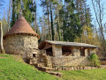
Set off from the village of Clémencey on a walk that winds its way along forest tracks and less well-trodden paths, taking in four iconic sites. The route first leads to the Leuzeu farm, a former monastic barn that became a key centre of the Burgundian Resistance in 1944, before climbing towards the Col de la Mialle (or ‘Maille’ according to the IGN), then on to the Col de la Toppe, traversing nearly two kilometres of woodland. The circular route ends at the Rente de Chamerey, one of those isolated farms typical of the Dijon region. A varied route, combining rural heritage, history and unspoilt nature, along trails that are sometimes technical but always offer a change of scenery.
On the path to Vergy and the Grosne spring from Gouville
 4.09 mi
+390 ft
-413 ft
2h 15
Easy
Departure from Corcelles-les-Monts (Côte-d'Or)
4.09 mi
+390 ft
-413 ft
2h 15
Easy
Departure from Corcelles-les-Monts (Côte-d'Or)
A circular route around Gouville Castle takes you along the Vergy path, where you can admire the Combe des Grands Vaux, before returning via a good footpath to the Crosne spring, which flows from a small cliff.
Route de la Combe à la Serpent
 4.46 mi
+446 ft
-449 ft
2h 25
Easy
Departure from Corcelles-les-Monts (Côte-d'Or)
4.46 mi
+446 ft
-449 ft
2h 25
Easy
Departure from Corcelles-les-Monts (Côte-d'Or)
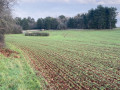
A short, easy route in Combe à la Serpent, taking in its main attractions: the Aviators' Memorial, the dry stone apiary, two springs and numerous cadoles. The little path along the Bressey hillside is particularly spectacular!
On the heights of Dijon via the Chenôve plateau
 6.88 mi
+866 ft
-869 ft
3h 55
Moderate
Departure from Corcelles-les-Monts (Côte-d'Or)
6.88 mi
+866 ft
-869 ft
3h 55
Moderate
Departure from Corcelles-les-Monts (Côte-d'Or)
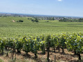
This circuit will take you on a route that will allow you to discover pretty valleys and charming woodland paths near Dijon.
From Velars-sur-Ouche to Flavignerot via the Jean Sage Trail
7.80 mi
+3,002 ft
-2,283 ft
6h 10
Moderate
Departure from Velars-sur-Ouche (Côte-d'Or)
A route with a significant elevation gain but few technical sections. Some steep climbs, steep descents and flat sections.
The route is perfectly signposted.
Velars-sur-Ouche plateau
10.96 mi
+2,224 ft
-2,218 ft
7h 00
Moderate
Departure from Velars-sur-Ouche (Côte-d'Or)
Walk on the Velars-sur-Ouche plateau, on the border with Plombières-lès-Dijon, through woods and farmland, with sections through four valleys.
The Fontenotte and Tuilerie springs are on the route.
The Batier Trail starting from Fixin
5.22 mi
+823 ft
-823 ft
3h 05
Moderate
Departure from Fixin (Côte-d'Or)
A short walk along the Félix Batier path, which can be summed up as follows: a mix of flat sections, ascents and descents, steep climbs and steep descents.
The descent into the Brochon valley and the ascent on the opposite side should be tackled with caution. A route not to be undertaken with children.
The Hundred Steps of Fixin and the Chamerey Spring
 10.84 mi
+1,486 ft
-1,509 ft
6h 15
Moderate
Departure from Fixin (Côte-d'Or)
10.84 mi
+1,486 ft
-1,509 ft
6h 15
Moderate
Departure from Fixin (Côte-d'Or)
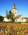
Depart from Fixin towards Chamerey then Ecotois, return via Chamerey then Fixey. A mainly forest route.
Fixin - Chamerey
 8.74 mi
+1,089 ft
-1,070 ft
5h 00
Moderate
Departure from Fixin (Côte-d'Or)
8.74 mi
+1,089 ft
-1,070 ft
5h 00
Moderate
Departure from Fixin (Côte-d'Or)
Some pleasant stopping points, including the Cents Marches de Fixin, the Chamerey Rent with views of Chamboeuf, and the Col de la Toppe.
The Parc Noisot Combe de Fixin – Napoleon’s Russian campaign
2.20 mi
+433 ft
-420 ft
1h 25
Moderate
Departure from Fixin (Côte-d'Or)
This a short pleasant walk, mostly in the shady forest with just a modest amount of climbing. There is a fascinating historic connection in that one of Napoleon’s grenadier guards, Noisot, created in his own name the Parc Noisot and the associated walks, waymarked with symbols of Napoleons’ Russian, Egyptian and Italian military campaigns.
This guide is for the longer but most fulfilling route – the Russian route. About halfway along is a staircase of 100 steps marking the number of days Napoleon took to regain power after release from first captivity.
The walk is also of geological interest, being part of the Combe de Fixin. The meaning of Combe is a narrow gorge, ravine or small valley often containing a mixture of limestone, cliff faces, and forestry, leading to a plateau, but with no significant water course, with similarity to the Combes in England such as Ilfracombe. The excellent Tourist Office in the nearby and famous Gevry Chambertin can tell you more.
Gevrey to Fixin ridge trail
 7.39 mi
+902 ft
-906 ft
4h 10
Moderate
Departure from Fixin (Côte-d'Or)
7.39 mi
+902 ft
-906 ft
4h 10
Moderate
Departure from Fixin (Côte-d'Or)
There are a number of interesting places to visit, including the 100 Fixin steps ('Cent Marches des Fixin') and the top of the Combe Lavaux ridges.
The heights of Combe de Fixey or Combe Laveau
 5.03 mi
+666 ft
-673 ft
2h 55
Easy
Departure from Fixin (Côte-d'Or)
5.03 mi
+666 ft
-673 ft
2h 55
Easy
Departure from Fixin (Côte-d'Or)
Pass through the Cent Marches de Fixin (100 steps), then head for the top of the Combe de Fixey on the south side, then on the north side to descend through the vineyards.
The stunning scenery of the Combe Durey
 6.60 mi
+879 ft
-853 ft
3h 50
Easy
Departure from Chambœuf (Côte-d'Or)
6.60 mi
+879 ft
-853 ft
3h 50
Easy
Departure from Chambœuf (Côte-d'Or)
You can explore the superb Combe Durey from within, as well as discover countless varieties of mushrooms.
2 x 100 steps
 3.60 mi
+682 ft
-669 ft
2h 15
Easy
Departure from Brochon (Côte-d'Or)
3.60 mi
+682 ft
-669 ft
2h 15
Easy
Departure from Brochon (Côte-d'Or)
This trail will take you to the 100 steps of Brochon and its valley and springs, and then the 100 steps of Fixin and its valley.
The Mediolanum archaeological site as seen from Fleurey-sur-Ouche
 10.75 mi
+515 ft
-489 ft
5h 25
Moderate
Departure from Fleurey-sur-Ouche (Côte-d'Or)
10.75 mi
+515 ft
-489 ft
5h 25
Moderate
Departure from Fleurey-sur-Ouche (Côte-d'Or)
A circular route starting from Fleurey-sur-Ouche which, running alongside the Burgundy Canal, takes us to Pont de Pany before heading up towards La Chassagne (golf course, castle, farm and private aerodrome) to reach the archaeological site of Mediolanum. Return via the outskirts of Mâlain and Ancey, before heading back down to Fleurey through the Combe Jardin and the Bois de Morcueil.
La Combe aux Mammouths
 10.77 mi
+1,545 ft
-1,522 ft
6h 20
Difficult
Departure from Fleurey-sur-Ouche (Côte-d'Or)
10.77 mi
+1,545 ft
-1,522 ft
6h 20
Difficult
Departure from Fleurey-sur-Ouche (Côte-d'Or)
Combe d'Arvaux, known as Combe aux Mammouths, with its Cave aux Loups.
Lantenay via the Cave aux Loups from Fleurey-sur-Ouche
11.51 mi
+978 ft
-974 ft
6h 10
Difficult
Departure from Fleurey-sur-Ouche (Côte-d'Or)
A circular route starting from Fleurey-sur-Ouche that leads to two plateaus via the Cave aux Loups, a ruined feudal castle belonging to the Dukes of Burgundy, the Chapelle Saint-Louis, the Château de Lantenay and the Viaduc de Fain, before returning via the suburbs of Velars-sur-Ouche and the banks of the Ouche.
The Cocheron Tower and the Orgère Rocks
6.09 mi
+614 ft
-604 ft
3h 20
Easy
Departure from Fleurey-sur-Ouche (Côte-d'Or)
This lovely walk, starting from the cemetery in Fleurey-sur-Ouche, will take you along the Roches d’Orgère path, through the grassy areas bordering the Combe de Beuchail and the Ouche Valley. Along the way, you can admire the mushroom-shaped Pierre qui Vire. You’ll also climb to the summit of Cocheron Hill and walk through the Combe du Sène, amongst woods and fields. Along the way, there are some lovely views over the Ouche Valley and the villages of Malain, Ancey, Lantenay and, of course, Fleurey-sur-Ouche. Halfway through the walk, along Rue de la Croix Saint-Pierre and Rue du Colombier, you’ll spot an old winegrower’s house, as well as a few other very distinctive houses that blend perfectly into their natural surroundings.
A short walk around the Cocheron from Fleury-sur-Ouche
3.26 mi
+1,283 ft
-1,273 ft
2h 35
Easy
Departure from Fleurey-sur-Ouche (Côte-d'Or)
This lovely walk, starting from the Fleurey-sur-Ouche cemetery, will take you to the summit of the Colline du Cocheron and into the Combe du Sène, through woods and fields, with some lovely views of the Ouche valley, the hamlets of Malain, Ancey, Lantenay, and of course Fleurey-sur-Ouche, seen from above.
At the start of the walk, along Rue de la Croix Saint-Pierre and Rue du Colombier, you’ll spot an old winegrower’s house, as well as a few very distinctive houses that blend perfectly into their natural surroundings.