Country:
 City:
City:


Park your car in the car park at Fleurey-sur-Ouche cemetery.
(S/E) Walk back towards the village until you reach the junction with Rue du Clos de la Cure, then turn left onto it. Head up towards La Vellotte, keep left at Saint-Jean-Baptiste Church and follow Rue Saint-Jean. Walk past the equestrian centre.
(1) Turn right towards the Combe de Beuchail, then turn right at a 90° angle about fifty metres further on to follow the path that runs alongside the valley. Continue to the mobile phone mast.
(2) After this, take the path on the left which leads back towards the bottom of the Combe de Beuchail.
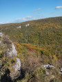
(3) Cross the valley and follow the plateau on the other side: as you climb up from the bottom of the valley, take a moment to admire the Pierre qui Vire. You’ll come to a track suitable for vehicles.
(4) Turn right onto it; further on, it curves and heads back towards the village: the Roches d’Orgère are on your right, just before the village, not far from the mast situated higher up, which you passed earlier. Continue alongside the River Ouche and the Burgundy Canal, following Rue des Roches d’Orgère and then Rue de Velars, which continues from there. Carry on to the junction with the departmental road, known here as Rue du Château.
(5) At this junction, turn right.
(S/E) Walk past the cemetery car park and take the D104L on the left, towards Ancey, for barely 100 metres, until you reach a pretty winegrower’s house at the junction with Rue du Colombier.
(6) Read the information board, then head up Rue du Colombier to the right: take in the sight of a few unusual houses, blending perfectly into their natural surroundings (the woodland). Continue up to the edge of the woodland on Cocheron Hill: there’s a lovely wayside cross here. Then turn left and carry on until you reach the track that climbs up from the Grapine neighbourhood towards the top of the hill.
(7) Take this track on the right and walk uphill, skirting round the hill.
(8) Look out for the path on the right which you’ll take on the way back, and head to the summit of Cocheron, where there’s a water reservoir: enjoy the view over Fleurey and Lantenay.
(9) Turn back to the start of the path you spotted on the way up.
(8) Turn left onto this path and walk straight down the slope until you reach a wide cross-country track that leads back up towards Lantenay.
(10) Follow this track to your right for just over 500 m until you reach the junction with a signposted path.
(11) Turn right at a 90° angle onto it. Walk down the Combe au Sène, come out onto the D104 (Rue du Château) and follow it straight on to return to the cemetery car park (S/E).
 Visorando Member
 Difficult

 Moderate