Country:
 City:
City:



Car park in front of the town hall or on Place Guy Geoffroy
Flavignerot – Rente Neuve (via Mont Afrique)
(S/E) From Place Guy Geoffroy, head north towards Mont Afrique and, after 100 metres, take the only road on the right, the Chemin de la Forée.
At the end of the tarmac road, at the edge of the woods, follow a lovely little path to the right which climbs up to the southern rampart walk of Mont Afrique. You’ll reach the Gallic wall.
(1) Continue to the right, heading south, along this rampart path for 500 metres.
At the south-eastern end of Mont Afrique, this path turns at a right angle: take the small track on the right which, after 20 metres, leads to a rocky outcrop.
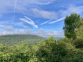
(2) Panoramic view. Continue along the rampart path north-eastwards for 700 metres. You’ll come across traces of the Gallic wall.
(3) When you see the tarmac road coming from Corcelles-les-Monts, 50 metres before this road, head down to the right along a hairpin bend – initially in good condition but then rutted – which emerges from the woods to join the Flavignerot–Corcelles road (D108g).
Follow this road to the left towards Corcelles, then, 400 metres further on, take the first hairpin bend to the right.
(4) At the bottom of the descent, at the first junction, turn right onto a path (unmarked) which, after a climb, emerges from the woods and takes you opposite the Rente Neuve and the Carmel de Flavignerot. You’ll come out onto a wide gravel track.
(5) You are now opposite the Rente Neuve. At the top of this hill (Mont de Siège) stands the Carmel de Flavignerot.
Take this track to the left (eastwards) for 200 metres, then take the first track on the right beneath the power line.
Rente Neuve – Rente de Chamerey
Continue for 1 km along this good gravel track, which runs below the Rente Neuve, crosses the fields and then a woodland.
(6) On emerging from the woodland, you’ll come out onto fallow land: turn right towards the west and follow the well-maintained white track for 1.6 km; this will descend to the bottom of a valley.
(7) At the end of this forest track, you’ll reach a clearing. Turn immediately left onto a track that climbs for 700 metres to the Rente de Chamerey.
Rente de Chamerey – Rente de la Reppe
(8) Turn your back on the Rente de Chamerey and follow a wide, east-facing path for 250 metres, running alongside the field.
Turn right at the end of the field towards Chambeuf.
200 metres further on, turn left onto a path marked in red. Follow these red markings carefully as far as the Ferme de la Reppe.
The path descends into a valley and leads to a junction.
(9) Follow the red-marked path straight ahead as it climbs.
As you come out of the woods, follow the only path to the right for 1 km through the fields, heading towards the farm visible a little further on.
Rente de la Reppe – Clemencey
Walk past the farm and continue for 500 metres along the road
(10) To the right of the road, look out for a line of trees and take a small path marked in yellow (labelled ‘Sentier du Chatelet’). This path leads through woodland (follow the yellow markings carefully) and then across fields to the village of Clemencey. At the T-junction, turn right towards the church.
Clemencay – Leuzeu Farm
(11) Just past the church, turn left onto Rue de l’Église, which becomes a good, level path through the fields. Beautiful views of Urcy, Roche d’Ance and Roche Pompon.
(12) When the path enters the woods, turn left onto the path marked with blue, white and White Crosses.
From here, follow the blue markings to the Col de Leuzeu. Head down to a junction where three white paths meet.
(13) At this junction, take the small path on the right marked in white, blue and White Crosses, which climbs into the woods (ignore the first wider, flatter path on the right). This marked path climbs straight up through the woods and then runs alongside a large field.
(14) At the end of the climb alongside the field, continue to the right along the path marked in blue; you will then leave the ‘White Cross’ trail
Note: the ‘White Cross’ path, which continues straight on, leads to La Roche Pompon, 500 metres away – a beautiful view awaits after a steep climb…
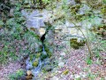
(15) 100 metres further on, to the left of the path, you can visit the lovely Sautouse spring (water not tested but very natural…). Opposite the field, you can see the Rente des Écotois (not open to visitors).
This blue-marked path runs on level ground along the upper edge of two large fields for 1.8 km, as far as Leuzeu Farm.
Leuzeu Farm – Flavignerot
(16) Walk through Leuzeu Farm, taking a look at the ruins.
Leave Leuzeu heading north, following the valley and the stream (left bank). Pass the gate at the entrance to the woodland, cross the source of the Leuzeu, and join the Blue trail, which you follow for about 100 metres.
(17): Turn right (east), staying on the Blue-marked path, which takes you to the Col de Leuzeu.
(18) Look out for the ‘Col de Leuzeu’ signpost on the left-hand side of the path. Opposite this signpost, take the path marked with White Crosses, which leads to the Col de la Mialle.
(19) Look out for the signpost and turn left onto a long descent, still marked with White Crosses.
(20) At the bottom of the descent, at the “Carrefour de l’Étoile”, cross the junction (leaving the White Cross markings behind), pass aGR®-marked path 20 metres to your left (this path leads directly to Flavignerot) and continue straight on at the bottom of the valley for 600 metres to reach the foot of Flavignerot Castle.
(21) Follow the path to the left for 300 metres.
(22) When you reach the lower part of the village, continue 10 metres to the left, then turn right onto a narrow path (marked in yellow) which takes you back to Flavignerot Town Hall (S/E).




 Visorando Member
 Moderate
 Easy
Easy