A short walk around the Cocheron from Fleury-sur-Ouche

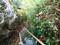
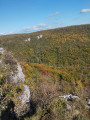
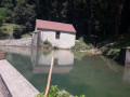
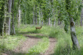
This lovely walk, starting from the Fleurey-sur-Ouche cemetery, will take you to the summit of the Colline du Cocheron and into the Combe du Sène, through woods and fields, with some lovely views of the Ouche valley, the hamlets of Malain, Ancey, Lantenay, and of course Fleurey-sur-Ouche, seen from above.

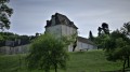
At the start of the walk, along Rue de la Croix Saint-Pierre and Rue du Colombier, you’ll spot an old winegrower’s house, as well as a few very distinctive houses that blend perfectly into their natural surroundings.

Details

n°108091130
Creation:
Last update:
Last review:
–
  • Walking
    Activity: Walking
  • ↔
    Distance: 3.26 mi
  • ◔
    Average duration: 2h 35 
  • ▲
    Difficulty: Easy

  • ⚐
    Back to start: Yes
  • ↗
    Ascent: + 1,283 ft
  • ↘
    Descent: - 1,273 ft

  • ▲
    Highest point: 1,578 ft
  • ▼
    Lowest point: 902 ft

Description of the walk

Park in the car park at the Fleurey-sur-Ouche cemetery.

(S/E) Turn left onto the D104L for just 100 m, towards Ancey, until you reach a pretty winegrower’s house at the junction with Rue du Colombier.

(1) At this junction, read the information sign, then head up Rue du Colombier to the right. Take in the sight of a few unusual houses, perfectly blended into their natural woodland surroundings. Walk up to the edge of the woodland on Cocheron Hill: there’s a pretty wayside cross here. Then keep to the left until you reach the track leading up from the Grapine neighbourhood towards the summit of Cocheron Hill.

(2) At the junction, take the track on the right, then follow the path uphill.

(3) At the junction, continue uphill to the top of the hill, where there is a water reservoir. Enjoy the view over Fleurey and Lantenay.

(4) From the reservoir, turn back to the start of a path that leads back down through the woods.

(3) Take this path on the left, which descends for about 200 metres until it joins a main track leading back up towards Lantenay.

(5) Follow this track to the right for just over 500 m until you reach the start of a signposted path which turns at a right angle to your right, heading towards Fleurey.

(6) Take this path on your right and follow it for about 2 km until you reach the Fleurey-sur-Ouche cemetery (S/E).

Waypoints

  1. S/E : mi 0 - alt. 906 ft - Car park at the Fleurey-sur-Ouche cemetery
  2. 1 : mi 0.08 - alt. 928 ft - Winegrower’s house, junction with Rue du Colombier
  3. 2 : mi 0.54 - alt. 1,020 ft - Junction with the Piste du Cocheron
  4. 3 : mi 1.24 - alt. 1,375 ft - Junction. Return to the summit
  5. 4 : mi 1.42 - alt. 1,578 ft - Water reservoir, summit of the Cocheron and viewpoint
  6. 5 : mi 1.81 - alt. 1,401 ft - Path on the right (towards Lantenay)
  7. 6 : mi 2.14 - alt. 1,191 ft - Start of the return path to Fleurey, on the right
  8. S/E : mi 3.26 - alt. 906 ft - Car park at the Fleurey-sur-Ouche cemetery

Worth a visit

(1) Winegrower’s house on the corner of Rue du Colombier.

(4) The summit of Cocheron and its viewpoint.

Other walks in the area

For more walks, use our search engine .

The GPS track and description are the property of this route's author. Please do not copy them without permission.