Via two passes from Clamencey

Set off from the village of Clémencey on a walk that winds its way along forest tracks and less well-trodden paths, taking in four iconic sites. The route first leads to the Leuzeu farm, a former monastic barn that became a key centre of the Burgundian Resistance in 1944, before climbing towards the Col de la Mialle (or ‘Maille’ according to the IGN), then on to the Col de la Toppe, traversing nearly two kilometres of woodland. The circular route ends at the Rente de Chamerey, one of those isolated farms typical of the Dijon region. A varied route, combining rural heritage, history and unspoilt nature, along trails that are sometimes technical but always offer a change of scenery.

Details

104093795
Creation:
Last update:
Last review:
  • Walking
    Activity: Walking
  • ↔
    Distance: 6.86 mi
  • ◔
    Average duration: 4h 00 
  • ▲
    Difficulty: Moderate

  • ⚐
    Back to start: Yes
  • ↗
    Ascent: + 961 ft
  • ↘
    Descent: - 938 ft

  • ▲
    Highest point: 1,867 ft
  • ▼
    Lowest point: 1,115 ft
  • ⚐ Country: France
  • ⚐ City: Clémencey (21220)
  • ⚑
    Start/End: N 47.247492° / E 4.882615°
  • ❏
    IGN map(s): Ref. 3023OT, 3123O
  • Hour-by-hour weather

Photos

Description of the walk

Starting point: the car park at Clémencey Town Hall, or the small village car park

(S/E) Take Rue de l’Église, located behind the church – a tarmac road that turns into a white gravel track. Follow it for 1.6 km to a crossroads (often marked by piles of wood).

(1) Take the path furthest to the left for about 1 km; the final few metres are a little more challenging. You’ll come to a dirt track

(2) Ignore the white track, but head uphill for about 800 m along the path situated almost directly opposite the one you have just come down, keeping to the right. You’ll reach a junction of small paths.

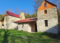
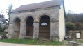
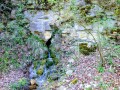
(3) Keep to the right, following a small stream (the Sautouze). After about 1.8 km, you’ll reach the Leuzeu farm (picnic table), restored by the Association des Amis du Val de Leuzeu.

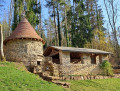
(4) From the farm, follow a path on the right for 400 m (stones, roots) towards the restored dovecote. You’ll come to a dirt track.

(5) Cut across this track to join another small path on the left. Walk barely 100 m and you’ll reach the Col de la Mialle.

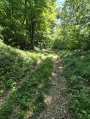
(6) Retrace your steps for 100 m and stay on this path, which widens slightly. Continue south through the woodland for about 1.6 km until you reach the Col de Troppe.

(7) From this pass, stay on the most clearly marked path for about 800 m until you reach a forest turning area. From here, either head down the main white track or continue straight ahead to descend via a path through a hollow to La Rente de Chamerey (please note: this is private property; rental may be available).

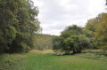
(8) Once past La Rente, ignore the wide white track leading down to Fixin and take the small path on the right, which runs alongside a field and then passes along the edge of the woods. After about 200 to 300 metres, there is a lovely view of the Ferme de la Reppe. Continue along this path for about 1.7 km until you reach an isolated house on the right.

(9) Continue along the road to reach the town hall (S/E).

Waypoints

  1. S/E : mi 0 - alt. 1,276 ft - Town hall car park
  2. 1 : mi 0.99 - alt. 1,362 ft - Crossroads
  3. 2 : mi 1.51 - alt. 1,115 ft - Fork in the road on the ascent
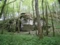
  4. 3 : mi 1.98 - alt. 1,519 ft - Beneath the Pompon rock
  5. 4 : mi 3.2 - alt. 1,414 ft - Leuzeu Farm
  6. 5 : mi 3.47 - alt. 1,657 ft - Dirt track. Return trip to the pass
  7. 6 : mi 3.54 - alt. 1,667 ft - Col de la Maille (507m)
  8. 7 : mi 4.52 - alt. 1,775 ft - Col de la Toppe
  9. 8 : mi 5.43 - alt. 1,654 ft - Rente de Chamerey
  10. 9 : mi 6.49 - alt. 1,575 ft - Junction
  11. S/E : mi 6.86 - alt. 1,280 ft - Return to car park

Notes

Avoid the hunting season; the best time for me is April and May (the Sautouze is usually still flowing).

Please note that the Col de Mialle is sometimes marked on maps as the Col de la Maille. They are indeed the same place.

Worth a visit

  1. La Ferme du Leuzeu (4)
  2. The Col de la Mialle (6)
  3. The Col de la Toppe (7)
  4. La Rente de Chamerey (8)
  5. Viewpoint after La Rente de Chamerey (8)

Other walks in the area

For more walks, use our search engine .

The GPS track and description are the property of this route's author. Please do not copy them without permission.