Country:
 City:
City:


Park near the pumping station in Velars-sur-Ouche, at the end of the old road to Dijon, continuing on from Allée de la Cude.
The start is signposted: Parcours Jean Sage. The route is marked with a vertical White Cross throughout.
(S) From the car park, walk up a few metres and take the path on the left which runs alongside the expressway. Follow it until the first junction, where you turn sharp right. This is followed by a series of ascents through woodland and over rocky terrain, then descents with varying degrees of curvature, almost back to the starting point, with a short, easy climb down towards the Roche du Crucifix.
(1) The path veers to the left; follow it slightly uphill until it turns to the right. It then descends over a variety of stones, along a winding path, before continuing straight on to the bottom of the Combe Maréchal.
(2) Turn left into the valley and head up the left-hand side, ignoring the path on the right. At the top, pass between two rocky outcrops and continue uphill to the top of this valley.
(3) At the junction of the paths, turn right and follow the path to a gravel track at a place called Montfeuillot, near the Ferme Équestre des Monts (not shown on IGN maps, even recent ones). Continue along this track to the right and follow it until you reach the signpost indicating you should turn left. You will arrive at the D 108 (Velars – Corcelles-les-Monts 21).
(4) Cross it and head straight ahead. Continue until you reach the descent into the Combe Bertrand. At the bottom of the valley, turn right as you go downhill, then keep to the right until you reach the signpost indicating a left turn. Then turn left onto a fairly steep dirt track, which you follow uphill until you rejoin a wide, carriageable track (marker).
(5) Turn left onto this path as it climbs and follow it to a junction. Carry on straight ahead and, on emerging from the forest, you’ll come out into an open area (field). Carry on straight ahead, uphill. Then head back into the woodland and follow the path until you come to a wide dirt track (yellow signposts).
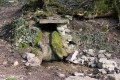
Turn right to reach the Fontaine du Naizou. Continue to the right until you reach the signpost.
(6) Head uphill to the left. It’s very steep. At the top, turn right onto a track that’s initially suitable for vehicles and then becomes tarmac. Follow it for a good kilometre. Pass a fenced-off building and carry on to a junction.
(7) Follow the signposting to the right as you descend into the Combe de Vic. The descent is steep at the start and very long. Descend, ignoring all the paths to the right and left, until you reach the bottom of the Combe Notre-Dame d’Étang.
Cross the path, then a dry gully, and climb up the slope opposite (well signposted).
(8) A lovely, steep climb. Cross the Route Forestière de la Roche à l’Oiseau by turning right then left.
This is the steepest climb on the route. At the top, go straight on, crossing a cleared section of woodland, until you reachthe GR® 7 (markedGR® 7 and the Jean Sage trail). Take theGR® 7 to the left and follow it for about 800 m until you reach a junction.
(9) Turn right (cross markings) and descend into the valley until you reach the bottom at elevation 429, then turn left onto the sunken track and follow it uphill until it widens. Keep to the left, ignoring the paths on the right. You’ll arrive at the Col de Leuzeu, which is unremarkable (elevation 511).
(10) Head left along a flat, earthen track for 400 metres until it meets a track suitable for vehicles. Do not take this track; instead, continue downhill to the Col de la Maille (signposted).
(11) Head down to the left along this wide track. Walk past the small Fontaine de la Mialle and continue straight on downhill to a level stretch. Take care. The Jean Sage path continues to the right, signposted “Col de la Toppe”. Do not take this path, but carry on straight ahead until you reach the sign indicating a left turn at elevation 381 (Flavignerot).
(12) Climb up the slightly steep path, which leads onto a field track; follow this to the village of Flavignerot (E).

 Visorando Member
 Difficult
 Easy
Easy