Country:
 City:
City:


From Corcelles-Les-Monts, head towards Flavignerot via the RD 108g. Drive up towards the village centre. Go straight on at the crossroads, then park 50 metres further on at Place Guy Geoffroy (decorative fountain). You can also park on the same street, 100 metres further on, still on the right.
(S/E) From the car park, walk down to the central crossroads in Flavignerot and turn right onto theGR®7. Walk past the Town Hall and head straight down into the valley. After passing under a high-voltage power line, the path narrows and winds its way through the woods. This will take you to a crossroads of tracks at the bottom of the valley.
(1) Turn right, then 30 metres further on, take the path branching off at a right angle to the left, signposted ‘Parcours Jean Sage’ (White Cross). Ignore a path on the left-hand side. When you reach the next junction, turn right and continue straight ahead uphill on the Jean Sage trail until you reach the Col de la Toppe and the junction with theGR®7variant, ignoring any side paths.
(2) Take this variant to the left, signposted “Rente de Chamerey”, ignoring any side paths. Once on level ground, you’ll see pits on both the right and left that were once used for making charcoal, and on the left, an abandoned, rusted cauldron. Shortly afterwards, head downhill whilst following the signpostedGR® route, passing through or over – on the left-hand side – a trench. Reach the Rente de Chamerey and go round it on the left.
(3) Once you reach the entrance to this clearing, continue along theGR® 7 alternative route (white path) towards Chambœuf until you reach the first junction. Go straight on along the Châtelet path. Continue on theGR® until you reach a distinctive crossroads with two forest tracks branching off to the left and a white track branching off to the right towards Chambœuf (elevation 527).
(4) Carry on straight ahead on the standardGR®7, towards Fixin. Follow theGR® continuously. It descends and passes through Les Rouvrais and the Bois de Lavoine. Continue straight ahead, maintaining the same direction, until you reach the hamlet of Moulin à Vent, where there is a signpost on the left (Fixin – 405m).
(5) Leave theGR® and turn right onto the track towards “Campagne de Russie”. Follow this path downwards until you rejoin theGR® 7. Turn right and carry straight on round the bend, ignoring theGR® which heads down to the left. Follow the path for a few dozen metres before turning off onto a path on the left which descends and leads to a washhouse with its karst spring (Chemin de l’Ermitage).
(6) At the wash house, head back up the path to the left until you reach the Noisot Park nature trail in Fixin (Combe des 100 Marches). You’ll arrive in a wooded park with a picnic area; continue towards the tarmac car park crossed by Rue de La Perrière. There’s a lovely view over the plain, the vineyards and the bell tower of Fixin church.
(7) Walk down Rue de La Perrière, keeping Clos Napoléon on your right. Continue until you reach the restaurant “Au Clos Napoléon”, which is situated on a street corner.
(8) Turn left onto Rue des Hervelets and follow this street, which continues to the right at the next junction; walk along this road through the vineyards. When you reach the first junction in Fixey, turn left and walk up Rue du Docteur Laguesse to the restored church on your right. Visit the church and walk around it.
(9) From the church, retrace your steps and head back down Rue Laguesse to the left until you reach a second junction. Turn left here, then keep to the right to follow Rue des Champs Perdrix. Walk through a housing estate and the vineyards until you reach a Fork in the road.
(10) Take the path on the right through the vineyards. Pass a ‘cadole’ (dry-stone shelter) by the side of the path on the left, and continue straight ahead at the next junction to take Rue Jean XXIII in Couchey. Continue to the junction with Rue Pasteur.
(11) Turn right. Ignore the dead-end turning off to the left, then, further on, Rue Rameau on the right. At this junction, keep left and continue down Rue Pasteur for about 70 metres.
(12) At the wooden sign for Marsannay-la-Côte, turn left onto the path between two houses. Carry on straight ahead to the last house in a housing estate, ignoring a path branching off to the left. Immediately afterwards, turn right onto a narrow lane running alongside a street and past houses on the right.
When you reach a junction, take the street on the left and walk past the cemetery. Continue straight on to reach Marsannay-La-Côte via Rue des Vignes. Walk past Marsannay Castle (wine cellar) and continue to the junction with Rue de l’Argilière.
(13) Continue straight ahead along Rue des Vignes after crossing Rue de l’Argilière. Pass the Notre-Dame stone cross (on the left). Ignore a path on the left that climbs up through the vineyards and continue along the main road until you reach the Carrefour Saint-Jacques (with a signpost).
(14) Turn left onto Chemin des Rosey, following the signs for “Sentier découverte de la Forêt”. Head straight ahead up this tarmac track through the vineyards. When you reach the old quarries, which are still visible, continue uphill towards the forest, ignoring the vineyard paths and a track branching off to the right at the edge of the woods. Enter the woods and, at the next junction of tracks, turn right, following the sign for “Vers carrefour du Bois des Francs”.
(15) After about 80 metres, turn right again onto a path. Follow this path all the way, as it curves slightly to the right and descends, with a low stone wall on your left to guide you. At the end of the stone wall, take the path that branches off to the left until you reach the edge of the woods. Follow it in this way, with a field visible on your right, until it joins a forest track. Turn left and walk up this track for about 400 m, then take the first path on the right (marked by two steps) which leads back down through the woods until you reach a picnic area and a car park.
(16) Turn left onto the André Marceaux Discovery Trail. Follow it straight ahead, ignoring any side paths, until you reach a three-way junction.
(17) Take the central path, then 30 metres further on, keep to the right, following the sign for “Dessus de la combe Semetrot”. Continue along the discovery trail, which climbs through the woods and follows the ridge for a while.
(18) Take the first path on the right, following the signpost for “Direction Dijon”. Descend steeply towards the Combe des Grands Vaux. Once at the bottom of the valley, turn left and walk back up the same path for some time. When you reach the end of the path, turn right and follow the track for about 50 m, until it joins a track suitable for vehicles (with a field opposite).
(19) Turn right, following the signpost for “Corcelles-Les-Monts”. Head up this wide track, which turns to a white-gravel surface, passing through the hamlet of Les Roulottes. Further on, ignore a track on the right; then, just before a fenced-off property, cut across to the left through a meadow to join the D108g. Turn left again to follow this road for about 270 m, until you reach a junction with a track leading uphill to the right.
(20) Take this track, heading towards Corcelles-Les-Monts. Walk up through the fields, skirting a larch copse (on your left), and at the top you’ll reach a track suitable for vehicles (circling Mont Afrique).
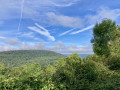
(21) Turn left and continue along this track, which passes an old ammunition bunker dating from 1870 (tagged). At certain points, there are panoramic views depending on the season.
(22) Just before the third sharp bend to the right, turn sharply left onto a track that descends to join the tarmac Forêt road (fields and meadows on the left). Pass the water reservoir for the village of Flavignerot. Follow this road to a crossroads and turn left downhill to reach the car park, the starting point of the walk (S/E).

 Visorando Member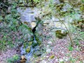

 Moderate
 Easy
Easy