


Refine your search for walks in Félines-Minervois
Félines-Minervois walks


 Ventajou
 Visorando Member
 13.56 mi
 +2,001 ft
 -1,998 ft
 8h 00
 Difficult
 Departure from Félines-Minervois (Hérault)
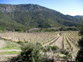
Starting from Félines-Minervois, this hike leads primarily to the ruins of Ventajou, which offer a magnificent view of the Corbières and the Pyrenees. But there are many other places of interest along the route: the pretty hamlet of Auberadou, the Planette dolmen, the stone apiaries and the old marble quarries of Planette, Castillou and Escaliers, a cistern carved into the rock, not to mention the Cubitus Cave, which is worth a short detour. Finally, a walk through a magnificent pine forest filled with wonderful scents will bring this journey to a harmonious conclusion.
From the Plateau de la Matte to medieval Ventajou
 5.86 mi
+942 ft
-942 ft
3h 30
 Easy
Departure from Félines-Minervois (Hérault)
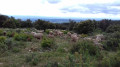
A magnificent hike in the hills above Féline-Minervois. Our footsteps echo on the marble that lies just below the surface of the heath. Sumptuous views of the Minervois. And medieval ruins to admire.
The Moulin de Biot and the marble quarries via Ventajou
 8.25 mi
+1,660 ft
-1,657 ft
5h 15
 Moderate
Departure from Félines-Minervois (Hérault)
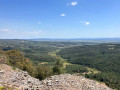
This hike, partly off the marked trails, allows you to see the hamlet of Biot, its quarry and its mill. As you pass the marble quarries (you will cross four during the hike), you will understand the titanic work carried out by our ancestors during the last century. The hike ends with a long, safe cliff-top path offering spectacular views of the Minervois plain and, beyond, the Corbières massif. In good weather, you can see the Pyrenees in the distance.
Towards the Ruisseau du Cros and Font dal Rainard
 8.42 mi
+1,703 ft
-1,667 ft
5h 20
Moderate
Departure from Félines-Minervois (Hérault)
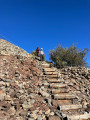
This hike offers a variety of landscapes and trails in the Félines-Minervois marble quarry area. The passage along trails that we have recently opened up allows you to discover places that are little known or unknown.
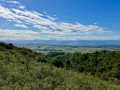
Circular walk starting from L’Abeuradou
 9.42 mi
+2,231 ft
-2,218 ft
6h 15
Difficult
Departure from Félines-Minervois (Hérault)
A lovely walk in this area, well known for its two PR® trails in Caunes-Minervois and Félines-Minervois: the Marble Quarries Route. To create this circular route, off the beaten track, we spent several days ‘working’ to find the best route, clearing certain sections overgrown with vegetation and marking the paths we created with Yellow Circles. In the marble quarries, you can really appreciate the titanic effort put in by the workers at the start of the 20th century. Information boards explain how the various quarries we come across used to operate.
The marble circuit in Caunes-Minervois
 7.68 mi
+1,686 ft
-1,696 ft
5h 00
Moderate
Departure from Caunes-Minervois (Aude)
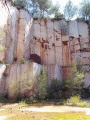
From Notre-Dame du Cros (Caunes-Minervois), a route takes you to former marble quarries, with a picnic stop at the renovated Ventajou refuge, near the ruins of the castle of the old village that has disappeared. On the way back, you pass by the Moulin de Biot, a former witness to a technique of using wind energy for sawing marble.
Warning from the author of the route in the "practical information" tab (2/11/2021)
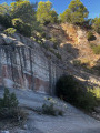
The red marble quarry known as the Carrière du Roy
 2.88 mi
+512 ft
-512 ft
1h 45
Moderate
Departure from Caunes-Minervois (Aude)
If you enjoy walking among junipers, gorse and rockroses on a very stony but not particularly difficult path, you will love this short hike, which will take you to the quarry where the red marble columns of the Palace of Versailles were quarried.
From Caunes to Citou (circular)
 12.51 mi
+2,812 ft
-2,799 ft
8h 10
Difficult
Departure from Caunes-Minervois (Aude)
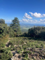
The first half of this walk takes place in the Argent Double valley, the second half in the Cros valley, following parallel paths on a roughly south-north axis, allowing you to discover different tree species and the geological diversity of this very dry limestone massif.
Around the Cesse
 9.57 mi
+1,545 ft
-1,549 ft
5h 45
Moderate
Departure from La Livinière (Hérault)
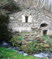
This small river, which flows into the Aude after 50 km, is the focus of this circular route starting from Cantignergues, a hamlet in La Livinière, in the commune of Hérault, to its source near the village of Ferrals-les-Montagne, a village in the Haut-Languedoc Regional Nature Park. A picnic area (with tables and barbecue) has been set up near the stone "gatehouse" where the waters of the Cesse emerge, disappearing during periods of drought at the foot of the Cathar citadel of Minerve.
Saladou – Les Pierres Blanches
 12.82 mi
+2,372 ft
-2,352 ft
8h 00
Difficult
Departure from Cassagnoles (Hérault) (Hérault)
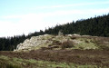
Starting from Cassagnoles, this walk in the Haut Languedoc Regional Nature Park leads to the Saladou and Pierres Blanches viewpoints, both offering exceptional views of the Minervois, the Corbières, the Montagne Noire and the Pyrenees. The alternation between long stretches through magnificent woodland, a mix of deciduous and coniferous trees, and ridge walks is what gives this challenging route – which includes several very steep sections – its charm.
Roc de Moussu - Soulanes de Nore
 11.23 mi
+2,349 ft
-2,326 ft
7h 15
Difficult
Departure from Citou (Aude)
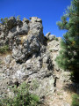
Starting from the village of Citou, this hike first leads to the Roc de Moussu which, despite its modest height (539 m), offers a viewpoint that is highly renowned in the region. The circular hike continues through the vast Soulanes de Nore State Forest, planted with deciduous and coniferous trees. The alternation of wide forest tracks and occasionally secluded paths makes the route varied and attractive, with two sections that are rarely or never used, requiring a good sense of direction and adding a touch of excitement. A route suitable for all seasons, even in summer, as it is mostly shaded. The autumn colours here are splendid.
Ferrut and the Roc du Moussu
 10.32 mi
+2,520 ft
-2,543 ft
6h 55
Moderate
Departure from Citou (Aude)
In the Montagne Noire, between Citou and Caunes-Minervois, this circular route follows trails that are less well-known than the traditional PR® routes. They are of great interest from both a sporting and environmental perspective. At the summit of the Roc du Moussu, the 360° panorama offers a remarkable view of the Minervois plain and the Pyrenees mountain range. On the section of trail between (4) and (6), it is recommended that you follow the GPX track closely.
Citou circular loop
 6.42 mi
+2,300 ft
-2,310 ft
4h 55
Moderate
Departure from Citou (Aude)
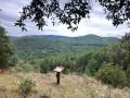
A beautiful circular route starting from the village of Citou. Almost the entire hike takes place in the woods, so it is feasible in hot weather. A passage along the ridge at the highest points of the route offers beautiful views of the surrounding area, particularly the village of Lespinassière.
Summit of La Bourrasse
 9.57 mi
+3,091 ft
-3,081 ft
7h 05
Difficult
Departure from Citou (Aude)
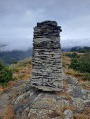
Starting from Citou, this circular route takes you on a route that winds along the western slopes of the massif, including the ascent to the summit of La Bourasse. Sections along the ridge offer interesting views over the Montagne Noire as far as the Minervois plain.
Mont Cayroux
 9.75 mi
+2,034 ft
-2,028 ft
6h 15
Moderate
Departure from Ferrals-les-Montagnes (Hérault)
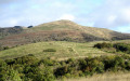
This hike in the Haut Languedoc Regional Nature Park allows you to discover small peaks and pastures around the village of Ferrals-les-Montagnes. After passing Mont Cayroux, which offers a magnificent 360° panorama despite its modest size (788 m), the route continues through woods, beautiful meadows and gentle hills offering new views. The Col de Serières memorial provides a historical complement, commemorating a tragic event that occurred in June 1944, while several decorated fire tanks along the way add an unusual artistic touch to the whole.
Pech Mégé – Roquedaut
 14.68 mi
+2,612 ft
-2,638 ft
9h 00
Difficult
Departure from Ferrals-les-Montagnes (Hérault)
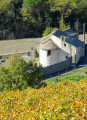
This walk, starting from Ferrals-les-Montagnes, leads to two small, easily accessible peaks, Pech Mégé and Roquedaut, situated on the southern foothills of the Montagne Noire and each offering a superb 360° panorama. It also offers the chance to walk through majestic forests, featuring a mix of different tree species, whilst enjoying a few ridge sections that provide sweeping views over the Carcassonne plain, the Minervois, the Corbières and the Pyrenees. Pleasant in any season – even in summer, as it is mostly in the shade – this route reveals its full beauty in autumn, when the leaves change colour.
The Bois des Gardes in Ferrals-les-Montagnes
 Tourist office6.79 mi
+984 ft
-984 ft
4h 00
Moderate
Departure from Ferrals-les-Montagnes (Hérault)
Here, sheltered by deciduous and coniferous forests, you can take your time to enjoy the hike in the cool shade.Here you’ll find the Cesse, the Minervois’ iconic river, which has its source here (to be explored off the trail).
The high meadows of Ferrals-les-Montagnes
 8.41 mi
+1,683 ft
-1,713 ft
5h 20
Moderate
Departure from Ferrals-les-Montagnes (Hérault)
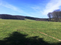
This hike starts from Ferrals-les-Montagnes and follows twoPR® trails among those that criss-cross the Haut-Languedoc Regional Nature Park, where the south of France becomes mountainous and the rivers flow either towards the Mediterranean or the ocean, thus determining the "watershed line". The source of the Cesse, at the end of this circular route, is a testament to this unspoilt area.
Around Mas de Lignières in Casseras
 6.31 mi
+965 ft
-938 ft
3h 45
Moderate
Departure from Cesseras (Hérault)
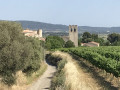
This beautiful walk allows naturist campers and hikers to explore the area around the Mas de Lignières campsite. The walk is done fully clothed and takes you through the vineyards and pine forest north of Cesseras. For non-naturists, there is a car park, marked on the map but not on the road, at thefirst crossing point, which can be used as a starting and finishing point.
The Capitelles de Laure-Minervois trail
 5.53 mi
+495 ft
-495 ft
3h 00
Moderate
Departure from Laure-Minervois (Aude)
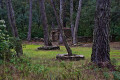
In the Laure-Minervois area, drystone shelters known as capitelles bear witness to the history and work of the rural world. This route, marked in yellow, will take you to around thirty capitelles that have been restored by the villagers.
Panoramic view between heath and pine forest in Saint-Frichoux
 4.54 mi
+180 ft
-177 ft
2h 15
Easy
Departure from Saint-Frichoux (Aude)
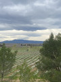
A lovely 8.5 km walk through heath and pine forest, or along one of the canals of the former, now-dry Marseillette pond.
Roc de Peyremaux – Le Cun de San Marti
 13.45 mi
+2,900 ft
-2,917 ft
8h 45
Difficult
Departure from Lespinassière (Aude)
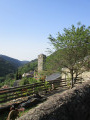
This challenging walk leads, initially, to the Roc de Peyremaux, renowned for its magnificent 360° panorama. The route continues through beautiful, varied woodland, featuring a mix of tree species dominated by beech, oak and conifers. Crossing the Realpo and Gelprigoun streams will provide a bit of extra coolness – most welcome in the warmer months – before you emerge into open country to reach the Cun de San Marti. Finally, you’ll need to navigate the final descent with caution, as it is particularly steep and even downright precipitous in places. The lack of signposting makes this section relatively difficult in terms of finding your way, before you return to Lespinassière and its welcome bar.
The soulanes of Nore
 8.99 mi
+1,526 ft
-1,516 ft
5h 30
Moderate
Departure from Cassagnoles (Hérault) (Hérault)
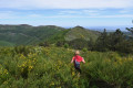
If you enjoy wide open spaces and magnificent cairns, you will be well served.
Stroll around the spillway at La Redorte
2.30 mi
+43 ft
-43 ft
1h 05
Easy
Departure from La Redorte (Aude)
This very short walk for the whole family takes in a boat harbour, a spillway, a canal bridge, a boatman's stop, an aqueduct, a beautiful dairy farm and a small lake where you can fish for trout. A wealth of discoveries!
Puichéric, along the Canal du Midi
 3.74 mi
+30 ft
-26 ft
1h 45
Easy
Departure from Puichéric (Aude)
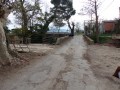
A walk on flat ground (less than 10 metres elevation gain), always in full sun. The ground is very clayey and should be avoided after heavy rain. Let’s not forget that the entire Marseillette and Puichéric basin used to be a lake that was drained for agricultural purposes. There’s water everywhere, and numerous canals and ditches criss-cross the area.
The sources of the Clamoux
 8.33 mi
+1,781 ft
-1,775 ft
5h 25
Moderate
Departure from Castans (Aude)
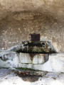
The Clamoux, a small river and tributary of the Orbiel, rises on the slopes of Pic de Nore, the iconic peak of the Montagne Noire, where a Tour de France relay station stands. Following forest tracks, with climbs of varying difficulty, you arrive near the source of the Clamoux, a small stream at the start, which you follow on the right bank, off the marked trail, descending into the Soulanes de Nore National Forest to Laviale, which, along with six other hamlets, makes up the village of Castans.
More walks in Félines-Minervois
Select a point of interest below: