Country:

 City:


On arrival at Cassagnoles, park in the small, shaded central square, which can accommodate three to four cars.
Blue signposting
(S/E) Leave the car park and turn immediately right uphill onto Rue de la Calade. When you reach the hamlet of La Caune, continue to the right, following the sign for “Route de Roquedaut” on a signpost, until you come to a crossroads.
(1) Go straight on, passing an old stone building on your left, on whose walls is a large plaque reading “Avenue des Boulistes”. After the last house, the tarmac road turns into a wide stony track. Stay on this main track as it climbs steeply, pass a telecoms mast and enter the Minervois State Forest (signposted) to reach a junction at a hairpin bend.
(2) Keep to the left to continue climbing. After a series of hairpin bends, you’ll reach a multi-way junction.
(3) Ignore the turn-offs to the left and carry on straight ahead on a virtually flat, straight stretch of road leading to a small tarmac road (D182).
No signposting
(4) Ignore the blue signposting on the left and turn right. Pass the houses at Mancès and follow the road to the junction (elevation 688). Turn left, staying on the D182, and begin a new climb.
(5) About thirty metres after passing a path coming from the left, head right onto a wide grassy path that leads into the woodland. Cross a stone-paved path and carry on.
(6) Keep heading in the same direction, passing another track on the left. Cross a second boulder field and continue along the track, which winds its way uphill through a magnificent woodland of mixed coniferous and deciduous trees before passing through a reforested area. After a wide bend to the left, continue along the flat ridge and rejoin the D182, roughly level with the track leading to Couchon le Haut (signpost).
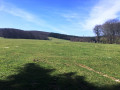
(7) Go straight on, passing a few meadows on your right.
Yellow PR® markings
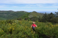
(8) Turn left 180° onto a stony track which climbs gently but steadily, making a wide circular loop to the left. Further on, the gradient reverses and a slight descent leads to a crossroads in open country. Head left across heathland covered in heather, following the narrow track that leads to the viewpoint.
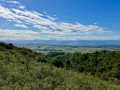
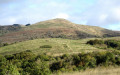
(9) Exceptional 250° view over the Minervois, the Carcassonne plain, the Corbières and the Pyrenees. Retrace your steps to the crossroads and take the path opposite, which climbs steeply straight up the slope: this very challenging section should be tackled gently. Head for the ridge and then the junction marked by a signpost bearing the words ‘Fontaine des Trois Évêques’.
No signposting
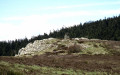
(10) Carry on straight ahead, leaving the yellow markings behind. The track, half grass and half scree, runs directly beneath the Pierres Blanches. Make a short detour to the right to reach this modest summit and enjoy the panoramic views.
(11) Return to the track and rejoin the route to begin a long stretch of ascents and descents offering magnificent views of the Pyrenees and the Corbières to the south, and the Pic de Nore and its easily recognisable radio relay station to the north. Pass a rocky outcrop on your left (elevation 886) and reach a small, unnamed pass at a place called La Ramière.
(12) Turn left to traverse diagonally across the southern slope. Depending on the season, you may have to cross a section that can be quite muddy, as the path acts as a channel for an intermittent stream. Reach the junction with a cross-path.
Blue markings
(13) Continue to the right. Pass the two entrances to an old mine, which are blocked by a gate, then turn left at a 90° angle. Facing a small copse of pine trees, keep to the right and continue for about a hundred metres until you reach a wide, motorable track opposite the “DFCI AVM2” sign.
(14) Turn left and follow this pleasant track, which winds through woodland before joining the D182 further on (signpost opposite on the right).
(15) Follow the road to the right, negotiate the tight right-hand bend and continue for about a hundred metres.
(16) Leave the road and take a grassy track with two ruts which skirts Pech Mégé to the south.
(17) Cross the ford over the Ruisseau de l’Aygue Blanche, pass between the first houses in the village and rejoin Rue de la Calade, which you took at the start. Turn right and walk gently downhill to the central square (S/E).

 Visorando Member
 Moderate

 Tourist office