Country:

 City:
City:


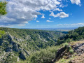
Coming from Caunes-Minervois, park at the side of the road at the entrance to Citou, near the bar-restaurant-village hall. It is a quiet road, but parking spaces are quite scarce in this village, which is crossed by the D620, the main road.
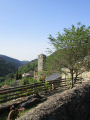
(S/E) Walk up the gently sloping road towards Lespinassières. As you go, you’ll notice several fountains, evidence that water is still abundant in this mountain range, which acts as a reservoir for this part of the Aude department. After the building housing three fountains, at the end of the high wall running alongside this section of road, take the street on the right which climbs for a few metres and turn left immediately onto the concrete lane leading up to Citou Castle: marked with a yellow sign topped with a green ‘M’. Just before a house with a swimming pool on its terrace, turn off onto the path on the right. The steady climb overlooks the village of Citou and enters a woodland. A short, steep stretch leads onto a wide stony track. Turn right and continue for about 70 metres to reach a crossroads of tracks.
(1) Turn left at a shelter built by hunters and head for the Col des Bious.
(2) Head into the woodland, turning right at a 90° angle. The path soon widens as it follows the Ruisseau des Escaliers (which is often dry), then veers away from it to climb steadily before a slightly steep descent leading to another stony track.
(3) Follow this track to the right for about 1.5 km, continuing downhill, until you reach the junction with a path branching off to the left just as the track begins to climb: Ferrut signpost.
(4) Take this path to the left. The descent is quite steep and ends at the Ruisseau de Linze (dry), a tributary of the Ruisseau du Cros, into which it flows a few metres further on. Follow the path as it winds its way uphill, passing the Ferrut ruins (notable holm oak) and continuing for about fifty metres.
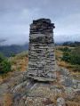
(5) Take the path on the right (which has been reopened; there is a cairn). Marked with Yellow Circles, this path – which we have rediscovered, cleared and signposted – allows you to walk alongside the Ruisseau du Cros, cross it and climb up the opposite slope, mostly through woodland. Once you reach the plateau, continue to follow these markings, which lead along paths that allow you to bypass the yellow-marked PR® track to the Caunes-Minervois marble quarries. Join a stony track.
(6) Turn right onto it for 200 m, then turn right again to take the path heading west-south-west. Further on, this path veers left towards the south-east and joins a track which you should follow to the right for a few dozen metres.
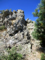
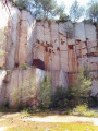
(7) Turn right through 180° to take an almost level path that enters the woods. After about fifty metres, turn left towards the south-west. The descent to the bottom of the Ruisseau du Cros valley follows a series of hairpin bends. All the cliffs above are equipped for climbing, and numerous routes are used by rock-climbing enthusiasts throughout the year.
(8) Above the stream, at the final hairpin bend on the right, ignore the path on the left leading to Notre-Dame du Cros. Further down, cross the stream via the concrete walkway, then climb up the other side along a fairly steep slope.
(9) At the final bend to the right, steps made from logs lead to the Carrière du Roy. Ignore these and continue along this path. At the next junction, ignore the path branching off to the left; continue climbing, admiring the valley floor carved out by the Ruisseau du Cros itself, until you reach a wide stony track.
(10) Turn left and, at the next left-hand bend, take the wide path on the right leading to Ausselous. This is private land where the owner allows walkers to pass through: there is a sign stating this. Continue climbing, heading roughly north, ignoring the next two paths on the left.
(11) Turn right at this junction and head towards the crossroads with a track.
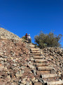
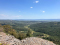
(12) Head up to the left towards the Roc de Moussu. The track narrows to a path and reaches the foot of the summit. Turn left to reach the Roc de Moussu: a beautiful view earned by a short, easy climb.
(13) Retrace your steps and rejoin the route to the left. A few dozen metres further on, turn right, then continue in the same direction, leaving the four trailheads on your left. You’ll come to a wide stony track.
(14) Turn left for about sixty metres, then head for the path marked by a cairn (often lying flat) which branches off to the left. A long, steady descent overlooking the Argent Double valley leads to the D620 county road.
(15) Turn right and follow this road with care – eventhough there is little traffic – for about 1.5 km to return to the car park (S/E).

 Visorando Member

 Difficult