Country:

 City:
City:


Park at the side of the D620 county road, alongside the stone wall.
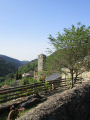
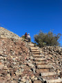
(S/E) Continue along the departmental road for about 50 m and take the narrow road leading uphill to the right in the opposite direction. About 20 m further on, follow the sloping concrete road to the left, then turn right onto the path leading up to the ruined castle: marked with a yellow sign topped by a green ‘M’.
(1) Take the path that climbs to the right after the castle. Ignore the one that goes straight on, which leads to the same place but is rather poorly marked, so it is not recommended. The path climbs steadily to reach a plateau and comes out near a stone building on the left.
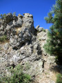
(2) A few metres before reaching the track, head into the woods on the left, make your way towards the house, go round the picnic table on the right to reach a rocky outcrop. Immediately turn right at a 90° angle, then follow a dry-stone wall. After a few metres, cross the low wall to join the cairn-marked path for a few metres; this descends to the left until it meets a now well-marked path that leads down through the woods. You’ll eventually reach a flatter section running alongside the Ruisseau de Réquinaut, which you’ll soon cross via a footbridge and which leads out onto a clearing. Let the track continue to the left, crossing a bridge painted yellow and returning to the D620.
(3) Aftercrossing the wooden footbridge, follow the track to the right and, when you see the gate to a private property, take the path for about ten metres. Look out for green markers on a tree to the left, then take a faint path that climbs alongside a dry-stone wall; turn left and continue along the wall. At the first gap in the wall, go through it and turn immediately left (green markers). On the next small clearing, the path turns right at a 90° angle and descends towards a field and a stream. Follow the stream along the left bank to cross a walnut grove:as you pass through, you’ll see a pretty waterfall topped by a huge weeping willow. In the middle of the walnut trees, head towards a stone building, climb a small hill, pass by the foot of a house and follow the fence to the right. At the end of the fence, continue along the terraced path above the stream, pass a small causeway spanning the stream, and carry on along the path through a pine plantation. The climb that follows, on the right, is quite challenging until you reach the ridge 250 m higher up. You’ll come to a path junction just before the edge of the woodland.
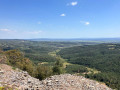
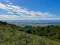
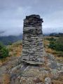
(4) Ignore the path on the left leading to the village of Lespinassière, which you may have spotted below during the climb. The path continues to climb along the ridge through a very beautiful stretch flanked by impressively large cairns. Look out for an aerial on the left; reach a grassy track and turn right to arrive at a hairpin bend on a stony track. Turn right and continue to a track junction. Turn left; after a few metres, take a hairpin bend to the left, then continue along the main track for a few kilometres until you reach a junction.This largely level stretch offers sweeping views of the surrounding mountain ranges.
(5) Leave the stony track and take the grassy track that climbs to the right. At the next track junction, turn right at a 90° angle and continue the climb to the summit of the mountain you can see, La Bourrasse,the highest point of the walk.
(6) The path descends to join a bend in a stony track.
(7) Carry on straight towards the summit opposite and descend through a section that has recently been cleared to create a firebreak. The path is no longer very visible due to the brush cutters, but simply follow the edge of the woodland to reach a stony track; follow this to the right for a few dozen metres to reach a junction.
(8) Turn due south onto a path that climbs to the left. A lovely climb through the woods leads to a “viewpoint” before descending to a track. Carry on straight ahead at the junction along a grassy track and turn right until you reach a stony track, where you turn right again to reach the Col des Bious.
(9) Continue to the right, heading north-west, along the track which further on turns left at a 90° angle. You’ll reach another T-junction (hunters’ shelter) and take the track on the right for about a hundred metres, keeping to the left-hand side to spot the path that branches off to the left and heads into the woods.
(10) Turn left here to follow this path, which overlooks Citou and leads back to the village. Return to the tarmac lane where you started and turn left. Then first turn right then left to return to the county road and reach the car park (S/E).


 Visorando Member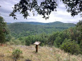
 Moderate