Country:

 City:


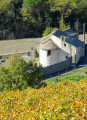
Once in Ferrals-les-Montagnes, park in the car park alongside the D12: this car park is located at the entrance to the village or at the exit, depending on which direction you’re coming from. There is an information board detailing the two main walks in the area.
PR® yellow and blue signposting
(S/E) Head towards the village, passing the inn and then the town hall and school.
(1) At a beautiful, solitary tree bearing the dual signposting, leave the road and turn left onto a concrete lane (Rue du Lavoir). You’ll come out onto a tarmac road; continue straight ahead to cross the bridge. Immediately afterwards, turn right onto a stony path that climbs gently and eventually rejoins the road you left earlier. Follow it to the right until you reach the junction marked by the road sign ‘Camp de Périès’.
Blue signposting
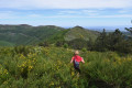
(2) Continue along the road to the right, negotiate a hairpin bend, then leave the road and take a wide stony track ascending to the right. This track follows a broad , gentle ridge across open terrain , offering stunning views of the Ariège Pyrenees, the Corbières and the Canigou in the distance.
(3) Keep to the left, staying on the same track, take a hairpin bend to the left, then descend gently to a junction where there is a signpost. Turn left to come immediately onto a forest track, and head right until you reach the three-way junction by the fire hydrant.
(4) Take the left-hand path, following the blue markings, and you’ll reach a four-way junction.
No markings
(5) Continue straight on, ignoring the blue markings: the IGN map is out of date at this point. A steep descent leads to a junction with a cross-country track.
(6) Turn right, negotiating several hairpin bends before reaching the junction north of the hamlet of Cantignergues.
(7) Carry on straight ahead to go round it and reach the three-way junction near a cistern not shown on the IGN map (elevation 368). Turn right and continue on level ground above the pretty, winding valley through which the Cesse flows. Pass a wide path on the right, carry on straight ahead and walk past a small, isolated dwelling. After a hairpin bend to the right, the wide track gives way to a narrow path running along the banks of the Cesse before emerging at a junction opposite a ‘Private Property’ sign.
(8) Turn left, cross the Cesse and join the D12. First turn right then left to turn onto a stony track opposite, leading to the small road to Cassagnoles.
Blue signposts
(9) Turn right, keep left at the road junction and reach the village. Go round the small square by the town hall, which serves as a car park, go up Rue de la Calade and leave the village.
No markings
(10) Leave the road and take the path on the left at a fire hydrant. Pass a metal cross, cross the culvert over the Ruisseau de l’Aygue Blanche and reach a junction marked by a tiny cairn. Turn right and begin the main challenge of the walk: a long, steep and sustained climb lasting over a kilometre.
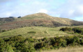
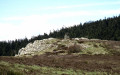
(11) Turn right and continue along the path, which levels out as it reaches Pech Mégé. Once at the top, turn right through the heather and over small outcrops of rock to reach the summit. Although not clearly marked, the summit offers a magnificent 360° view that is well worth a short stop.
(12) Next, retrace your steps and carry on straight ahead. Join a cross-country path and follow it to the right, eventually emerging onto the D182 after crossing a short, steep rocky section. Turn right and follow this small road to the next junction. Then take the hairpin bend to the left and head towards Masnaguine.
(13) Once in the centre of the hamlet, turn right, staying on the same road, and continue to a small pass which also marks a crossroads.
(14) Take the narrow, overgrown path starting on the right at the small sign marked ‘Point de vue 450 m’. You’ll quickly reach the summit of Roquedaut. Enjoy the exceptional 360° panorama, taking in the Montagne Noire, the Corbières, the Ariège Pyrenees, the Couserans Massif, and more.
(15) Return to the start of the path.
(14) Take the road on the right and continue to the hairpin bend before the hamlet of Mancès.
Blue markings, very sparse and pointing in the wrong direction.
Turn right onto the forest track. Further on, let the path leading to the mast (Blue Cross) branch off to the right and carry on for about twenty metres.
(16) Keep left at the three-way junction and carry on to the next junction.
(17) Navigate the hairpin bend to the left and continue down the gentle slope. This descent is a long one down to the D12, giving you plenty of time to admire the beautiful forest you’re passing through, with its harmonious mix of deciduous and coniferous trees – a particularly enchanting sight in late autumn.
(18) Head back up the road to the left, keeping to the left-hand side of the carriageway, taking the usual precautions. Turn right at the crossroads to continue through the village.
(1) Carry on straight ahead to return to the car park (S/E).

 Visorando Member
 Moderate

 Tourist office
 Easy