Country:

 City:
City:


To reach the start of the walk from Félines-Minervois, take the D12E9 departmental road to the hamlet of L’Abeuradou or Labéouradou (two spellings depending on the signs or maps). Park on the right-hand side by an electricity pylon, just before heading down into the hamlet. A few parking spaces at the entrance to the hamlet are used by local residents, so please avoid them out of courtesy.
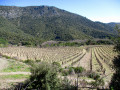
(S/E) Take the track that branches off to the left of the D12E9 road as you reach the hamlet (heading west, in other words). Turn immediately onto the track and begin a steep climb. At the three-way junction, turn right (west) and continue climbing. Walk alongside a fenced-off vineyard plot, climb more gently and join a track.
Yellow markings
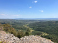
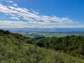
(1) Follow it to the right and immediately take a sharp left-hand bend. Walk alongside a very high hedge concealing private property to reach the hamlet of Bel Soleil (a renovated house with a lovely terrace) which overlooks the Domaine de Ventajou. There is a stunning view over the Minervois plain and beyond, further south to the Pyrenees mountain range.
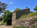
(2) At the junction, continue along the track on the right to reach the hamlet of Ventajou (a restored refuge open all year round). Ignore the signposted path that climbs to the right, before the refuge. A clearing in front of the ruins offers a remarkable view of the plain and the Pyrenees mountain range (orientation table).
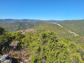
(3) Continue by going round the ruins on the left and take the yellow-marked path heading north-west. Stay on this path for a long while as it runs along the mountain ridge (it is safe), offering remarkable views. Depending on the weather, you may be able to see the Maladeta massif and Aneto.
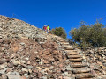
(4) At the junction, carry on straight ahead to reach the Bessous marble quarry. Go down the steps (a handrail makes the descent safe and easy).
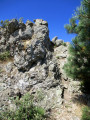
(5) At the bottom of the steps, it’s worth popping into the quarry to see the marble walls left behind after the blocks have been extracted. Make your way out of the quarry.
(5) Continue along the path, which is still marked in yellow, through scree formed by marble debris, until you reach a stony track.
(6) Follow it to the right at a sharp angle. Climb up, take a hairpin bend to the left and continue climbing until you reach a T-junction.
(7) Leave the track and take a first turn left then right to join a path leading to the Moulin de Biot (remarkably restored by a local association).
No signposting
(8) Walk back a few dozen metres, turn left and head uphill. Stay on the main path, ignoring the side tracks, until you reach a track.
(9) Follow the track to the left and pass through the hamlet of La Matte, which consists of some very pretty farmhouses. Continue westwards until you reach a stony track.
Yellow markings
(10) Follow this track to the right for about 250 metres.
No markings
(11) At the start of a right-hand bend, turn left onto a path that heads north-north-west, then north-west and finally north-east, until you reach a Fork in the road on a flat stretch (near the 505 contour line).
Yellow Circles
(12) Turn left onto a recently opened path that curves in an arc. When you reach a track, follow it to the left.
(13) Just before reaching the end of this track, head down to the left onto the path, which is still marked with Yellow Circles. The path quickly turns right and descends along the mountainside. Cross a (dry) stream and turn left. From this stream onwards, we have carried out extensive pruning and marking work to enable this circular route to be created. Head back up the valley until you reach a path.
No signposting
(14) Follow the path to the right and continue climbing. Pass the hamlet of La Borie and head back down. Cross the Ruisseau des Trémouls and climb up a series of hairpin bends to emerge onto a track, just after the small cemetery at Argentières.
(15) Follow the track to the right. Just past the first house on the left, take a path that descends to the right (be careful not to miss this turn-off). Walk down for a few metres and, before reaching some gardens, take the path that branches off to the left.
(16) Cross a concrete footbridge to cross the Ruisseau des Trémouls once more. Climb up the opposite slope and reach the ridge at a cairn with three wooden stakes stuck in it.
(17) Ignore the path on the right and turn left onto the almost level path. At the first junction, head left (cairn).
Yellow markings
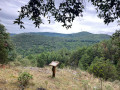
(18) You’ll soon come to a path marked in yellow; follow it to the left. Climb gently along the ridge, passing an orientation table and a cave (the highest point of the walk). Head back down in an east-southeast direction to reach a grassy clearing at a place called Font dal Rainard.
No markings
(19) Then turn left, heading north-north-east (leaving the marked path). Descend until you come across a pile of wooden pallets on the right.
(20) Leave the path here and head towards the pallets (a hunting post?). Turn left to enter the woods and head down towards the hamlet of L’Abeuradou. The descent through the woods is sometimes difficult to follow. The rest of the route, which is open, is better marked. You’ll reach a track.
(21) Follow it to the right and continue along this lovely track to reach the hamlet.
(22) Go round the hamlet on the right. On the right, there is a pond with a constant flow of water. Join the D12E9 and follow it to the right to quickly reach the starting car park (S/E).


 Visorando Member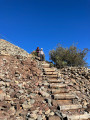
 Moderate
 Easy
Easy