Country:

 City:
City:




Once in Lespinassière, park in the marked spaces near the village’s bar-restaurant-grocery shop, which is housed in the former school premises.
(S/E) Continue along the county road towards the village.
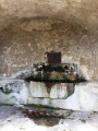
(1) When you reach an old cast-iron pump/fountain and a canopy used as a carport, leave the road and turn right onto a narrow, sunken path running alongside the retaining wall of a house. Join a wider track, continue uphill to the right and you’ll soon come out onto a tarmac road. Turn left and follow it for a few dozen metres.
Signposting: Yellow + Yellow and old Green, sparse and sometimes missing
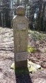
Turn right onto a sunken track that climbs steeply in a diagonal line and comes out onto the D620. Cross the road to rejoin the track opposite, at the wooden sign bearing the inscription “Stèle de la Résistance”. A few metres before reaching the road again, head down the stone steps on the right to see the memorial in question, commemorating the murder of two Resistance fighters by German forces in August 1944. Turn back.
(2) Cross the road carefully to take the wide path that starts opposite and slightly to the left. Keep to the left a few metres further on, then turn right at the three-way junction that appears shortly afterwards. This is followed by another very steep, winding climb leading to a forest track.
(3) Turn left to follow this track: the IGN map is out of date at this point, as the marked path shown opposite is now inaccessible, having been blocked off by a fence. Further on, let a path branch off to the left and stay on the track until you reach a very tricky junction.
No signposting
(4) At a tree on the right, marked with a small blue and white plaque reading “Poste” and a small cairn that I added, leave the track and immediately turn right onto a faint, barely visible trail. Follow it to the left. This trail quickly becomes overgrown with various types of regrowth and tall ferns, making progress difficult.
When it is no longer possible to follow it, climb the slope on the right to follow the track higher up, until you come to a small, deeply incised stream. Then turn right to walk along the upper edge of the stream, before veering off again to the right into a more open coniferous undergrowth where progress is easier. You’ll soon reach a wide, grassy path running across the slope.
(5) Follow it to the right, then take a bend to the left to climb slightly and reach a tarmac road after about a hundred metres, which is once again very cluttered. Turn right until you reach the first junction.
Yellow and green markings, old and sparse
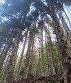
(6) Turn left onto the Route Forestière de la Fage (sign hidden by vegetation in May 2023). Pass an elevated fire tank on the left and continue gently uphill through a magnificent undergrowth of beech and coniferous trees. After two hairpin bends, the track reaches a junction on the ridge.
Yellow and Green + Yellow + GR®7 White and Red markings
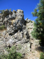
(7) Turn left, following the wooden sign marked ‘Castans via the Roc de Peyremaux’. Keep left at the next three-way junction, then turn right about a hundred metres further on. A steep climb leads to a junction where red and white barrier tape is strung up (!). Head right to reach the Roc de Peyremaux very quickly after a short, easy climb where you’ll need to use your hands, however.
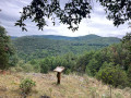
(8) Take in the exceptional 360° view. To the south, the Minervois, the Carcassonne plain, the Corbières and the Pyrenees. To the north, the Thoré Valley and the Anglès Plateau. Turn back, continue between the barrier tape to reach an information board on the geological formation of the Montagne Noire, then rejoin the track you left earlier. Follow it to the right until the next junction, marked by numerous directional signs.
GR®7 white and red markings
(9) Head straight ahead. A little further on, pass a magnificent granite boulder, unfortunately marred by two road signs (!), and arrive at a gravel turning area.
No markings
(10) Turn left onto the Route Forestière de Sarraliou, which runs on level ground through a magnificent, open woodland landscape dominated by conifers.
Yellow and Green + Yellow signposting, old and sparse
Veer to the right as you pass through a forest gate (Castans wooden sign). Further on, pass a clear-cut area and you’ll soon reach another junction (new Castans wooden signpost).
No markings
(11) Turn right onto the wide grassy path. After passing the poignant ruins of the hamlet of Perga, you’ll come out onto a cross-country track.
Yellow and Green + Yellow markings, old and sparse, sometimes missing
(12) Turn right, following the ‘Castans’ sign, and walk for about 200 m.
Yellow markings
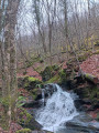
Take a sharp left-hand bend and begin a steep descent through oak woodland. Pass the “fountain” marked on the IGN map but which no longer flows in reality; cross the Réalpo Stream and its numerous small waterfalls over two large stone slabs, then continue along the hillside.
No markings
(13) Leave the markings behind, keeping to the left, rejoin the tarmac road and turn right. Pass the houses at La Quintaine (several of which have been beautifully restored) and continue along the road to Escandelle.
Yellow and Green + Yellow markings, old and sparse, sometimes missing
(14) At the right-hand bend, opposite a beautiful stone house, turn left to cross the hamlet. Rejoin the track, which quickly becomes a path and winds along the hillside, skirting fenced-off sheep pastures: be careful, there are very active sheepdogs! After a sharp bend to the right, the path turns south-west and eventually leads onto a double-track path opposite a mobile phone mast. Turn left, negotiate the hairpin bend to the right and reach the Col du Coudel.
Old yellow and green markings
(15) Turn left: sign for “Cabrespine via Fount Fréjo”. Follow the path as it follows the contour line, fords the Ruisseau de Gelprigoun (small wooden sign) and continue to the next junction.
(16) Turn left, following the sign for “Lespinassière via the Cun de San Marti”. Cross a forest track at a small, unnamed pass; head straight ahead and maintain the same direction as you make your way along the southern flank of Mont Péril.
(17) Carry on straight ahead along the wide track which crosses the shoulder and then winds its way before reaching the Cun de San Marti.
(18) Turn right, then right again about twenty metres further on. Pass close to a mobile phone mast, cross the Pic de San Marti (large cairn on the right-hand side)—a misnomer, as it is really more of a gentle ridge—then begin a gentle descent.
(19) Do not miss this pathhead on the left, fortunately marked by the unobtrusive ‘Lespinassière’ sign. Then begin a very steep descent straight down the slope, featuring a few genuinely steep sections that will require care. You’ll emerge onto a forest track at a gate and turn right, continuing for a good hundred metres.
(20) Turn left onto a very narrow, unmarked path. After a right-hand bend, this path also begins a very steep descent through dense undergrowth. You’ll emerge onto a wide track; turn left, then immediately right onto a track suitable for vehicles.
(21) When you reach the sign for the Forêt Domaniale des Soulanes de Nore (hidden by vegetation in May 2023), take the path on the left. Take care not to miss the fork to the left at Plan de Rouire, and do not be tempted by a path that continues vaguely to the right. Further down, the path emerges from the undergrowth, runs alongside a magnificent dry-stone wall and crosses an open area where the trail is easily lost on the rocky ground covered in gorse. With virtually no signposting, make sure you keep heading south-east and rejoin a more clearly marked path near the beautiful ruined buildings of the former hamlet of Poujol. Take a 90° left-hand bend and descend to the departmental road.
(22) Turn right, then immediately left, in a hairpin bend. Turn left at the first junction and left again at the next one. When you reach the old feudal castle, turn right to go round it, then head straight up to rejoin the departmental road.
(1) Turn right to return to the car park (S/E).


 Visorando Member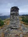

 Moderate