


Refine your search for walks in Eymouthiers
Eymouthiers walks
 The Banaret Circular Trail
 Visorando Member
 6.87 mi
 +554 ft
 -571 ft
 3h 40
 Moderate
 Departure from Bussière-Badil (Dordogne)
Welcome to the charming village of Bussière-Badil. This easy and enjoyable circular walk will allow you to explore the region’s rolling countryside. The route mainly follows shaded dirt tracks, with a few sections on small tarmac roads. You’ll be able to enjoy magnificent views of the surrounding hills and pass through unspoilt woodland. Get ready for a lovely day out in the countryside!
The foothills of the Limousin, starting from Montbron
 10.44 mi
+771 ft
-771 ft
5h 30
Moderate
Departure from Montbron (Charente)
Montbron is a border village: to the west lies the Angoumois region with its limestone subsoil, and as soon as you cross the bridge over the Tardoire at the eastern exit of Montbron, you’re in the Limousin region with its rolling countryside, granite subsoil and Limousin cattle. This route takes you through some truly beautiful countryside.
Loop between Tardoire and the forests, starting from Vouthon
7.93 mi
+148 ft
-148 ft
3h 45
Moderate
Departure from Vouthon (Charente)
Vouthon is home to a 12th-century Templar church. The Tardoire river flows near this church and you will cross it several times. In places, you will walk along the platform of an old railway line. This walk will bring you closer to history and nature.
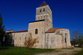
Circular route from Javerlhac to La Chapelle-Saint-Robert
 8.95 mi
+407 ft
-420 ft
4h 30
Moderate
Departure from Javerlhac-et-la-Chapelle-Saint-Robert (Dordogne)
A walk through the Périgord Vert, taking in farmland, footpaths, country lanes and typical villages.The route takes you through cultivated and wooded valleys.Please note: this walk is completely unmarked.Signposts for walkers and horse riders may provide some guidance.
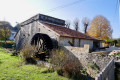
The Virade circular route via La Chapelle Saint-Robert and Les Chenauds
 8.46 mi
+709 ft
-702 ft
4h 30
Moderate
Departure from Javerlhac-et-la-Chapelle-Saint-Robert (Dordogne)
A lovely walk, suitable for a half-day, through wooded countryside with large areas of farmland. Discover hamlets and farms along the way. The route follows paths, small farm tracks and quiet country lanes.
The route is marked in yellow, with plenty of signposts, but it is a circular route that intersects with or follows other suggested routes. The GPX track is essential; the route description may be helpful, and a base map could be useful for identifying hamlets and farms in the distance.
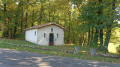
Quiz walk through the village of Saint-Sornin
 Tourism professional
 2.53 mi
+246 ft
-246 ft
1h 25
 Easy
Departure from Saint-Sornin (Charente) (Charente)
This route can be combined with a quiz walk, which allows you to discover the town’s iconic sites and learn about its history and heritage in a fun way. Look for the ‘Au fil de nos histoires’ poster in the sports hall car park (starting and finishing point) and scan the QR code to start the game (free, no registration required, and no app to download). You can split your smartphone screen in two to display both the Visorando route and the quiz.
 Quiz walk: “Through our stories in Saint-Sornin”
 9.56 mi
+574 ft
-564 ft
3 hrs
Moderate
Departure from Saint-Sornin (Charente) (Charente)
This route can be combined with a quiz walk, offering a fun way to discover the town’s iconic sites and learn about its history and heritage. Look for the ‘Au fil de nos histoires’ poster in the sports hall car park and scan the QR code to start the game (free, no registration required, and no app to download).
The Raboliots circuit in Saint-Germain-de-Montbron
7.35 mi
+177 ft
-197 ft
3h 30
Moderate
Departure from Saint-Germain-de-Montbron (Charente)
This circuit will take you through the Charente countryside, following in the footsteps of the "raboliots" (wild rabbits) that were once hunted by poachers. You will alternate between passages in the undergrowth and paths running alongside cultivated plots and meadows.
Vilhonneur Roman Ford Loop
2.39 mi
+16 ft
-16 ft
1h 05
Easy
Departure from Vilhonneur (Charente)
A short, relaxing walk around the River Tardoire, dotted with ancient monuments including a Roman ford to cross at the start. Don't miss the castle ruins either.
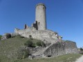
From Saint-Estèphe to Piégut
 Association / Club / Walk leader
 8.47 mi
+548 ft
-548 ft
4h 20
Easy
Departure from Saint-Estèphe (Dordogne)
This hike will give you an insight into the life of the monks of the Order of Grandmont, who were only allowed to eat fish from the large pond at Saint-Estèphe. You will pass their priory, then the Menhir de Fixard and the Tour de Piégut with its history. You can also take an old Roman road and explore the discoveries of centuries past in the small villages you pass through.
Let’s go for a walk in the woods of Moulin-sur-Tardoire
3.95 mi
+59 ft
-59 ft
1h 50
Easy
Departure from Rancogne (Charente)
This walk takes place mainly in the undergrowth and allows you to get up close and personal with nature. A small section of this walk follows the GR®4. If you enjoy a leisurely stroll, this route is perfect for you.
Hike in the footsteps of the Yvracoise (intermediate route)
6.14 mi
+138 ft
-141 ft
2h 55
Easy
Departure from Yvrac-et-Malleyrand (Charente)
The municipality of Yvrac and Malleyrand organises a mountain bike and walking event every Easter Monday. Registration is from 8.00 am to 10.00 am. Three routes are available: 7.5, 10 and 13 km; I recommend the medium route (10 km).
The heritage of Les Salles-Lavauguyon
6.60 mi
+404 ft
-377 ft
3h 25
Moderate
Departure from Les Salles-Lavauguyon (Haute-Vienne)
An easy walk that will allow you to discover the heritage around Les Salles Lavauguyon.
Around Pranzac
 6.58 mi
+174 ft
-171 ft
3h 10
Moderate
Departure from Pranzac (Charente)
Come and enjoy a stroll through the pastures, farmland and woods around Pranzac.
Pranzac feudal park and valley with fords and footbridges
 4.27 mi
+207 ft
-200 ft
2h 10
Easy
Departure from Pranzac (Charente)
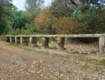
Pranzac is a small commune in Charente with a rich feudal past. The association "Les secrets de Pranzac" is involved in the partial reconstruction of the Château des Comtes des Cars.Our walk will first take us around the old seigneurial park of the castle, then continue along the valley, crossing fords and footbridges.
Around Bunzac
 10.41 mi
+433 ft
-443 ft
5h 10
Moderate
Departure from Bunzac (Charente)
A beautiful hike along dirt tracks, forest paths and small tarmac roads.
Tour of Lake Mas Chaban starting from Massignac
 8.36 mi
+190 ft
-187 ft
4h 00
Moderate
Departure from Massignac (Charente)
This hike will take you around Lake Mas Chaban and offer beautiful views of Lake Chaban and a passage through the small village of Lésignac-Durand, where there is a church worth seeing.
The difficulty lies mainly in the length of the walk. In very wet weather, the path can be very muddy or even impassable.
The route can also be done in the opposite direction. Please note that the view is not clear between Valette and the starting/finishing point.
 Bouëx circular loop
12.88 mi
+420 ft
-436 ft
1.5 hrs
Moderate
Departure from Bouëx (Charente)
A short, unpretentious ride on a mountain bike or hybrid bike.
Route of Resistance in Bouëx
 Tourist office
 8.08 mi
+276 ft
-279 ft
3h 55
Moderate
Departure from Bouëx (Charente)
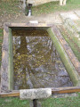
This walk, which starts at a beautiful spot where you can admire the church, the château and its wash house, is also a page in the history of the Resistance and the Demarcation Line, anchored in the Bouëx countryside on the edge of the Braconne-Bois Blanc national forest.
Prehistory route in Sers
 7.46 mi
+892 ft
-886 ft
4h 10
Moderate
Departure from Sers (Charente)
Unspoilt nature, pretty villages, art in the countryside, magnificent views, remarkable limestone cliffs and a major prehistoric site are all good reasons to explore this route in the shade of the undergrowth.
The Saut du Chalard
 2.42 mi
+394 ft
-407 ft
1h 25
Moderate
Departure from Champs-Romain (Dordogne)
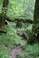
A circular alternative to the walk to Saut du Chalard takes you along the rushing Dronne river on a slightly difficult path at the bottom of a wooded valley that is always shaded.
Pauline’s Walk – Route de Sienne
1.07 mi
+121 ft
-115 ft
0h 35
Easy
Departure from Édon (Charente)
A short route in the footsteps of Pauline de Tourzel (who died in 1839), a friend of Madame Royale and the much-loved wife of the Count of Béarn, through the former grounds of the Château de La Rochebeaucourt (which was burnt down in 1941 and subsequently demolished).
From Rochebeaucourt to the Ste-Croix quarry
6.95 mi
+755 ft
-728 ft
3h 50
Moderate
Departure from La Rochebeaucourt-et-Argentine (Dordogne)
PDIPR route no. 1, proposed as part of the Departmental Plan for Walking and Hiking Routes (PDIPR), in the commune of La Rochebeaucourt et Argentine.From the heart of the village, you will reach the Argentine Plateau and its historical past. Then, a long wander along the former Angoulême-Marmande railway line will take you through woods and copses, along the edge of the Ste Croix quarry, before turning onto a green slope facing the Nizonne and returning to the village.
À la claire fontaine - Route Orange
1.58 mi
+177 ft
-177 ft
0h 55
Easy
Departure from La Rochebeaucourt-et-Argentine (Dordogne)
Short walk in the heart and on the outskirts of the village of La Rochebeaucourt.
From Rochebeaucourt to the Argentine Plateau
6.33 mi
+525 ft
-509 ft
3h 20
Moderate
Departure from La Rochebeaucourt-et-Argentine (Dordogne)
PDIPR route no. 2, a variant of no. 1, proposed as part of the Departmental Plan for Walking and Hiking Routes (PDIPR) in the commune of La Rochebeaucourt et Argentine.From the heart of the village, you will reach the church of Argentine and its historical past. Then a long walk along the old Angoulême - Marmande railway line will take you through woods and copses on the limestone plateau on the edge of the airfield, before turning onto a green slope facing the Nizonne and returning to the village.
Black route of Les Cluzeaux
1.59 mi
+98 ft
-98 ft
0h 30
Easy
Departure from La Rochebeaucourt-et-Argentine (Dordogne)
From the heart of the village of La Rochebeaucourt, take an easy walk to Les Cluzeaux d'Argentine, one of the most remarkable sites on the plateau. Only the outward route is signposted, but you can return via the same path or extend your walk by joining other signposted trails around the nearby church of Argentine or, a little further on, the Plateau d'Argentine car park.
The Robinia Circular Loop
 4.97 mi
+390 ft
-377 ft
2h 35
Easy
Departure from Saint-Pardoux-la-Rivière (Dordogne)
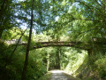
At the start, the flat route, following an old railway line, offers a lovely view of the village of Saint-Pardoux-la-Rivière; the walk then becomes idyllic, winding through the valleys of meadows and woods characteristic of the Périgord Vert.
The Pic circular route from Saint-Pardoux-la-Rivière
6.84 mi
+551 ft
-551 ft
3h 40
Moderate
Departure from Saint-Pardoux-la-Rivière (Dordogne)
A long circular walk starting from Saint-Pardoux-la-Rivière, following the route of a very ancient trade route between Charentes and Limousin. Charming hamlets and the rolling countryside of the Périgord Vert.
Around Lake Lavaud
 8.69 mi
+243 ft
-233 ft
4h 10
Moderate
Departure from Saint-Quentin-sur-Charente (Charente)
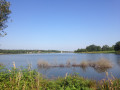
A very pleasant route, especially the last part where you walk along the lake.
Circular route around Saint-Quentin-sur-Charente and the Lavaud Dam
 5.24 mi
+315 ft
-299 ft
2h 40
Easy
Departure from Saint-Quentin-sur-Charente (Charente)
A circular route around the village of Saint-Quentin-sur-Charente, which mostly follows wide paths and small grassy tracks suitable for mountain biking, with very few tarmac roads.
L’Échappée Belle – Route Violet – P4
8.62 mi
+420 ft
-404 ft
4h 20
Moderate
Departure from La Rochebeaucourt-et-Argentine (Dordogne)
The final section of the Violet route, offering five routes ranging from P0 to P4.
After a shared section taking in panoramic plateaus and woodland, the routes diverge along a long walk beside the Nizonne, leading to a finale through hamlets or past small castles and even historic ruins.
The final stretch of the P4 route offers the chance to learn about the legend involving the daughter of Baron Galard de Béarn and the son of Baron de Feuillade, before exploring some magnificent ‘cluzeaux’ (cave shelters).
The Great Escape - Purple Route - P0 -
6.69 mi
+328 ft
-328 ft
3h 20
Moderate
Departure from La Rochebeaucourt-et-Argentine (Dordogne)
For those who want to "make a break for it", here is thefirst variation of five hikes (P0 to P4) that play hide-and-seek with the boundaries of the municipalities of La Rochebeaucourt-Argentine, Champagne-Fontaine and Blanzaguet.
L’Échappée Belle – Route Violet – P2
9.59 mi
+456 ft
-479 ft
4h 50
Moderate
Departure from La Rochebeaucourt-et-Argentine (Dordogne)
The Purple route comes in five versions (from P0 to P4), for those who want to ‘give it a go’.This is a long, rural walk that follows the boundaries of the municipalities of La Rochebeaucourt and Champagne-Fontaine, then runs alongside the boundary marked by the Nizonne, between the Dordogne and Charente.
Under the watchful eye of the lords of the manor - Blue Route -
3.85 mi
+328 ft
-328 ft
2h 05
Easy
Departure from La Rochebeaucourt-et-Argentine (Dordogne)
After a beautiful walk through the countryside and its hamlets, the castles of Fieux and Argentine will bring the history and legends of the ancient commune of Argentine to life.
L’Échappée Belle – Route Violet – P3
10.09 mi
+554 ft
-581 ft
5h 05
Moderate
Departure from La Rochebeaucourt-et-Argentine (Dordogne)
The Violet route offers five different routes (P0 to P4). P3 is the longest route.
You’ll walk along the boundary between the communes of La Rochebeaucourt and Champagne Fontaine, with lovely open stretches offering a magnificent 180° view from Villebois Lavalette to Vendoire. Sections through woodland and along the River Nizonne will provide a refreshing change of pace that’s sometimes very welcome. Rural hamlets and castles dotting the landscape will round off this ‘Échappée Belle’.
The Renaudie Circular
 6.08 mi
+476 ft
-449 ft
3h 15
Moderate
Departure from Saint-Front-la-Rivière (Dordogne)
A lovely walk through the hills bordering the Dronne Valley, discovering charming hamlets and the ruins of La Renaudie Castle.
Circular walk from Croze to Milhac-de-Nontron
 9.02 mi
+728 ft
-702 ft
4h 45
Moderate
Departure from Milhac-de-Nontron (Dordogne)
Around Milhac-de-Nontron, a route taking you from hamlet to hamlet along country lanes trodden by generations of locals before the age of the motor car. Another way of experiencing the local area and rural life.