Circular route from Javerlhac to La Chapelle-Saint-Robert

A walk through the Périgord Vert, taking in farmland, footpaths, country lanes and traditional villages.
The route takes you through cultivated and wooded valleys.
Please note: this walk is completely unmarked.
Signposts for walkers and horse riders may provide some guidance.

Details

1630530
Creation:
Last update:
Last review:
  • Walking
    Activity: Walking
  • ↔
    Distance: 8.95 mi
  • ◔
    Average duration: 4h 30 
  • ▲
    Difficulty: Moderate

  • ⚐
    Back to start: Yes
  • ↗
    Ascent: + 407 ft
  • ↘
    Descent: - 420 ft

  • ▲
    Highest point: 646 ft
  • ▼
    Lowest point: 384 ft

Photos

Description of the walk

Park at the former Javerlhac-et-la-Chapelle-Saint-Robert SNCF station on Avenue de la Garenne.

(S/E) Set off on flat ground, heading due south-east towards Nontron along the old, gravel-surfaced railway line for 400 m. You’ll reach the road junction: the post office and town hall are on the right, and the old weighbridge is opposite.

(1) Caution: Cross the D93. Continue straight ahead along the old, grass-covered railway track. Look out for yellow signposts for walking routes and green ones for horse riding routes.

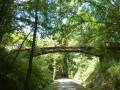
(2) Caution: Cross the D75 at the bend. Continue along the old, raised, grass-covered railway line. Crossing the Bandiat on the old SNCF bridge requires some care. Walk on the right-hand side, holding onto the scrap metal handrail.
Go through a large gate (without opening it) and cross the junction of tracks. Continue straight ahead along the old sunken railway line, which runs alongside the road on your right and the Bandiat stream below on your left. The old railway line descends slightly, breaks off and joins the road. Continue along this road for a few metres. Do not go as far as the road junction.

(3) Caution: Cross the road and climb steeply to the right along a hairpin bend, via a stony, grassy track. You’ll reach a crossroads of tracks in an open area, at elevation 178.

(4) Turn left towards the abandoned farm buildings at Les Brousses. Pass between the buildings. Continue straight ahead at the next junction. Stay on level ground, following a grassy section used as a track for the small airfield, on your left. Join the road after Pic Pérou at elevation 192.

(5) Cross the road and continue along the grassy track opposite. Carry on down this track until you reach a road. Do not turn left towards Le Petit Gillou.

(6) Turn right and head downhill along the Route de Pierre Virande, keeping to the left-hand verge, and eventually join the D93 at elevation 156.

(7) Cross the D93 and continue along the road opposite towards Les Chenauds. There is a bus stop here. Pass through a small cluster of houses. Ignore the first track on the right. Continue along the small road until you reach a junction where the road meets a track.

(8) Turn right and follow the track (Route de Pierre Virande) for 350 m towards the road. You’ll reach the T-junction with the Route des Brandes.

(9) Continue left along this road, heading north-west, keeping to the verge. 200 m further on, turn right onto a track. Then, another 200 m further on, turn left onto a path running parallel to the road at the edge of the woodland.
At the end of the cultivated field, turn left, skirting the crops, to rejoin the road, and follow it to the right as you enter a wooded area.

(10) Just before you come out of the woodland, turn right onto a grassy track. You’ll emerge into a clear area as you leave the woodland. Yellow marker post.

(11) Turn left, north-west-west, onto a wide track suitable for vehicles. You’ll emerge into an open area and reach a road at a junction at elevation 176. Yellow signpost.

(12) Cross the road and continue along the small road opposite. Carry on towards the village of La Chapelle Saint-Robert. In the centre of the village, turn left towards the D92. Direction: La Chapelle Saint-Robert.

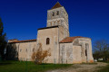
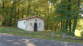
(13) Look out for the yellow signpost indicating the direction to Javerlhac. Go round the chapel on the left, following the signposting. Join the small road, turn right, and follow the route you took on the way there in the opposite direction.

(12) Cross the road again and continue along the wide, vehicle-accessible track.

(11) Turn left, heading south-east, onto a grassy track that descends into an open area at a crossroads at elevation 172.

(14) Continue left, due north, along a wide track suitable for vehicles. Head down towards the hamlet of Le Buisson. The approach to the hamlet is rough and often muddy. Pass through the hamlet and continue down a small road for 200 metres.
At the T-junction with another road, turn right towards Forgeneuve, with the Bandiat on your left. Continue downhill along this small road.
Cross the Bandiat via the road bridge near a beautiful watermill that has been restored to working order. Join the D75, then turn right and follow the right-hand verge for 100 metres. Pass the sign marking the entrance to Javerlhac.

(15) Caution. Cross the D75 and continue to the right along the old, gravel-surfaced railway track running parallel to the departmental road. You’ll reach the old SNCF station (S/E).

Waypoints

  1. S/E : mi 0 - alt. 417 ft - Former SNCF railway station
  2. 1 : mi 0.19 - alt. 417 ft - At the junction, cross the D93.
  3. 2 : mi 0.47 - alt. 407 ft - At the junction, cross the D75. Cross the - Bandiat (rivière) - Affluent de la Tardoire
  4. 3 : mi 1.26 - alt. 420 ft - Turn right onto a grassy, stony track
  5. 4 : mi 1.59 - alt. 584 ft - At the crossroads of the tracks, turn left.
  6. 5 : mi 2.2 - alt. 630 ft - Cross the road
  7. 6 : mi 2.81 - alt. 531 ft - Turn right onto the road.
  8. 7 : mi 3.26 - alt. 509 ft - Cross the D93; there is a bus stop opposite.
  9. 8 : mi 3.59 - alt. 548 ft - Turn right at the fork.
  10. 9 : mi 3.8 - alt. 636 ft - At the fork, take the road on the left.
  11. 10 : mi 4.85 - alt. 574 ft - At the fork, turn right onto the track.
  12. 11 : mi 5.05 - alt. 610 ft - Junction marking the start of the circular loop.
  13. 12 : mi 5.43 - alt. 577 ft - Junction shared with the circular route.
  14. 13 : mi 5.86 - alt. 584 ft - La Chapelle Saint-Robert.
  15. 14 : mi 6.97 - alt. 564 ft - At the fork in the tracks, take the left-hand path.
  16. 15 : mi 8.49 - alt. 407 ft - Cross the D75 and turn right.
  17. S/E : mi 8.95 - alt. 417 ft - Former SNCF railway station

Notes

There is no shelter as such, but a bus stop can easily serve as one if needed. You can take a break at La Chapelle-Saint-Robert.
Hiking kit is essential; don’t forget water, the route description, the GPS track and the OSM map so you can follow the route described above.

Wooden posts topped with yellow markings and directional signposts are dotted along this walk. These can help if you’re unsure which way to go.

Javerlhac-et-la-Chapelle-Saint-Robert is situated on the Nontron–Angoulême route.
From Nontron, head towards Javerlhac via the D75. In the centre of the village, at the junction with the speed bump, turn right onto the Route de Piégut, leave the first street on your left (at the post office) and turn left at the second street to reach the old railway line.

Worth a visit

Reviews and comments

4.2 / 5
Based on 3 reviews

Reliability of the description
5 / 5
Ease of following the route
3.7 / 5
Route interest
4 / 5
Claude-Meignen
Claude-Meignen

Overall rating : 4.3 / 5

Date of your route : Apr 27, 2026
Reliability of the description : ★★★★★ Very good
Ease of following the route : ★★★★★ Very good
Route interest : ★★★☆☆ Average
Very busy route : No

A lovely walk for those:
Who enjoy walking.
Who love nature
Who love beautiful scenery.
Apart from the "Forgeneuve", there are few points of interest!
Boring stretches across fields: and even then, at the end of April the fields are green: later on, scorched rapeseed, dry maize, mown cereals... Under a blazing sun???

Machine-translated

Cptmaumau
Cptmaumau

Overall rating : 5 / 5

Date of your route : Sep 14, 2023
Reliability of the description : ★★★★★ Very good
Ease of following the route : ★★★★★ Very good
Route interest : ★★★★★ Very good
Very busy route : No

A very pleasant walk starting from Javerlhac.
The route description literally guides you every step of the way. The GPX track is accurate. So you’ll have no trouble following this route without any signposting along the way, apart from a few kilometres before the chapel.
In the first section, construction work is underway, so the old railway line has become a tarmac track which is currently completely bare; however, you can walk on the ‘grassy’ side.
It’s also worth noting that, about 2 km before the chapel, part of the field/woodland layout has changed slightly from the GPX track; it’s easy to adapt by looking up from your screens and observing the terrain.
Thanks to the kind creator.
Cptmaumau

Machine-translated

JFTBILL
JFTBILL

Overall rating : 1 / 5

Date of your route : Oct 31, 2022
Reliability of the description : Not used / Not applicable
Ease of following the route : ★☆☆☆☆ Very disappointing
Route interest : Not used / Not applicable
Very busy route : No

Nothing – not a single mark anywhere!

Machine-translated

Other walks in the area

For more walks, use our search engine .

The GPS track and description are the property of this route's author. Please do not copy them without permission.