Country:

 City:


Start from the centre of Montbron, Place de l’Hôtel de Ville. Plenty of parking spaces available.
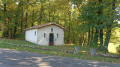
(S/E) Take the southern exit from Montbron towards Piégut. At a roundabout, go straight on until you reach a fork in the road (with the Notre-Dame du Bon Secours Chapel, known as the ‘Chapel of the Lepers’, opposite).
(1) Turn left and leave the chapel on your right. At the junction shortly afterwards, go straight on towards Chez Marvaux.
(2) After passing the tennis courts on the outskirts of Montbron, continue along the main road as it curves to the right. Head uphill and ignore the turnings on the right. You will reach the hamlet known as La Croix.
(3) Carry on straight ahead. Ignore the turn-off on the left for the hamlet of Chez Marvaud and you’ll soon reach a Fork in the road.
(4) Turn left towards Chez l’Houmy. Stay on the road until you reach a T-junction at the top of a hill.
(5) Turn right onto an unpaved track towards Marsac (beautiful scenery along the way, a superb pear tree halfway along). Once in Marsac, pass a pond on your right and you’ll soon reach a junction.
(6) Turn left onto Rue du Lavoir. Go straight on and continue along a track that soon curves to the left. This will take you to the Marsac wash house.
(7) The path then splits: take the left-hand fork. Continue straight on, leaving the junction on your right. The path now descends gently towards the Tardoire, heading north. The gradient steepens as you reach this river, which is classified as Category 1.
(8) Find a path, follow it to the right and walk alongside the river on your left. Go round the Moulin du Chambon on the right. Join a small road and follow it to the left.
(9) At the junction, take the first right towards a campsite. Walk alongside a pond on your left.
(10) Leave the road when it bends to the left and take a path on the right. Go round a pond on the right and you’ll come to a T-junction. Then follow a path to the right for about a hundred metres, until you reach a Fork in the road.
(11) Then head slightly to the left and climb up into a woodland.
(12) At a junction, turn right and continue uphill. Ignore a path coming from the right and carry on south-east on roughly level ground. Further on, turn right and head back down. You’ll come out onto a small road and reach the centre of the village of Puyservaud.
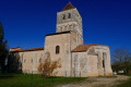
(13) Turn right (west) and walk past a house bearing inscriptions by a former pacifist soldier who, on returning from the trenches, carved his thoughts on this“bloody war” onto his house.
(14) After a left-hand bend, leave the street and turn right onto a path (there’s an insect hotel on the way out of the village). Ignore a path branching off to the left and turn right onto the main path. Then ignore two paths branching off to the right.
(15) Cross a small road and follow the small road opposite. Ignore a path on the left. At the T-junction, turn left. At the next junction, turn left.
(16) You’ll come out onto the D6; follow it to the right, passing the church and the town hall. Turn left before leaving the village, heading towards Chez Vincent. Immediately ignore a road coming from the right and carry on straight ahead along the main road. Pass under a high-voltage power line, ignore a road on the right and turn left onto the main road.
(17) As you come out of the bend, take a track on the right at an acute angle. Go round a small building on the right and head north-west.
(18) At a fork in the road, keep left. Ignore a path on the left and a small road on the right. Cross a small road, ignore a small road coming from the right and carry on straight ahead.
(19) Before the D6 road, turn sharply left and follow a track. At the three-way junction shortly afterwards, turn right. Further on, ignore a path branching off to the left and you’ll come to a T-junction.
(20) Turn right here. Carry on straight ahead, skirting the Coudraudes housing estate. Cross a small road, then join the D65 and follow it to the right. You’ll come out onto the D6; follow it to the left and you’ll immediately reach the junction near the Notre-Dame de Bon Secours Chapel.
(1) Continue straight on until you reach the starting point (S/E).

 Visorando Member

 Tourism professional
 Easy