Around Pranzac

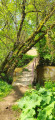
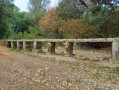
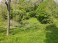
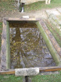
Come and enjoy a stroll through the pastures, farmland and woods around Pranzac.

Details

n°21345111
Creation:
Last update:
Last review:
  • Walking
    Activity: Walking
  • ↔
    Distance: 6.58 mi
  • ◔
    Average duration: 3h 10 
  • ▲
    Difficulty: Moderate

  • ⚐
    Back to start: Yes
  • ↗
    Ascent: + 174 ft
  • ↘
    Descent: - 171 ft

  • ▲
    Highest point: 397 ft
  • ▼
    Lowest point: 276 ft

Photos

Description of the walk

Park at the rear of the Place de la Lanterne des Morts, in the village hall car park at the end of Rue de la Lanterne des Morts.

(S/E) Head towards Place de la Lanterne des Morts and its funerary monument. Cross the Route d’Angoulême (D699) and take the tarmac path opposite. A few metres further on, take the first path on the left.

(1) Turn left onto this path and continue to the bridge.

(2) Cross the bridge, turn left and cross a road.

(3) Take the path leading into the woods on the left and carry on straight ahead until you reach a cycle path.

(4) Cross the cycle path to go through the tunnel on the left, then take the first right after about 300 m. Continue along the Chemin de la Voie Ferrée, cross the D669 at the pedestrian crossing and continue along the D512.

(5) Take the Chemin de Roulier, which enters the woods on your left between the bus shelter and Rue du Moc Panier. This path follows the edge of the woods and leads to a four-way junction. Take thesecond road on the left and carry on straight ahead until you reach a road.

(6) Cross this road and continue straight on until you reach the entrance to the hamlet of La Pipaudie.

(7) Enter the village via Rue de l’Écuyer on the left, then, to leave, turn off onto thefirst street on the left. Continue along a path until you reach the cycle path.

(8) Take the cycle path to the right, ignore the first pathon the left and take thesecond one.

(9) Leave the cycle path by taking the white track on the left, cross a bridge and reach the next fork a few metres further on.

(10) Head left and pass under a power line. Ignore the ford on the left and continue alongside a stream.

(11) When you reach a pretty bridge, turn right, cross another bridge and, at the entrance to Pranzac, turn right to reach the village hall car park (S/E).


Waypoints

  1. S/E : mi 0 - alt. 285 ft - Village hall car park
  2. 1 : mi 0.12 - alt. 279 ft - Path to the left
  3. 2 : mi 0.63 - alt. 279 ft - Bridge over the - Bandiat (rivière) - Affluent de la Tardoire
  4. 3 : mi 0.75 - alt. 295 ft - Entrance to the woods
  5. 4 : mi 1.65 - alt. 338 ft - Crossing the cycle path
  6. 5 : mi 2.84 - alt. 397 ft - Path leading into the woods
  7. 6 : mi 4.03 - alt. 374 ft - Crossing the road
  8. 7 : mi 4.5 - alt. 348 ft - Entrance to the hamlet of La Pipaudie
  9. 8 : mi 4.81 - alt. 344 ft - Cycle path
  10. 9 : mi 5.04 - alt. 335 ft - Junction on a dirt track
  11. 10 : mi 5.29 - alt. 289 ft - Junction after the bridge
  12. 11 : mi 5.91 - alt. 279 ft - Junction opposite a bridge
  13. S/E : mi 6.58 - alt. 285 ft - Village hall car park

Worth a visit

Reviews and comments

4 / 5
Based on 2 reviews

Reliability of the description
4 / 5
Ease of following the route
4 / 5
Route interest
4 / 5
randoroullet
randoroullet

Overall rating : 3.7 / 5

Date of your route : Feb 10, 2025
Reliability of the description : ★★★★☆ Good
Ease of following the route : ★★★★☆ Good
Route interest : ★★★☆☆ Average
Very busy route : No

A 10-kilometre walk; it can be done in 9 kilometres, but only in dry weather as the grassy paths become muddy, particularly along the 1-kilometre stretch beside the river. A walk through the fields, with nothing of particular interest.

Machine-translated

Florikawalk
Florikawalk

Overall rating : 4.3 / 5

Date of your route : Jan 23, 2023
Reliability of the description : ★★★★☆ Good
Ease of following the route : ★★★★☆ Good
Route interest : ★★★★★ Very good
Very busy route : Yes

Very pleasant.
Not very busy, except on the track, which is very busy.

Machine-translated

Other walks in the area

For more walks, use our search engine .

The GPS track and description are the property of this route's author. Please do not copy them without permission.