Country:

 City:
City:


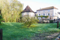
From the Route d’Angoulême (D75), in the centre of the village, head down the Route de Mareuil (D93) towards Le Bandiat. Park in the car park at Saint-Étienne Church, next to Javerlhac Castle (D93). Accessible by public transport
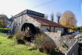
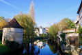
(S/E) With your back to the church entrance, turn left and cross the road bridge over the Bandiat. Note the Moulin Martin on your right (unfortunately no longer maintained, as observed in September 2026). Head down towards it and find the footbridge that takes you round the mill to the left. Then continue straight ahead along the small road until you reach the left-hand bend in the road.
(1) Leave the road and continue straight ahead along the very narrow track that runs alongside the old sewage treatment works and the Bandiat. You’ll come to a beautiful house on the left and its private forge on the right (sometimes open during maintenance work or on Heritage Days, etc.). You’ll reach a four-way junction.
(2) Leave Forgeneuve and head up the small road on the far left, heading south-west.
(3) Pass through the hamlet of Le Maine and continue uphill opposite along a farm track which turns left at an EDF electricity box on your left-hand side. A little further on, you’ll reach a fork in the road.
(4) Carry on straight for 300 m until you reach a fork at elevation 179:there is no track to the left, contrary to what is shown on the IGN map. There is a signpost.
(5) Turn right towards La Chapelle Saint-Robert. On leaving the forest: there is no track to the right, contrary to the IGN map. Continue straight on along the track until you reach a junction of four tracks at elevation 172.
(6) Carry straight on along a farm track and, after a slight bend to the left, you’ll reach a junction where three tracks meet. Signpost and yellow marker post.
(7) Turn right towards the Chapelle Saint-Robert. Pass a yellow waymarker. Continue straight on and you’ll come out onto a small cross-road. Yellow waymarker.
(8) Cross it and continue straight ahead along the street (Chemin du Bois des Giroux). At the end, at the junction, turn right and you’ll come out onto a small road (Route du Clos Chapelaud). No signposts or markings. Follow it to the left for about 300 m. Turn left at the first left, into Ruelle Passeron. Join the main road, the D92, and follow it to the left for a few dozen metres.
(9) Take the first left, look out for the imposing Saint-Robert Church and go round it on the left. At the end of the track, turn left past a shelter in a field on the right and turn right onto a small grassy track. You’ll come out at the very bottom onto the end of a tarmac road. No signposts. Turn left onto a stony track and you’ll immediately see a yellow signpost on your left . Continue along the stony track heading due south. You’ll come to a fork in the track. There’s a signpost here.
(10) You can turn left straight away: towards Javerlhac. Carry on straight ahead and, after 100 m, you’ll reach a fork (shown on the IGN map). Yellow signpost. Carry on straight ahead and reach a fork in a wood at elevation 146.
(11) Ignore the track on the left. Continue, making a slight right-hand bend, heading south-west. You’ll reach a wider farm track crossing your path. There are no signposts at this exact spot.
(12) Pass the farm entrance on your right. Turn left, heading south-east. Five metres further on, on the left, along the edge of the woodland, there is a yellow signpost indicating a right turn – i.e. in the opposite direction. Carry on and you’ll come to a fork in the middle of a field, which is not very visible on the ground, at elevation 154. There’s a yellow signpost opposite, at the corner of the woodland. It’s misleading!
(13) Turn right along this woodland onto a path that’s almost ploughed at the edge of the field! After 50 m, ignore a barely visible track on the left; continue along the edge of the woodland, then enter the forest. You’ll reach a three-way junction. (IGN map background is inaccurate). Directional signpost. Continue straight ahead towards Javerlhac. You’ll soon reach another three-way junction. Yellow marker post indicating a left turn.
(15) So carry on to the left, due east, and arrive at a junction at elevation 158. Signpost and yellow marker post. It seems possible to make a round trip to the Pierre Virade site on the left (unverified). Carry on straight ahead. You’ll reach a three-way junction. Yellow marker post indicating a right turn. Take care.
(16) The path to follow is shown on the IGN base map when zoomed in. Turn right, heading due south, then south-east for 600 m until you reach a junction not shown on any base map. Take care. Landmark: an unusual everyday object in the middle of the forest! Observed on 24 September 2026. Yellow signpost indicating a left turn.
(17) Turn left, heading north-east, and carry on straight ahead, leaving the forest and staying on the edge of the woodland. Pass a yellow signpost, and you’ll eventually come out onto a small road (Route de Pierre Virande). Yellow signpost indicating a left turn. A house on high ground, opposite. Follow this road to the left and you’ll reach Les Chenauds. Yellow signpost indicating a right turn.
(18) Turn right onto Route de Pierre Virande. At the junction with a track, marked by a yellow signpost, continue along the road. You’ll reach a slightly wider road (Route des Brandes). No signpost. Elevation 194.
(19) Follow it to the left along the wide right-hand verge for 450 m and look out for a track into the forest on the right. No signpost.
(20) Turn right into the woodland, heading north-east, for about 200 m. Leave the track straight ahead. Turn left, heading north-west, still through the woodland, then follow the edge of the woodland. After less than 400 m, you’ll reach a junction not shown on any map. Yellow signpost. Continue straight ahead for another 400 m and enter the woodland again. Take care. Yellow signpost indicating a right turn.
(21) Turn right, still through the woods, and eventually come back to a fork in the path that you passed on the way out.
(5) Head straight ahead, in the opposite direction to the outward journey, and come to another fork in the path, which you also passed on the way out.
(4) Turn right and follow the narrow track. Arrive at Chez Joly, continue along the small access road to the right and rejoin the other road from the start of the route.
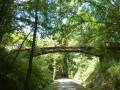
(1) Turn right, heading in the opposite direction to the outward journey, and you’ll come to the second fork you passed on the way out. Keep left on the path, pass the Fontaine des Amours, and further on, the mill footbridge, to reach the road bridge over the Bandiat. Cross it and you’ll rejoin the (S/E).
 Visorando Member

 Association / Club / Walk leader
 Easy
Easy  Tourism professional