The Robinia Circular Loop

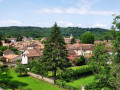
At the start, the flat route, following an old railway line, offers a lovely view of the village of Saint-Pardoux-la-Rivière; the walk then becomes idyllic, winding through the valleys of meadows and woods characteristic of the Périgord Vert.

Details

2073220
Creation:
Last update:
Last review:
  • Walking
    Activity: Walking
  • ↔
    Distance: 4.97 mi
  • ◔
    Average duration: 2h 35 
  • ▲
    Difficulty: Easy

  • ⚐
    Back to start: Yes
  • ↗
    Ascent: + 390 ft
  • ↘
    Descent: - 377 ft

  • ▲
    Highest point: 755 ft
  • ▼
    Lowest point: 449 ft

Photos

Description of the walk

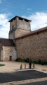
Start from the market square in Saint-Pardoux-la-Rivière: Place Henri Brives.

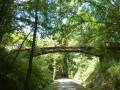
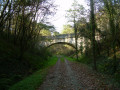
(S/E) Access the greenway via a zigzag staircase that climbs the embankment at the far end of the market square. Turn left onto the greenway towards Thiviers.
From the viaduct, don’t miss the view over the village.
Follow the greenway for 2 km. Shortly after the 2 km marker (to the right of the path), near a bench, a yellow signpost marks the start of a narrow path that leads into the woodland to the right of the greenway.

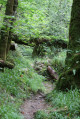
(1) Take this path through the woodland until you reach a road. Turn left onto the road and, before it climbs towards the hamlet of Puyriol (houses in sight), it crosses a signposted track heading towards Bordessoule on the right. Take this track to the left. It climbs through the woodland to the houses in the hamlet of La Robinie. At the top of the hill, the track gives way to a tarmac road leading to the first houses.

(2) Turn right, passing between the buildings, and take the grassy path slightly to the left which descends between fenced meadows. At the bottom of the slope, follow the path on the left which climbs back up through the woods, skirting the edge of the meadows. On emerging from the woods, another grassy path runs alongside a meadow, heading towards a few houses. It joins a road in the middle of a bend. Take this road on the left, passing the houses on your right.

(3) After the hamlet of Les Boissières, at the crossroads, turn right towards Saint-Front-la-Rivière. After the junction with the Route du Chadeuil on your left, continue to the junction with a stony track marked with yellow signposts, part of the circular Chadeuil route.

(4) Follow the gravel track to the remains of a stone monument on your right.

Yellow markings

(5) Then take a narrow path between low stone walls. Starting in the woodland and then passing through meadows, the path runs below an airfield on the right-hand side.

(6) After the airfield, turn left and, at the next two junctions, turn right towards Saint-Pardoux (towards the village). After a few houses, the path descends quite steeply, passing close to the greenway. Continue down the slope until you reach the road.

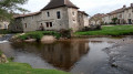
(7) Follow the D83 to the right, go under the viaduct, and at the roundabout, turn left to cross the Dronne. Carry on straight ahead along the Grand Rue de la Barre to the end of the street, then turn left towards the market square (S/E).

Waypoints

  1. S/E : mi 0 - alt. 463 ft - Place Henri Brives – Towards the cycle path, then the - Dronne (rivière)
  2. 1 : mi 1.25 - alt. 591 ft - Puyriol Path
  3. 2 : mi 1.88 - alt. 659 ft - The Robinia
  4. 3 : mi 2.69 - alt. 738 ft - Route de Saint Front la Rivière
  5. 4 : mi 3.03 - alt. 656 ft - Gravel path on the right
  6. 5 : mi 3.45 - alt. 607 ft - Remains of a cross
  7. 6 : mi 3.97 - alt. 640 ft - Airfield
  8. 7 : mi 4.6 - alt. 469 ft - Saint-Pardoux RD 83
  9. S/E : mi 4.97 - alt. 466 ft - Place Henri Brives

Notes

An easy walk.
Depending on the season, some paths may be overgrown with tall grass.

Picnic areas on the greenway (1) and at the entrance to the village, under the viaduct (7)

Worth a visit

Sights to see along the walk:

  • the 19th-century railway engineering structures (viaduct, guardrails, footbridges)
  • Observe the contrast in vegetation around (5), where the limestone of the Dronne Valley supports Causse-type vegetation, accompanied by low stone walls marking out the plots.

Reviews and comments

4.5 / 5
Based on 2 reviews

Reliability of the description
5 / 5
Ease of following the route
5 / 5
Route interest
3.5 / 5
balou17
balou17

Overall rating : 4.3 / 5

Date of your route : Sep 04, 2022
Reliability of the description : ★★★★★ Very good
Ease of following the route : ★★★★★ Very good
Route interest : ★★★☆☆ Average
Very busy route : No

A lovely walk through woods, meadows and truffle oak groves. A panoramic view at the end of the route. “And that’s it” “And that’s all there is to it”

Machine-translated

papygibus94
papygibus94

Overall rating : 4.7 / 5

Date of your route : Sep 22, 2020
Reliability of the description : ★★★★★ Very good
Ease of following the route : ★★★★★ Very good
Route interest : ★★★★☆ Good
Very busy route : No

A lovely walk, very varied and not too difficult. It offers views of all the different aspects of a hike: woodland, vineyards and meadows. Highly recommended

Machine-translated

Other walks in the area

For more walks, use our search engine .

The GPS track and description are the property of this route's author. Please do not copy them without permission.