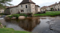
The Pic circular route from Saint-Pardoux-la-Rivière

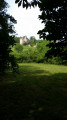
A long circular walk starting from Saint-Pardoux-la-Rivière, following the route of a very ancient trade route between Charentes and Limousin. Charming hamlets and the rolling countryside of the Périgord Vert.

Details

n°25943649
Creation:
Last update:
Last review:
  • Walking
    Activity: Walking
  • ↔
    Distance: 6.84 mi
  • ◔
    Average duration: 3h 40 
  • ▲
    Difficulty: Moderate

  • ⚐
    Back to start: Yes
  • ↗
    Ascent: + 551 ft
  • ↘
    Descent: - 551 ft

  • ▲
    Highest point: 988 ft
  • ▼
    Lowest point: 463 ft

Description of the walk

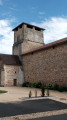
Car park behind the market hall in Saint-Pardoux (Place Henri Brives).

No signposting

(S/E) Follow the embankment of the greenway (former railway line) to the right and head uphill past the houses. Turn right onto Avenue de la Gare, then left onto Rue Syreyjol, towards Nontron. Walk alongside the supermarket car park. After the next junction, opposite the cemetery, take the street on the left, which quickly turns into a grassy track.

Signposted “Circular route of the PNR”

(1) At the junction, take the path on the right which passes a few houses and leads to the D707. Cross carefully and follow the road to the left until you reach the bend. Take the dirt track which branches off to the right at the bend.

No signposting

(2) At the top of the hill, turn right and continue along this track until you reach a road. Turn left and continue to the hamlet of Le Pic (no place-name sign).

(3) At the fork in the road, turn left into the houses. At the last house, turn right onto a dirt track that descends through the fields. Continue along this track across the meadows.

Signposted “Circular route of the PNR”

(4) At the junction in the woods, turn left and carry on to a crossroads.

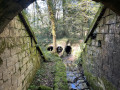
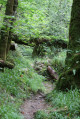
(5) Take the “Roman road” on the left, which leads into the forest. In the valley, you’ll reach a junction after crossing a stream (Roman bridge).

Yellow markings

(6) Follow the path to the right until you reach the D707.

(7) Cross carefully and take the Route de Puypelat opposite. Continue straight on until you reach the hamlet. At the junction, after the wash house, continue straight on, then turn left and follow the lane until you reach a road.

(8) To return to Saint-Pardoux across the fields, turn right until you reach the next house. Just before this house, take the path branching off to the left. Turn right, then left onto the path coming from the bottom of the valley. Walk past the recycling centre, then follow the road which continues from the path.

(9) At the end of the Route des Châtaigniers, turn left, then right at the next ‘Stop’ sign. Follow the signs for Nontron, pass under the greenway and turn right to reach the starting car park behind the market hall (S/E).

Waypoints

  1. S/E : mi 0 - alt. 463 ft - Place Henri Brives. Near the - Dronne (rivière)
  2. 1 : mi 0.68 - alt. 584 ft - Crossroads
  3. 2 : mi 1.46 - alt. 846 ft - Top of the hill
  4. 3 : mi 2.47 - alt. 938 ft - The Peak
  5. 4 : mi 3.23 - alt. 988 ft - Crossroads in the woods
  6. 5 : mi 3.67 - alt. 912 ft - Roman road
  7. 6 : mi 4.59 - alt. 791 ft - Roman bridge
  8. 7 : mi 5.28 - alt. 604 ft - D707 road
  9. 8 : mi 5.63 - alt. 499 ft - Route de Lapeyronnie
  10. 9 : mi 6.57 - alt. 495 ft - Crossroads
  11. S/E : mi 6.84 - alt. 463 ft - Place Henri Brives

Notes

There are no particular difficulties on this walk, apart from the first climb, which is a bit long. The route runs entirely through the countryside, between woods and fields, and passes through a few hamlets.

Worth a visit

Starting from Saint-Pardoux-la-Rivière, the route follows the course of a thousand-year-old trade route, used since the Gallic (“Roman”) era and later as the “Postal Route” between Saintonge and Limousin. It follows a section of the 200 km of paths that encircle the Périgord Limousin Regional Nature Park.

Reviews and comments

4.2 / 5
Based on 2 reviews

Reliability of the description
4 / 5
Ease of following the route
4.5 / 5
Route interest
4 / 5
TONY24
TONY24
• Edited:

Overall rating : 4 / 5

Date of your route : Aug 26, 2023
Reliability of the description : ★★★★☆ Good
Ease of following the route : ★★★★☆ Good
Route interest : ★★★★☆ Good
Very busy route : No

A pleasant little walk, mainly through the countryside. There’s a slight error in the route at point 8, as has already been pointed out, but it’s hard to go wrong as PR signposts have been put up.

Machine-translated

EVELYNE24
EVELYNE24

Overall rating : 4.3 / 5

Date of your route : Jan 02, 2023
Reliability of the description : ★★★★☆ Good
Ease of following the route : ★★★★★ Very good
Route interest : ★★★★☆ Good
Very busy route : No

A pleasant walk along paths and through woodland, with very few roads, which makes it a real pleasure. Lovely views across the meadows and countryside.
Take care at point 8: Do not take, as indicated, the path on the left before the first house (yellow post with a cross), but take the path on the left 50 metres after this house and follow this path all the way to St Pardoux (ignore the instructions to ‘turn right then left…’).

Machine-translated

Other walks in the area

For more walks, use our search engine .

The GPS track and description are the property of this route's author. Please do not copy them without permission.