L’Échappée Belle – Route Violet – P3

The Violet route offers five different routes (P0 to P4). P3 is the longest route.
You’ll walk along the boundary between the communes of La Rochebeaucourt and Champagne Fontaine, with lovely open stretches offering a magnificent 180° view from Villebois Lavalette to Vendoire. Sections through woodland and along the River Nizonne will provide a refreshing change of pace that’s sometimes very welcome. Rural hamlets and castles dotting the landscape will round off this ‘Échappée Belle’.

Details

2666745
Creation:
Last update:
Last review:
  • Walking
    Activity: Walking
  • ↔
    Distance: 10.09 mi
  • ◔
    Average duration: 5h 05 
  • ▲
    Difficulty: Moderate

  • ⚐
    Back to start: Yes
  • ↗
    Ascent: + 554 ft
  • ↘
    Descent: - 581 ft

  • ▲
    Highest point: 538 ft
  • ▼
    Lowest point: 282 ft

Description of the walk

Start at the Plateau d’Argentine.

(S/E) Head south-west along the small road. At the start of the descent, keep to the right of the sheep farm fence. Take the small, steep path and then cross the old railway line.

(1) You’ll reach the old Seguignas wash house. From there, head to the junction on the left and cross the D12 opposite, heading towards Fontaine. Walk up the small road to the stone cross.

(2) At the fork in the road, turn left towards the hamlets of Seguignas and then Lutardias.

(3) At Lutardias, turn left; a little further on, cross the small wood of Les Gros Chênes and head right towards its edge.

(4) On emerging from the woods, turn right again, heading due west towards the Masdonnaux hills. Continue straight on until you reach the tarmac road.

(5) Turn left, carry on for 1 km towards Fontaine and reach the next junction. You are now on the boundary between the municipalities of La Rochebeaucourt and Fontaine.

(6) Take the path on the right, follow the row of truffle oaks and continue straight ahead along the path.

(7) Turn slightly to the right into the Péricaud Forest. A little further on, pass the Violet P0 route on your right and head into the undergrowth opposite.

(8) Join the ridge path, which is still bordered in places by a low stone wall.

(9) Turn left on the heights of the Combe du Prieur, walk past an imposing pidgeon hunting hut and continue to the Chaussade bridge.

(10) Leave it on your left and follow the tarmac road to the right, alongside the Lizonne (or Nizonne in its upper reaches), to the village of Nadaillac.

(11) Leave the Violet P1 route, which heads up to the right, and cross through the village. Continue along the Nizonne. After 1 km, you’ll rejoin the Violet P2 route, which you should also leave.

(12) You’ll reach the village of Les Fieux; turn right as you enter.

(13) 200 m further on, admire the castle of the former lord, the Baron de Feuillade, on your left. Continue along the pretty, shaded forest path through the Renaudières forest. Pass the hamlet of Lagland and reach a four-way junction.

(14) Turn left towards the Plateau d’Argentine.

(2) Carry on straight ahead, cross the D12 and follow the small road opposite.

(15) On the final climb, walk alongside the old quarry, which has been converted into an educational mushroom farm, then reach the Plateau d’Argentine (S/E).

Waypoints

  1. S/E : mi 0 - alt. 443 ft - Plateau d’Argentine
  2. 1 : mi 0.21 - alt. 344 ft - Seguignas wash house
  3. 2 : mi 0.52 - alt. 420 ft - Seguignas Cross
  4. 3 : mi 1.23 - alt. 512 ft - Lutardias
  5. 4 : mi 1.74 - alt. 518 ft - Hauteur des Masdonnaux
  6. 5 : mi 2.33 - alt. 489 ft - Route de Fontaine on the left
  7. 6 : mi 3.23 - alt. 404 ft - Crossroads at the boundary of the municipality (elevation 123)
  8. 7 : mi 3.63 - alt. 443 ft - Péricaud Forest
  9. 8 : mi 3.93 - alt. 410 ft - Ridge path
  10. 9 : mi 4.34 - alt. 400 ft - The heights of the Combe du Prieur
  11. 10 : mi 5.2 - alt. 285 ft - Chaussade Bridge - Lizonne (rivière)
  12. 11 : mi 6.42 - alt. 325 ft - The village of Nadaillac
  13. 12 : mi 7.56 - alt. 341 ft - The village of Les Fieux
  14. 13 : mi 7.72 - alt. 361 ft - Château de Fieux
  15. 14 : mi 8.91 - alt. 499 ft - Fontaine–Argentine road
  16. 15 : mi 9.93 - alt. 390 ft - Former quarry now used for mushroom cultivation
  17. S/E : mi 10.09 - alt. 443 ft - Plateau d’Argentine

Notes

After a shared section, this route splits into five possible paths (P0 to P4) as you walk.
Stone tables and benches on the Plateau d’Argentine.
Dry toilets.
The route runs alongside the river for much of the way.

Worth a visit

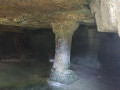
A small drainage structure beneath the old Angoulême–Mussidan railway line.
Processional cross at the entrance to Seguignas.
A beautiful 180° view from Vendoire to Villebois Lavalette across the Masdonnaux hills.
View due west towards Villebois Lavalette Castle.
View of the Château de la Ligerie at the entrance to the village of Fontaine (former home of the Chaban-Delmas family).
A rectangular stone boundary marker in the centre of the ridge path, marking the municipal boundary.
The Lizonne, or Nizonne in its upper reaches, a river marking the boundary between Charente and Dordogne.
The village of Fieux and Fieux Castle, former fief of the Baron de Feuillade.
A small educational mushroom-growing quarry on your right, 100 metres before you reach the Plateau d’Argentine.

Reviews and comments

4.6 / 5
Based on 3 reviews

Reliability of the description
4.7 / 5
Ease of following the route
4.7 / 5
Route interest
4.3 / 5
Tony C
Tony C

Overall rating : 4.7 / 5

Date of your route : Jul 31, 2023
Reliability of the description : ★★★★★ Very good
Ease of following the route : ★★★★★ Very good
Route interest : ★★★★☆ Good
Very busy route : No

A lovely walk through fields and woodland. The 3.7 km stretch along the road is a bit long. Very good signposting.

Machine-translated

josyetjo
josyetjo

Overall rating : 4 / 5

Date of your route : Apr 18, 2023
Reliability of the description : ★★★★☆ Good
Ease of following the route : ★★★★☆ Good
Route interest : ★★★★☆ Good
Very busy route : No

A lovely walk through beautiful woodland, with a bit too much of a narrow road for my liking, but very pleasant all the same
Watch out at point 14 – the sign isn’t very visible

Machine-translated

batontordu
batontordu

Overall rating : 5 / 5

Date of your route : Jul 11, 2021
Reliability of the description : ★★★★★ Very good
Ease of following the route : ★★★★★ Very good
Route interest : ★★★★★ Very good
Very busy route : No

The signposting is recent and excellent; you hardly need a map, except to get your bearings.
Let’s hope the signposting is maintained and remains in good condition over time.

Machine-translated

Other walks in the area

For more walks, use our search engine .

The GPS track and description are the property of this route's author. Please do not copy them without permission.